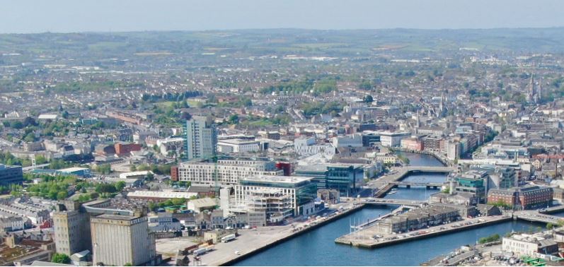
I would like to raise an objection to the proposed road through The Marina Park area. I feel it will cut through the communities in the area as the south link and ring road do. It will cause a huge...
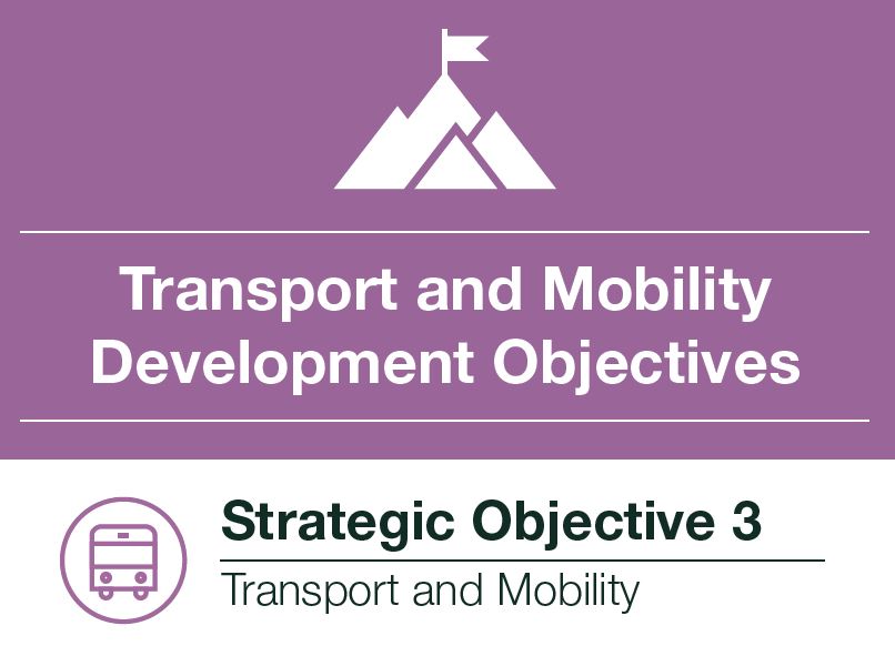
4. Transport and Mobility
Closed1 Apr, 2022, 09:00 - 28 Apr, 2022, 23:59
Towards an Integrated Transport System
4.1
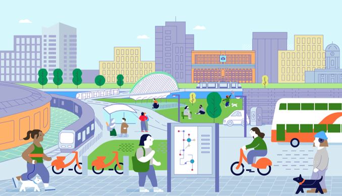
This projected population and associated economic growth planned for Cork City will result in a significant increase in the demand for travel. This demand needs to be managed and planned for carefully to safeguard and enhance the city’s attractiveness to live, work, visit and attract investment.
4.2
Therefore it is important that transport plans for Cork City consider the implication for climate change mitigation. Cork City Council, working with partners such as the NTA, TII, CIE and Iarnrod Eireann, will work to achieve a considerable modal shift to reduce the car dependence of residents of Cork City.
4.3
In 2020 the National Transport Authority (NTA) published the Cork Metropolitan Area Transport Strategy. Key objectives of the Strategy are to improve current mobility in the City, plan for the transport needs of the population growth of the metropolitan area and support modal shift towards more sustainable transport modes; waking, cycling and public transport. The Socio Economic Profile of
Cork City, which was prepared to inform this Draft Development Plan, highlights that there is slightlyhigher than average dependence on private car to commute to school or work (at 62.6%) , and a lower than average uptake of public transport at 9.1% of journeys.
| CMATS Modal Share (Peak Morning) Baseline and Targets | ||||
| Mode | Walking | Cycling | Public Transport | Car |
| Existing | 21% | 1% | 10% | 66% |
| Target | 21% | 4% | 25.7% | 49.3% |
Table 4.1: CMATS Modal Share Baseline and Targets. Source: CMATS.
4.3
The modal share across the Cork Metropolitan Area (CMA) differs from that of the city due to the larger geographic area that the CMA covers. A key objective of CMATS is to shift this modal shift in favour of more sustainable transport modes as follows.
4.5
These are targets that the CMATS was modelled on, however there is scope, and an ambition of Cork City Council, to exceed the targets set for sustainable transport modes. Due to forecast population growth, achieving these targets will mean that by
2040 there will be:
• 90 million annual walking trips, with a 250% increase in footfall in the city centre;
• 19.5 million annual cycling trips;
• 85 million bus passenger trips;
• 16 million trips on suburban rail; and
• 46 million trips on light rail.
4.6
Linking sustainable transport provision with land use provides a co-ordinated approach to the development of the city. This in turn can
facilitate compact growth and, through a broad range of transport options; reduce congestion and the economic and environmental cost of congestion; herald a reduction in car dependency, whilst strengthening the basis for investment in sustainable transport alternatives by providing some of the necessary prerequisites for these alternatives, the primary requirement being a critical mass of population.
4.7
This will involve focusing new residential and employment development in areas with good access to the planned public transport network, and in locations where people can live close to work, making it easier to walk and cycle, yielding the potential for big changes in the way people move around the city.
4.8
Addressing sprawl by creating the opportunities for people to live and work in proximity to employment and services via a modern and efficient public transport network is fundamental to the success of Cork as a City, both in terms of a successful city of neighbourhoods and as the economic driver of the Southern Region.
4.9
The delivery of a €3.5 billion investment in transport infrastructure set out in the Cork Metropolitan Area Transport Strategy (CMATS) which was developed by the National Transport Authority and will fundamentally change how people move around Cork City.
4.10
The strategy provides for dramatic interventions in how our city moves with new dedicated walking/ cycling routes, a high frequency bus service (BusConnects), the development of a light rail network, the expansion of commuter rail and investment in local route improvements including new orbital routes.
4.11
The investment in the M28 will facilitate the Port of Cork relocating operations away from the City and will enhance the potential redevelopment of the Cork Docklands as a major mixed use centre whilst improving connectivity to the major sea port and strategic employment centre of Ringaskiddy.
4.12
As outlined in previous sections, the population of Cork City is projected to grow significantly during this and subsequent plan cycles. CMATS will deliver an integrated transport network that addresses the needs of all modes of transport offering better transport choices for the population growth envisaged for Cork City.
4.13
CMATS is supported in the Southern Regional Spatial and Economic Strategy (RSES) and has formally been adopted by the National Transport Authority and, as such, underpins the aims and objectives of this section.
4.14
Table 4.2 below outlines the significant interventions and approximate projected costs associated with future transport provision in the Cork Metropolitan Area.
| Transport Intervention | Timeframe | Approximate Cost | ||
| Short Term up to 2026 | Medium Term up to 2031 | Long Term up to 2040 | ||
| Suburban Rail | ||||
| Through running at Kent Station | ||||
|
Kent Station platform improvements |
||||
|
Bypass loops at new stations online north of Kent Station |
||||
| Mallow platform improvements | ||||
| New rail stations | ||||
| Cobh platform improvements | ||||
| Purchase of rolling stock | ||||
| Dual track to Midleton | ||||
| Electification | ||||
| Purchase of rolling stock | ||||
| Suburban Rail Approximate Cost | €274,000,000 | |||
Table 4.2: CMATS Modal Share Baseline and Targets. Source: CMATS.
| Transport Intervention | Timeframe | Approximate Cost | ||
| Short Term up to 2026 | Medium Term up to 2031 | Long Term up to 2040 | ||
| Light Rail | ||||
| Route alignment reservation and interim bus route | ||||
| Interim bus service | ||||
| Planning and design of LRT | ||||
| Construction and implementation of LRT | ||||
| Light Rail Approximate Cost | ||||
| Bus | ||||
| Bus network implementation | ||||
| Bus Approximate Cost | ||||
| Cycling | ||||
| Primary network | ||||
| Secondary network | ||||
| Feeder network | ||||
| Inter urban | ||||
| Greenways | ||||
| Cycling Approximate Cost | ||||
| Transport Intervention | Timeframe | Approximate Cost | ||
| Short Term up to 2008 | Medium Term up to 2021 | Long Term up to 2040 | ||
| Roads | ||||
| Borth & Southern Distributor Roads Appraisal | ||||
| Delivery of both NDR & SDR | ||||
| Appraisal of Northern Ring Road (NRR) | ||||
| Delivery of NRR | ||||
| Dunkettle interchange | ||||
| M28 Cork to Ringaskiddy motorway | ||||
| M20 Cork to Limerick | ||||
| Delivery of Cork Distributor Roads | ||||
| N27 | ||||
| N40 Demand Management | ||||
| Docklands and Tivoli road network and bridges | ||||
| Regional Roads | ||||
| Operation and maintenance parking management integration & ITS | ||||
| Parking Management | ||||
| Integration & ITS | ||||
| Roads Strategy Approximate Costs | €1,390,000,000 | |||
Table 4.2: Transport Interventions

Walking
4.15
The creation of an attractive, accessible and safe pedestrian environment regardless of age or ability is one of the key aims of Cork City Council during the lifetime of this plan. Tangible benefits that may be derived include,
• Improved health outcomes for residents and visitors to Cork City;
• Support climate change mitigation;
• An increase in walking levels for work, education and leisure, especially for short journeys of 2-3km;
• Facilitate walking’s role as part of linked trips, particularly with rail and bus journeys;
• Encourage a high standard of urban design in new developments and in road design, encouraging permeability and allowing for the safe movement of pedestrian is prioritised over vehicular traffic; and
• Enhance the pedestrian environment in tandem with Cycle Network improvements, Bus Connects, light and heavy rail and other initiatives proposed for Cork City.
4.16
Cork has a compact city centre that can be navigated with relative ease on foot. However, many areas outside the City Centre present challenges for pedestrians in terms of topography, whilst some suburban areas and parts of the urban towns have developed largely in the absence of pedestrian and cycling facilities being provided.
4.17
The City Centre Movement Strategy (CCMS) adopted in 2013 with the aim of reducing through traffic in the City Centre core area and to improving access for non-car modes of travel continues apace. Much of the strategy has been implemented to date with implementation commencing on phases 3, 4 and 5 (McCurtain Street Area) and phases 6 and 7 which encompasses on area extending from the South Mall to Georges Quay, Anglesea Street and Eglantine Street are at options assessment stage. Some changes to the strategy may be required to accommodate transport interventions identified in CMATS such as BusConnects.
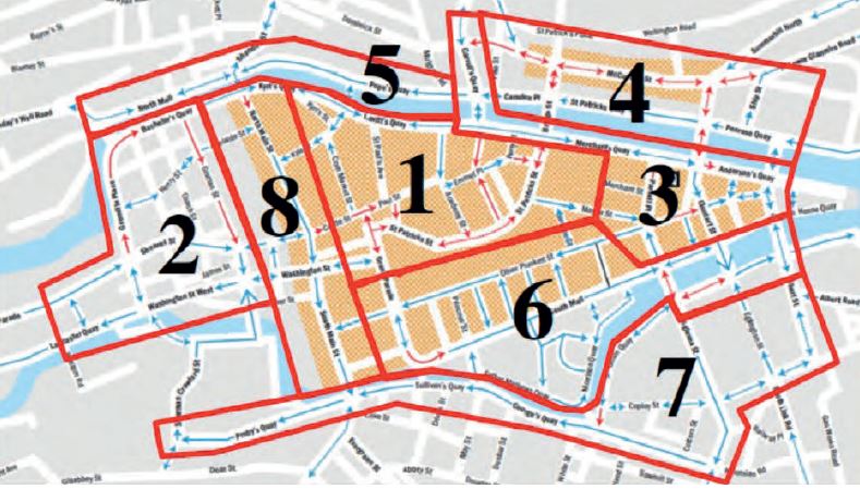
Figure 4.1: Source: CCMS
4.18
Cork City Council is committed to improving pedestrian and cycling connectivity in these areas, some of the initiatives expected to come on stream or further develop during the lifetime of this plan (see Table 4.3 below).
4.19
A range of high quality, public realm improvements have been implemented in recent years to include pedestrian priority areas, wider footways and improved crossing facilities in Cork City Centre and Ballincollig Town Centre in particular. Further improvements are required across the city particularly upon approaches to centres of activity as there are a number of barriers to walking in some areas including street clutter, insufficient footpath widths, insufficient crossing opportunities, pavement parking and a lack of pedestrian priority across local junctions. With its relatively compact city centre and reasonably self-sufficient metropolitan towns, Cork City has significant potential to enhance the pedestrian experience.
| Walking and Cycling Improvements | |
| Initiative | Description |
| Lee to Sea Greenway |
The Lee to Sea Greenway envisions a high quality walking, running, and cycling route through Cork city, county and around its harbour. Commencing at Inniscarra Dam, the Lee to Sea will follow the River Lee through Cork City Centre via the City quays before travelling along the Amongst the benefits accruing include improvements physical and mental health reductions in air borne pollution and carbon emissions whilst boosting businesses and tourism. During the lifetime of this plan Cork City Council will collaborate closely with key stakeholders including the NTA,TII, Cork County Council and other stakeholders to deliver on this project which will be a significant catalyst towards sustainable travel in the Cork Metropolitan Area. |
| Lehanaghmore Road Improvement Scheme |
In addition to road enhancements in this area of the city this contains a suite of measures aimed at improving pedestrian connectivity including new footpaths, pedestrian crossings and a new pedestrian cycling bridge which will link to the planned Greenway on the former Cork-Bandon railway line. This scheme will provide connectivity between the Togher and Lehanaghmore and further on the City Centre and western suburban and will address the infrastructural deficit which has been more acute as the area developed in recent years. |
| Glanmire Roads Improvement Scheme | This scheme contains measures designed to address connectivity issues this Glanmire Area and will allow for more seamless connections between the three villages that comprise the settlement, Glanmire, Sallybrook and Riverstown. Amongst the measures proposed are dedicated off road, segregated cycling routes and the development of a Greenway linking Glanmire Community College to Riverstown and Colaiste na Piarsaigh. |
| Passage Railway Greenway |
The Passage Railway Greenway was previously identified as a key transport corridor by Cork City Council as it has the potential to provide the best quality and most direct route for pedestrians and cyclists between the City Centre and Mahon. It recommended various improvement measures In addition, this route may be shared by the proposed Light Rail section between Mahon and the City Centre. |
| Grange Road Transport Corridor & Tramore Valley (N40 bridge) |
Currently Pedestrian and cycle access to Tramore Valley Park and the wider City centre from the Grange Frankfield area of Douglas is severed by the N40 South Ring Road with crossing points limited to Douglas Village and Kinsale Road interchange. The Cork Cycle Network Plan 2017 provides a clear strategy for the future development of the cycling network within the Metropolitan Area,. The aim is to encourage a greater use of cycling for trips to work, school, recreation and leisure. Cork County Council initiated a proposal to construct a pedestrian and cycle link from the Grange Road, Douglas to the Tramore Valley Park to include a pedestrian and cycle bridge over the N40. The proposal consists of a 4m wide path, circa 995m long extending from Grange Rd north to the N40 South Ring Road and then includes a bridge over the N40 to create a connection to the Tramore Valley Park, There is an existing trail located within the woodland area which commences to the west of Amberley Heights terminates to the west of Alden Grove. The proposed path will extend the trail to connect with Grange Road to the south and the Tramore Valley Park to the north via an overbridge over the N40 South Ring Road where a path will continue through the Park and on to Cork city. The proposed path will provide a safe and direct off-road route for commuter, school and leisure trips from the Grange Road and Donnybrook to Douglas, Turners Cross and Cork City |
| Ballybrack Valley Pedestrian & Cycle Track (Phase 4) | The purpose of the extension is to connect the existing Ballybrack Pedestrian and Cycle Path with Maryborough Hill and a new proposed residential development on the R609 Carrigaline Road. The long-term objective is to provide a cycle link between Carrigaline and the South Environs with the City Centre. |
Table 4.3: Walking and Cycling Improvements.

Permeability
4.20
A permeable street network is a key component of supporting more accessible, walkable and cycle friendly environments. However, the layout of many residential developments across the City in recent decades have tended to favour impermeable, cul-de-sac layouts leading to circuitous routes to local services, schools and public transport stops. Requirements aimed at ensuring permeability across new and established residential areas are presented in the Development Management Standards section of this plan. Cork City Council will undertake a permeability study of Cork City and the urban towns during the lifetime of this Plan.
Pedestrianisation
4.21
A key objective if this plan is to develop Cork as a liveable city. This will require improvement of pedestrianisation in the city. In cities across Europe there is emerging evidence of the reallocation of additional road space to walking and cycling in the response to the COVID-19 pandemic is increasingly being pursued as the best available option to safely facilitate the movement of a considerable volume of people to work, education and amenities.
4.22
In 2020 temporary changes to the layout of some streets in the City Centre were initiated and following public consultation in 2021 it was decided to make this a permanent initiative.
4.23
Table 4.4 below details the streets to be pedestrianised and the planned phasing of same, the times of operation may vary.
Street |
|
| Phase 1 | Phase 1 |
|
• Oliver Plunkett Street from • Cook Street South, • Caroline Street, • Pembroke Street, • Princes Street South, • The Marina |
Grafton Street, • Marlboro Street South • Robert Street • Morgan Street • Smith Street, • Phoenix Street • Beasley Street • Tuckey Street • Little Cross Street • Emmet Place • Peter and Paul’s Place and part of Paul St. |
Table 4.4: List of streets to be pedestrianised.
4.24
A lack of awareness of routes and distances to destinations is often quoted as barrier to walking in the City. Much of Cork City’s existing wayfinding signage system consists of finger post signs, that are inconsistently applied, often damaged, and primarily aimed at visitors. Cork City Council will improve wayfinding for pedestrians, both residents and visitors, over the period of this plan. This will interpret key areas of interest and support behavioural change by illustrating walking times to key areas of the city.
Walking Network Improvement
4.25
The Cork Walking Strategy 2013-2018 provided a clear vision and implementation plan for increasing the modal share of walking for commuting within Cork City’s suburbs. The Walking Strategy proposed the development of a walking network that connects
neighbourhoods, origins, and destinations, increases the permeability of the built environment, and creates an attractive, safe environment that prompts more people choosing to walk, resulting in a healthier population, a more liveable and sustainable city, and stronger communities.
4.26
Much of the focus areas for improvement identified in the Walking Strategy remain relevant but have been adapted in CMATS and will further applied in this plan. These include:
• Network Development of the primary pedestrian network throughout the city;
• Neighbourhood infrastructure to enhance the attractiveness, safety, and accessibility for all pedestrians.
• Behavioural Change initiatives that promote walking.
• Collaboration between stakeholders.
• Upgrade walking provision in tandem with BusConnects corridor improvements, light rail stations development and Cycle Network Implementation; and
• Upgrade pedestrian network in tandem with those proposed for the cycle network to minimise conflicts in shared spaces such as greenways and quietways.
4.27
The Walking Strategy identified several Strategic Routes that overlap with the City’s employment and education areas. These routes were linked with public transport services to identify areas where investment in pedestrian infrastructure would deliver most benefits to modal shift. The Strategic Routes remain relevant over the lifetime of this Plan and CMATS, particularly in the context of planned population growth and residential development in the City in the short to medium term.
4.28
The Strategy detailed above was adopted prior to the Boundary extension in 2019 and as such covers the former administrative area. During the lifetime of this plan Cork City Council will continue to provide new and upgraded footpaths and pedestrian facilities across the whole City including recent and future growth areas.
Cycling
4.29
Cycling is a low cost sustainable and fast-growing mode of transport in Cork. CMATS modelled the potential for an additional 56,000 daily car trips transferring to cycling in the Cork Metropolitan Area by 2040, with mode share increasing from 1% in 2011 to 4% by 2040. This growth rate may be higher than anticipated as there has been an increase in cycling has taken place across the City and in response the number of cycle plans has increased. Significant investment in cycling infrastructure has and will continue to further build on the transition to a cycling culture that has arisen during the pandemic.
4.30
The National Development Plan (NDP) commits to the delivery of walking and cycling networks for all of Ireland’s cities. Key priorities for developing a cycling network for Cork are:
• Designating a coherent network of east-west and north-south cycle routes to provide access to all major trip generators.
• Improve access to key employment areas and third level education as a priority, followed by schools.
• Provide the highest possible level of service on the identified high demand corridors.
• Identify and maximise opportunities for high quality greenways; and
• Work with key stakeholders and the public in identifying and developing the priority routes.
Cork Metropolitan Cycle Network Plan 2015
4.31
The 2015 Metropolitan Cycle Plan has been incorporated into CMATS and will inform the City Councils cycling strategy. This Plan was devised to increase cycling mode share from a low base at the time of publication to provide a clear strategy for the development of the cycling network to encourage greater levels of cycling trips to places of employment, education, recreation, and leisure.
4.32
The routes outlined in the cycle plan have largely been retained and updated to include new primary routes. These include future high quality, segregated routes developed and integrated into the design and development of new strategic road infrastructure and a new link from new residential areas in Glanmire to the strategic employment area of Little Island to enhance connectivity.
4.33
To ensure compliance with the strategy all new development, including changes of use, must demonstrate how they can provide improved linkages to-and-from the Cork Cycle Network. New cycle tracks or cycle lanes, or upgrades to cycle routes, shall be designed in accordance with the ‘National Cycle Manual’ (2011). Recreational car-free cycle routes, cycle routes to schools and Greenways will also be developed to promote cycling within the city and the wider metropolitan area and connections will be required as part of larger developments.
4.34
The proposed network was developed based on the following:
• Transport and land use proposals set out in the policies and plans for the relevant areas.
• Assessment of existing cycling infrastructure within the area.
• Agreed targets for mode share.
• Designating a coherent network of east-west and north-south cycle routes across the area which will provide access to all major trip generators.
• Priority access to employment areas, academic institutions, public services and third level education and schools,
• Providing the highest possible level of connectivity on identified corridors of high demand.
• Identifying and maximising opportunities for high quality greenways and quietways;
• Based on the recommendations within the National Cycle Manual several different infrastructure types are proposed at various locations within the network, including:
– Cycle Lanes
– Mixed Streets
– Cycling and Bus Lanes
– Cycle Tracks
– Cycle Trails or Greenways
– Quietways
4.35
An explanation of the terms above is contained in the Glossary which accompanies this Plan.
Primary Cycle Network
4.36
Primary routes have been designated as such because they experience the highest level of demand. Primary routes are typically direct
and provide medium long radial connections to key destinations across the Cork Metropolitan Area (CMA). These routes are supplemented by secondary and feeder routes which may provide access to residential catchments.
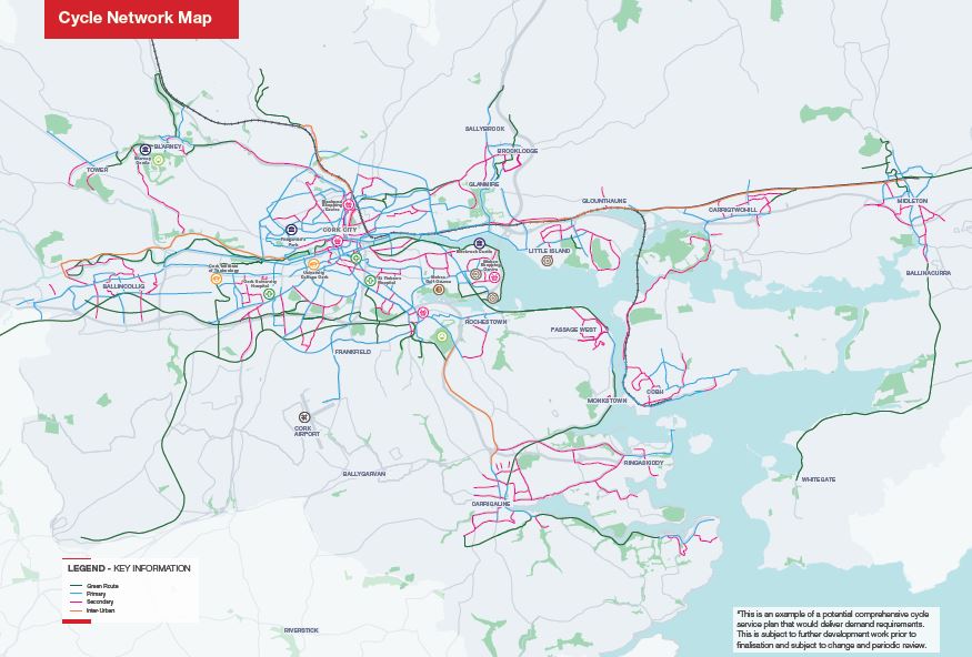
Figure 4.2: Cork Cycle Network Map (CMATS)
4.37
Figure 2 above provides an illustration of the proposed Cork Cycle Network. Primary Routes are outlined in red.
NTA Cycling and Walking Infrastucture 2021-25
4.38
The NTA has recently launched a 5 year plan for Cycling and Walking Infrastructure in Ireland With a budget of €1.8 Billion it is envisaged that this plan “enable a step change in the number of people taking daily journeys by foot and bicycle, which will help improve quality of life and air quality”.
4.39
For Cork City this Plan envisages in excess of 100 km of new and upgraded cyce facilities to be delivered during its lifetime.
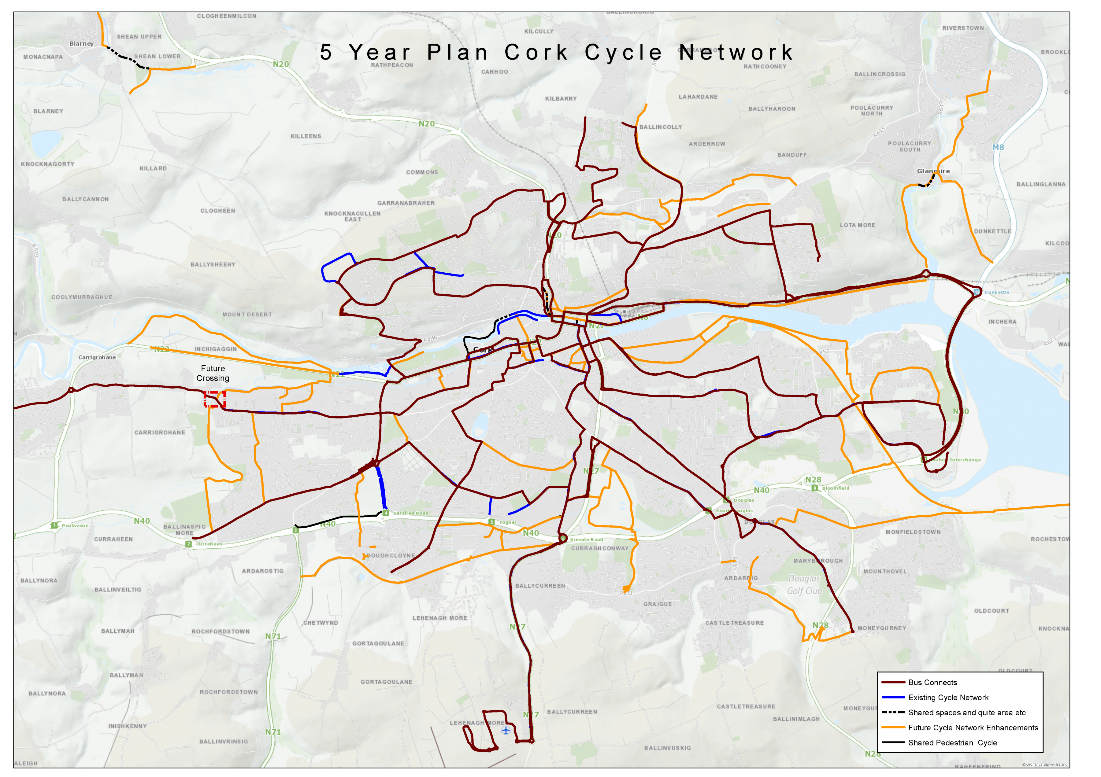
Figure 4.3: Indicative 5-year Cork Cycle Network Map. (Click on Map for High Resolution Image)
Cork City Bike Sharing Scheme
4.40
The Cork City Bike sharing scheme was launched in 2014 and reached over 1 million journeys in 2018. Today, it has 330 bikes located at 32 bike stations in a mostly east-west corridor throughout the city centre. Its most western stations are at UCC and Fitzgerald’s Park, with the most easterly at Kent railway station. Cork City Council will work with the National Transport Authority to further develop the scheme during the lifetime of this plan. Further enhancements to the scheme include including consideration of electronic bikes, dockless bikes and an expansion of the current network to include additional locations throughout the city.
Other Cycling Interventions
4.41
To support behavioural change, Cork City Council will implement a range of other innovations and interventions designed to enhance the cyclist’s experience and safety. This will include interventions that encourage people with disabilities to cycle, improved safety measures, and smart mobility. In addition, the City Council will continue to develop safety awareness campaigns for both motorists and cyclists.
Safe Routes to School
4.42
The Safe Routes to School programme aims to create safer walking and cycling routes within communities, alleviate congestion at the school gates and increase the number of students who walk or cycle to school by providing walking and cycling facilities. The improvements to the school commute could range from an upgraded footpath or new cycle lane to a complete reworking of a school’s entrance. It is funded by the Department of Transport through the National Transport Authority (NTA) and is supported by the Department of Education. An Taisce’s Green-Schools is co-ordinating the programme, while funding will be made available to local authorities which will play a key part in delivering the infrastructure along access routes and at the school gate. Cork City Council will fully support and engage with the programme by delivering the infrastructure along access routes and at the school gate.
![]()
4.43
It is the primary objective of CMATS to significantly increase modal share of public transport from its current level of 9.1% to over 26% by 2040. A combination of major upgrades to the bus transport and rail networks will underpin this increase.
4.44
With an investment in the BusConnects project, improved services and more stations on the suburban rail line and the development of a Light Rail Transit (LRT) system linking Ballincollig to Mahon, via the City centre and Docklands, public transport in Cork will change radically during the lifetime of this Plan and future City Development Plans.
BusConnects
4.45
Over recent years there has been a considerable expansion of both the level of use and the provision of bus services across Cork City. The city was host to the first 24 hour bus service, linking Ballincollig, the City Centre and Carrigaline. In addition, investment has been made to provide real-time data on the bus services, there has been significant expansion of the fleet, there was improved access to people with reduced mobility, revised fare structures and the introduction of the LEAP card. Surveys conducted to inform this development plan, or assess satisfaction with the city, all found that the residents of Cork would prioritise the expansion of bus services across the city.
4.46
The enhanced BusConnects network will comprise of a significantly increased bus network, bus priority routes and around 220 new double decker vehicles. The BusConnects programme represents an opportunity to overhaul the public bus service across Cork. This process has commenced, and the NTA has commissioned the redesign of the bus network. In addition, it will involve improvements on the core corridors and the provision of additional park and ride facilities.
In addition to these infrastructural improvements, BusConnects will involve continued operational improvements, such as improvements in relation to ticketing, real-time information and passenger facilities, all of which are designed to improve the reliability and frequency of the service, thereby enhancing the appeal of public transport in the city.
4.47
In total, the network will comprise of over.
• 200 km of cross city routes,
• 50 km of orbital routes and
• 150 km of radial routes
4.48
BusConnects will be interchangeable with the Cork Suburban Rail Network, Light Rail Network and the proposed Park and Ride services located around the Strategic Road Network. Detailed planning is currently being undertaken on the identification and selection of proposed routes which will form the spine of the proposed transport improvements. Additionally, bus services will be subject to regular review and changes may be introduced to reflect evolving development patterns and changing passenger needs within the City. The process of identifying both the location and number of routes has commenced and it is anticipated that this will be available at the next stage of this plan process. It is expected that the network will comprise of core routes, supplemented by a supporting radial bus service in outer areas of the City such as Rochestown, Blarney, Tower, Kerry Pike and Glanmire
4.49
A list and maps of indicative routes is contained below.
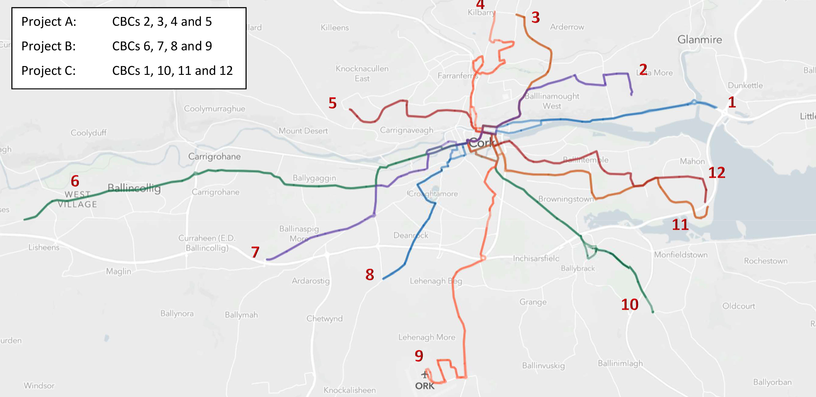
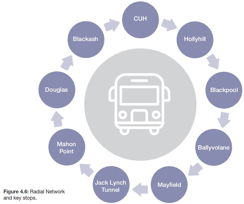
Figure 4.4: Core bus network map and routes. (Click on Map for High Resolution Image)
CORE Bus Corridor Number |
Route |
| CBC 1 | Dunkettle to City Centre via Tivoli and Kent Station. |
| CBC 2 | East of Mayfield to City Centre via Montenotte. |
| CBC 3 | Ballyvolane to City Centre via Montenotte. |
| CBC 4 | North of Dublin Hill to City Centre via Blackpool. |
| CBC 5 | Hollyhill / Apple to City Centre via Shandon area. |
| CBC 6 | West of Ballincollig to City Centre via Mardyke. |
| CBC 7 | West of Bishopstown to City Centre. |
| CBC 8 | Wilton to City Centre. |
| CBC 9 | Cork Airport to City Centre via Turners Cross area. |
| CBC 10 | South of Douglas (N28) to City Centre via Douglas. |
| CBC 11 | Jacobs island to City Centre via Balinlough. |
| CBC 12 | Mahon to City Centre Via Balintemple. |
Table 4.5: Core Bus Corridor Routes
Note: For the purposes of these route descriptions City Centre is defined as the area of the island in
Cork City Centre bounded by South Mall to the south, Parnell Place to the east, Merchants Quay and
Levitt’s Quay to the north and Grand Parade and Cornmarket Street to the west.

Figure 4.5: Key stops. (Click on Map for High Resolution Image)
Urban Town Bus Services
4.50
The provision of local bus services within the urban towns will be reviewed during the lifetime of CMATS. Such services may provide local benefits through linking residential and urban expansion areas with town centres, schools, rail stations and employment areas. Local City town services may comprise of new bus services developed specifically to service the local area or comprise an expansion/re-routing of existing regional bus services. Consideration of the routing through of regional services to provide for improved integration and interchange with suburban rail stations and local public transport services will be given in CMATS. Within the urban towns, Cork City Council will focus on identification and implementation of bus priority measures through their respective centres and noted pinch-points. These will be considered in tandem with proposed public realm projects and/or the realisation of distributor roads to remove through traffic from town centres. In some cases, the potential for shuttle buses from Interchange points to serve centres of employment – for example, at Ballincollig and Blarney will be considered through CMATs.
Regional Bus Service
4.51
Regional bus services provide an important element of connectivity between the City, the CMA and the wider Cork Region. Continuous improvement of the existing network of regional services, with a view to expanding on service frequency to meet the growing demand as required is being considered in CMATS.
Bus Priority Measures
4.52
The delivery of an efficient and reliable bus system is contingent on prioritising bus services above general traffic. The proposed increase in bus services and vehicle numbers will benefit a significant proportion of the City’s population. This will be dependent on the implementation of bus priority across the city. Otherwise, public buses will be held up in general traffic, providing reduced additional advantage to public transport.
4.53
Currently there are 14km of bus lanes provided in Cork City. Proposed bus priority measures provide for approximately 100km of new bus lanes. The extent of the planned bus lanes will align with the proposed Core Bus Network, ensuring efficient, reliable, and frequent services can be accommodated.
4.54
On key bus routes end-to-end bus priority in each direction will be provided, where practicable. On some parts of the National Road Network, further investigation, analysis, and agreement with TII will be required, to determine the optimal bus priority outcomes. In some areas of the City measures including the removal of some on-street car parking and the acquisition, by compulsory purchase or otherwise, of some private land will be required to facilitate bus priority lanes and footpaths to provide access to the bus network itself.
4.55
Bus gates, protected laybys and bus priority at signalised junctions are amongst the interventions being considered as a means of prioritising bus services above general traffic. Implementing these measures will facilitate a significant improvement in punctuality and bus journey time reliability. Greater levels of connectivity will be provided with the suburban rail network enhancing access to employment centres at Cork City and the wider CMA including at Little Island and Carrigtwohill.
Light Rail
4.56
The development of an east-west mass transit, rapid transport corridor has been a long-term objective for the Cork Metropolitan Area.
4.57
The commitment to examining the feasibility of such a route is confirmed by the publication of both the National Planning Framework (NPF) 2040 and the National Development Plan 2018-2027 and a recent upsurge in planning developments and interest in key sites along the corridor has provided further momentum to determine the feasibility of such a route.
4.58
Following detailed analysis of projected travel demand within the CMA, CMATS has determined that the East-West Transit Corridor is best served through the provision of a new Light Rail Transit (LRT) tram system.
4.59
This analysis marks a significant change from previous strategies that provided for a lower capacity Bus Rapid Transport (BRT) system.
4.60
It is anticipated that approximately 25 stations will be required to serve the route between Ballincollig and Mahon Point, providing an estimated total journey time of 47 minutes. These stations will serve a catchment area of all existing and proposed key adjoining development areas along the corridor and provide interchange with InterCity and suburban rail services at Kent station plus the proposed BusConnects service.
4.61
To reflect the more ambitious growth targets of the NPF and the requirement to future-proof such a route up to and beyond, the 2040 horizon year.
4.62
The LRT will be preceded by a high-frequency bus service between Mahon and Ballincollig. This will be delivered in the short-term to underpin higher development densities along the corridor including the regeneration of the Docklands. The provision of LRT system will be a focal point to enable the growth of population, employment health and education uses as envisaged by the NPF 2040 and will underpin Compact Growth.
4.63
The LRT system is a key enabler for development of the City as it will.
• Unlock strategic development areas in its catchment area including the
• Cork City Docks; Curraheen, Ballincollig and Mahon.
• Maximise the development potential of windfall sites.
• Provide greater certainty for future planning and development, to pursue higher densities required to meet NPF population and employment targets for Cork City;
• Underpin the planned expansion of University College Cork (UCC), Munster Technological University (MTU) and Cork University Hospital (CUH);
• Enable car-free and low car development within its catchment in line with recent changes to government policy outlined in the NPF and Sustainable Apartment guidelines.
• Reduce reliance on the N40 in particular, for short trips within the Metropolitan Area.
4.64
The LRT route will serve a wide range of existing and future destinations including employment, institutional and retail uses, facilitate modal shift away from the private car for short trips and free up capacity on arterial roads for bus services. The LRT will link with a strategic Park and Ride station near Ballincollig to reduce cross-city trips, it will also facilitate greater levels of walking and cycling as part of linked trips with public transport and reduce transport related noise and emissions.
Proposed Route
4.65
The topography and distribution of existing trip generators and attractors, combined with the proposed development opportunity areas within Cork City and its suburbs, indicate the desirability for a linear route from Ballincollig in the west to Mahon in the east, via Cork City Centre. The following locations are required to be within the catchment area of the future light-rail system:
• Ballincollig.
• The proposed Cork Science and Innovation Park (CSIP);
• Munster Technological University (MTU)
• Cork University Hospital (CUH).
• University College Cork (UCC).
• The City Centre.
• Kent Station / Cork North Docklands.
• Cork South Docklands; and
• Mahon.
4.66
Determination of the final LRT route alignment and depot location has not yet been identified. A definitive route alignment is needed to maximise the ability to provide appropriate densities for development sites at locations along the route and to avoid conflict with emerging development proposals.
4.67
Application of appropriate safeguards within the study corridors and the application of appropriate development densities to ensure the long-term feasibility of the proposed routed by Cork City Council will be applied in this Development Plan and once the emerging preferred route is identified a variation of this plan will take place to safeguard the route.
Figure 4.7: Indicative LRT route.
Advance Bus Provision
4.68
In advance of the development of the LRT, and to allow the development consolidation to support its delivery, the selected route will be served with a high frequency bus service with bus priority measures to enable a high level of performance in advance of its transition to light rail.
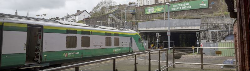
Suburban Rail
4.69
The existing rail network provides direct and reliable access to Cork City Centre from a significant portion of its east and northern Metropolitan Cork catchment area. This plan through CMATS proposes to maximise opportunities offered by the existing suburban rail network to support the travel needs across the CMA. Maximising the potential of the rail corridor will support better integration of land use planning and public transport. This approach provides justification for new greenfield development at Blarney / Stoneview, brownfield development at Tivoli and an examination of the potential for future development in the North West Corridor of the City such as Killeens. The provision of new train stations at Blackpool, Blarney and Tivoli is consistent with Cork City Councils policy and objective to significantly intensify development around these locations. As the Suburban Rail will utilise the existing mainline between Mallow and Kent and onto Midleton is important to ensure that the provision of additional suburban rail stations and services will not preclude the ability of train providers to increase the speed or frequency on this line.
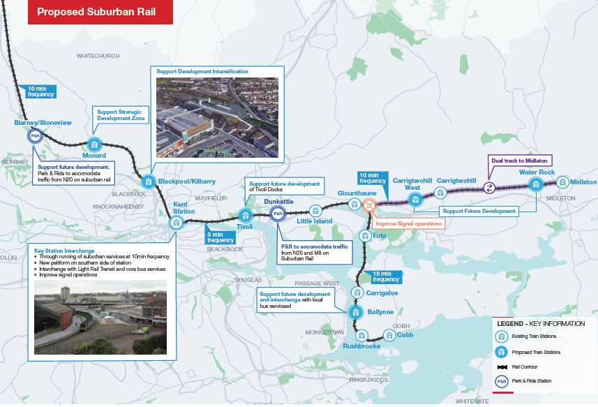
Figure 4.8: Indicative Suburban Rail.
Public Transport Storage & Maintenance Depots
4.70
The Bus fleet serving the City will be increased significantly to accommodate the enhancement of services anticipated in CMATS. The current depot at Capwell is at overcapacity and a replacement depot is required in the short term.
4.71
Similarly with Light Rail depots will be required. Cork City Council will work with CIE group, the NTA and TII to identify both temporary and permanent bases for the respective fleets at an early stage followed adoption of this plan.
4.72
The location of such facilities in the City Hinterland is acceptable subject to demonstrable need and normal planning and environmental considerations.
InterCity Services
4.73
The Cork-Dublin rail corridor is the primary InterCity service in the State in terms of patronage and frequencies.
4.74
The National Development Plan and 2016 Rail Review Report proposes number of relevant improvements to this line including the following:
• Examination of opportunities for improvements in journey times and investment in high-speed rail between Belfast, Dublin, Limerick-Junction and Cork.
• Examine opportunities to increase the frequency of InterCity services at peak times between Cork and Dublin.
• Electrification of the rail line once the current InterCity carriages outlive their useful life-estimated by the mid-2020s; and
• Improving InterCity journey time between Dublin and Cork to least at 2 hours.
New Development in areas served by High Quality Public Transport
4.75
New commercial and housing Developments in these areas must allow for continuous, direct pedestrian and bicycle access routes from the surrounding neighbourhood to railway stations and public transport interchanges.
4.76
A continuous active frontage along pedestrian approach paths to these facilities is required.
4.77
Pedestrian approach paths from new developments must be developed with clear sightlines to and from railway station buildings, and to and from public transport interchanges.
Public transport infrastructure and the receiving environment
4.78
Railway station forecourts and public transport interchange stations can form a key part of the public realm and should be developed in such a manner that allows for high levels of pedestrian activity.
4.79
Where commercial activities are proposed as part of a Transport led development, consideration should be given to locating these uses such as convenience stores close to the station entry point so as to provide for informal surveillance and increase perceptions of safety.
4.80
Where commuter car parking areas are proposed these should be located away from the main pedestrian approaches to stations to allow for unimpeded movement.
4.81
Where development or works are proposed on land abutting a railway or light rail corridor, consultation with Iarnroid Eireann or the Light Rail operator should occur early in the planning process.
Accessibility of Public Transport for People with Disabilities
4.82
Inaccessibility to Public Transport can be a barrier and prevent people with disabilities availing of Public Transport. Cork City Council are cognisant of the need to improve access to public transport for all users.
• New Public Transport Infrastructure
4.83
Accessibility features, such as wheelchair access and audio and visual aids, must be built into all new public transport infrastructure projects and vehicles from design stage in addition accessibility for stationsand stops must be incorporated at design stage.
• Older Infrastructure
4.84
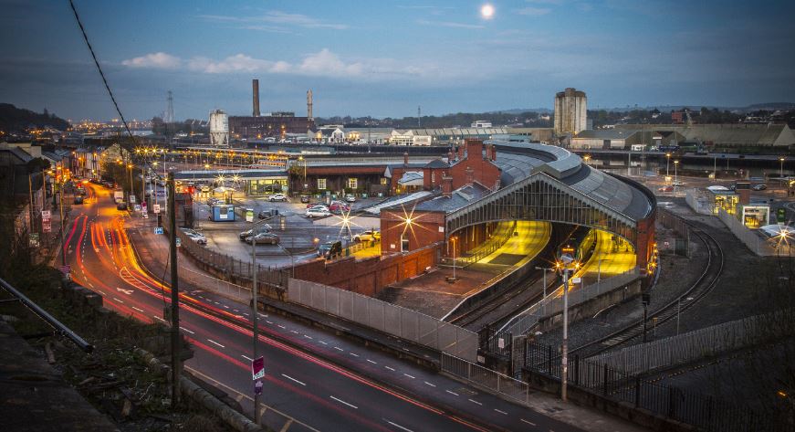
Cork City Council are aware that there are legacy issues in relation to older infrastructure and facilities in particular Kent Station.
4.85
Whilst access to the Station for people with disabilities has improved in recent years some areas of the complex continue to present difficulties for people with disabilities particularly the curved platform which provides access to trains on the Inter City and Northern Commuter Routes.
4.86
Cork City Council together with Irish Rail and NTA will engage to improve to improve access to this area at an early stage during the lifetime of this plan for wheelchair users and people with mobility or visual impairment.
Park and Ride
4.87
Park and Ride (PnR) involves the provision of high capacity, car parking facilities at designated public transport interchanges to provide onward access to the City Centre and other key destinations via high frequency public transport, walking or cycling.
4.88
Park and Ride can deliver the following benefits for Cork City:
• Support economic vitality by improving overall accessibility to the City Centre area.
• Reduce road traffic congestion on radial routes.
• Increase the attractiveness of the City Centre to visitors and shoppers.
• Increase the effective catchment area of the public transport network.
• Transfer commuting trips from private car to public transport.
• Improve access for those living on the city edge and in low density suburbs; and
• Maximise public transport patronage.
4.89
CMATS is a means of increasing the accessibility of the transport network to a population that might not otherwise have access by walking, cycling or bus transfer.
4.90
At present, Cork has limited PnR services with the existing Black Ash facility near the Kinsale Road interchange operating below capacity. A number of strategic PnR facilities are therefore proposed to address the shortcomings in recent provision.
4.91
Strategic PnR facilities will cater for between 400 - 600 car parking spaces and will in all cases, be serviced by reliable, high frequency public transport including the suburban rail corridor, BusConnects and/ or light rail system.
4.92
Quality local walking and cycling networks will be required to support safe and reliable interchange services and adjoining employment and residential uses.
4.93
Indicative locations for high capacity, strategic PnR facilities are proposed at:
• Dunkettle – catchment for M8 and N25. Will be supported by suburban rail and BusConnects.
• Carrs Hill / M28 – BusConnects
• Cork Airport – BusConnects
• Bandon Road Roundabout (N40) (BusConnects).
• Blarney/Stoneview (rail based)
• Ballincollig/Woodberry (light rail)
4.94
The above represent indicative locations only and are subject to further investigation. In the majority of cases, strategic PnR will be related to the delivery of the BusConnects network and require bus priority measures to be implemented in advance of the opening of the facility.
Local Mobility Hubs
4.95
The strategic Park and PnR will be complemented by a number of smaller, local facilities sometimes known as ‘mobility hubs’ in a European city context. Local mobility hubs may include formalising existing surface or multistorey car parks at locations including Mahon, Pouladuff Road, Carrigrohane Road, Blackpool, and Docklands. These hubs may potentially take the form of multi-storey car parks or basement car-parking in some circumstances. Existing rail and bus stations may also be retrofitted as mobility hubs.
4.96
Typically, a local mobility hub will be supported by frequent public transport, quality walking and cycling networks within a catchment area of 500-600m and include supplementary facilities including public transport stops, high-capacity cycle parking, bicycle sharing systems dedicated car club spaces, carpooling spaces, electric charging facilities for cars and taxi drop-off facilities.
4.97
Local mobility hubs typically support lower levels of residential parking from new development areas but can potentially support some limited destination parking in areas where on-street parking has been re-purposed to support public transport or local public realm improvements. Site specific locations and suitable capacities for mobility hubs will determined during the lifetime of the plan.
Parking Management
4.98
Car parking is a key issue, both from the point of view of the continuing health of the city’s economy, and its influence on the choices made amongst modes of transport. Cork City Council is committed to encouraging alternatives to the private car and will continue to encourage a shift toward increased use of sustainable transport.
4.99
The availability and price of parking are major determinants of the relative attractiveness of the private car versus sustainable transport options and an extremely effective demand management tool.
4.100
Parking management measures can include pricing, supply and enforcement controls. Parking restraint can also be applied as a fiscal measure alongside land use planning measures.
4.101
Cork City Council has been guided by the provisions of and the anticipated roll out of CMATS in determining new Parking standards for the City and the Urban Towns.
4.102
This Plan includes comprehensive car parking standards which are set out in Chapter 11 Placemaking and Managing Development. Four parking zones have been established for the City with the aim of ensuring adequate residential parking/car storage and control of destination carparking (non-residential uses), whilst also allowing greater flexibility in car parking standards on sites well served by public transport. The four zones are detailed in Table 4.3.
4.103
Separate standards are prescribed for the Docklands and Tivoli and are set out in Chapter 10 Key Growth Areas and Neighbourhood Development Areas.
4.104
These standards will be reviewed periodically as the measures and interventions prescribed in CMATS come on stream.
Parking for New Development
4.105
As a mechanism in achieving the City Councils overarching aim of providing for a co-ordinated approach to the development of the City the following approach will be taken towards new developments:
• Direct high-density residential land use and high trip generating uses including employment and retail to areas that are currently, or will be, served by high frequency transport services.
• Set maximum parking standards across the City including the Urban Towns, taking into account accessibility to public transport and / or access to local services including education and employment.
• Set out car-free or low car standards in development areas within an 800m walking catchment area of Cork city centre and / or of quality public transport; and
• Ensure that alternatives to private car ownership are made available including provision of car club bays and membership, public transport cards and increasingly, provision of and membership of cycle hire schemes.
| Car Parking Zones | Primary Areas |
| Zone 1 | Cork City Centre and Inner City |
| Zone 2 |
Areas accessible to mass transit (existing or proposed Light Rail Corridor, Core Bus Network) Most City Suburbs, including Ballincollig, Ballyphehane, Ballyvolane, Bishopstown, Blackrock, Blackpool, Douglas Mahon, Mayfield, Sundays Well, Togher |
| Zone 3 | Blarney, Glanmire, Rochestown, Tower |
| Zone 4 | City Hinterland, Kerry Pike, Killeens, Upper Glanmire |
Table 4.6: Car Parking Zones.
On-Street Parking
4.106
Cork City Council will continue to reduce the levels of on-street parking in the city and urban town centres over the lifetime of the plan to accommodate a wide range of sustainable transport measures including bus priority, laybys, safer crossing facilities, seating, contra-flow cycle lanes, parklets, bicycle share schemes and cycle parking.
4.107
Additional on-street spaces will be repurposed to support flood management schemes and public realm improvements including street trees, wider footpaths and recreational facilities. Where onstreet parking is provided to support the economic functions of the City and Urban town centres, the emphasis will be on supporting a quick turnover of spaces to ensure that spaces are readily available for those businesses that rely upon them.
4.108
In residential areas, the objectives will be to discourage commuter parking that contribute to parking stress and unsafe parking practices immediately outside paid parking zones, and to free-up kerbside space by providing alternatives to private car ownership.
4.109
Cork City Council operates a pay parking system for the payment of on-street parking. The availability and pricing structure for on-street parking within the City and Urban Towns will be reviewed as CMATS measures are rolled out with a view to moving towards a smarter, more user-friendly system that facilitates a quicker turnover of spaces.
4.110
The proposed approach to on-street parking is as follows:
• Undertake comprehensive rolling reviews of the available kerbside space in the City and Urban Town centres to understand how the space is being used and assess against existing and future needs, including bus and light rail implementation. Employ performance based smart parking pricing systems in the city and town centres to ensure that spaces are used efficiently but are readily available for non-commuting purposes including shoppers.
• Conduct a review of pricing and durations for parking.
• Extend coverage of parking zones controls across the City and Urban Towns to safeguard spaces for residents, tackle illegal parking and to discourage commuter and other forms of llong-stay parking;
• Gradual increases in the price of permits, particularly in areas where off-street parking options are readily available will be implemented; and
• Facilitate alternatives to private car ownership including providing more designated on-street bays for car clubs, bike share systems and similar measures.
Off-Street Parking
4.111
The main objective of the off-street parking measures is to free-up kerbside space within the city and town centres and to support a viable, public transport system. The approach to addressing these matters in the form of Park and Ride Facilities and Local Mobility hubs is discussed earlier in this Chapter.
Electric Vehicle Charging Points
4.112
The provision of car parking spaces for the charging of electric vehicles will be facilitated at appropriate locations.


4.113
The promotion of sustainable means of travel, and the encouragement of modal change from the private car Is a key commitment of this plan. However, it is recognised that the roads infrastructure maintains a central position in Cork City’s overall transportation network, catering for the movement of buses, goods vehicles, pedestrians, cyclists, as well as the private car. During the lifetime of this plan Cork City Council will strive to roll out an adequate road infrastructure to ensure the sustainable, economic development of the City.
4.114
A number of key road improvements are required to facilitate the movement of goods and people within and without the City and to ensure ease of access, especially for major areas of new development.
4.115
It will be an aim that all roads’ projects will provide for enhanced provision for public transportation, cyclists, and pedestrians, as appropriate.
4.116
Amongst the road’s projects planned for Cork City include:
• The northern distributor road, and
• The southern distributor road.
4.117
In addition, Cork City will act as a terminus for both the:
• M28 project which will enhance access to
Ringaskiddy from the City and beyond; and
• The N/M20 project which will provide for
improved connectivity between Cork City
and Limerick.
Northern Distributor Road
4.118
CMATS identifies the need for additional road network infrastructure on the north side of Cork City to cater for access to planned development lands, provide walking and cycling linkages, access to radial public transport routes, orbital public transport provision, and the removal of some strategic traffic from Cork City Centre.
4.119
This new road will be in the form of a distributor road referred to as the Cork Northern Distributor Road (CNDR). This is distinct to the Cork North Ring Road (N40 north), outlined below in this Chapter, which will be examined by Transport Infrastructure Ireland.
4.120
The Cork Northern Distributor Road is a short-term objective and considered to be a ‘critical enabler’ for CMATS as it:
• Creates opportunities for sustainable development of existing land banks in the North City Cork Metropolitan area including the Ballyvolane Urban Expansion Area.
• Facilitates the rollout of sustainable transport measures including public transport services for the North City area.
• Facilitates the introduction of a HGV ban within the City Centre;
• Serves the requirements of local traffic demand in the northern CMA; and
• Allows for the downgrading of national routes entering Cork City, which can therefore allow for the prioritisation of sustainable modes on these routes.
4.121
The Cork Northern Distributor Road will provide an orbital route for bus, pedestrian, cycle and some strategic and general traffic and will reduce reliance on radial routes through the City Centre. CMATS proposes that the NDR would provide connectivity at its western end to join the existing N22.
4.122
To achieve this, the link would need to address several topographical and environmental considerations including the River Lee and its associated floodplain, the requirement for a new bridge. Further assessment of the final alignment will be needed to address these concerns and the requirement to provide orbital connectivity between Cork’s Northside and key destinations including CUH, CIT, Blackpool, and Tivoli Docks.
4.123
At time of writing this Draft City Development Plan, consultants have been appointed by Cork City Council to appraise and design the new road and a number of route options are emerging. These will be considered at next stages of preparation of the Development Plan.
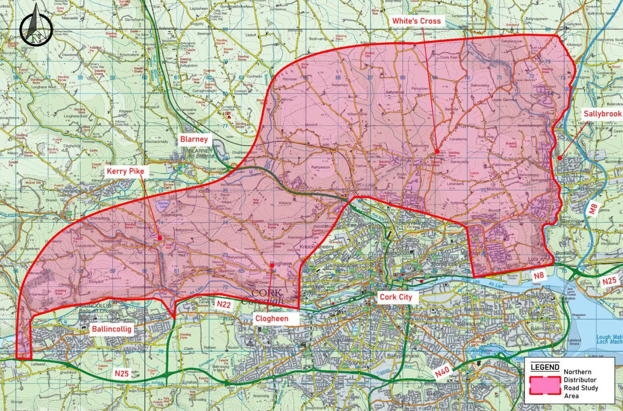
Figure 4.9: NDRR study area. (Click on Map for High Resolution Image)
Southern Distributor Link Road (SDLR)
4.124
The Southern Distributor Link Road is specifically identified in CMATS as one of a limited number of new road-based projects required to facilitate the sustainable movement of people, goods and services, and to complement public transport, walking, cycling and traffic management objectives.
4.125
The Southern Distributor Link Road is a critical component of the SDR and is a proposed new road link between the N27 and Sarsfield Road with the potential to also link to the N71 via Lehenaghmore and Spur Hill and could also provide enhanced connectivity to Cork Airport with a potential secondary access point.
4.126
The current road network within the SDLR study area does not include a direct east-west link between the southern extent Sarsfield Road and the N27. Road users wishing to travel between Sarsfield Road and the N27 travel a circuitous route along Spur Hill, Togher Road, Lehenaghmore Road and Forge Hill, or alternatively use the N40 to the north.
4.127
The N40 currently conveys a significant proportion of east-west trips in the South City Area and is operating over capacity.
4.128
This over-reliance on the N40 for private vehicle trips allied to limited sustainable transport connectivity has resulted in significant congestion at several pinch-points including Douglas Village and the Kinsale Road Roundabout. To address the significant shortfall in local connectivity in the Southern Environs area, CMATS has identified the requirement for a comprehensive, multi-modal SDR. The SDR will comprise of a new Douglas bridge, an upgrade to existing roads including the Grange Road and a new road to connect the N27 to Sarsfield road.
4.129
At time of writing this Draft City Development Plan, consultants have been appointed by Cork City Council to appraise and design the new road and a number of route options are emerging. These will be considered at next stages of preparation of the Development Plan.
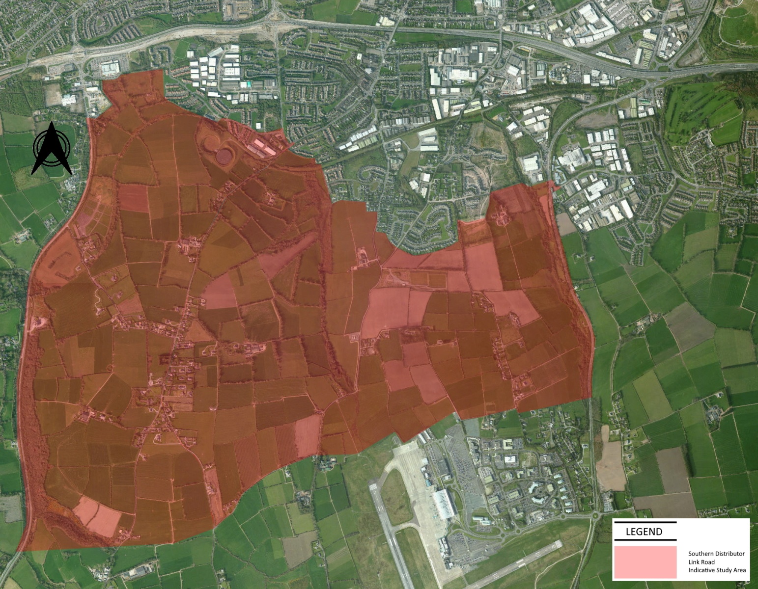
Figure 4.10: SDLR Study Area. (Click on Map for High Resolution Image)
M28
4.130
The N-28 National Primary route links Ringaskiddy to Cork City and onwards to the wider regional and National road network. It is proposed to construct a new M28 Motorway from Cork to Ringaskiddy from the existing N28 N40 Bloomfield interchange on the South Ring Road to Ringaskiddy village. The new road will remain online using the existing N28 from the Bloomfield interchange to Carrs Hill and from there the route will go offline to the west where it will terminate at the new Port of Cork facility at Ringaskiddy.
4.131
Contained within the Motorway Scheme are ancillary local road network upgrades. Development or at least the scale of development in the vicinity of this scheme may be contingent on the timing and delivery of this scheme and ancillary upgrades.
M20
4.132
The N/M20 Cork to Limerick Road Improvement Scheme is a key element in Project Ireland 2040 and has been identified as a major enabler for balanced regional development.
4.133
The N/M20 Cork to Limerick scheme will provide better connectivity between Ireland’s second and third largest cities enabling safer and more efficient journey times.
4.134
The scheme development is currently at Phase 2 Option Selection. Four emerging routes have now been identified with a preferred route due to be selected in 2021.
4.135
Application of appropriate safeguards within the study corridor to ensure the long-term feasibility of the proposed route will be applied in this Development Plan and once the emerging preferred route is identified a variation of this plan will take place to safeguard the route.
4.136
In addition to roads improvements a series of railbased improvements are also being examined and are discussed in preceding sections of this chapter.
Source: Dunkettle Interchange Upgrade Scheme.
CNRR (N40 NORTH)
4.137
The Cork North Ring Road/N40 north (CNRR) linking the N20 to the Dunkettle Interchange is currently being appraised.
4.138
The CNRR is a complementary but independent scheme to the N/M20 corridor scheme. It is envisaged that the CNRR would not be delivered in advance of the substantive public transport elements of the Cork Metropolitan Area Transport Strategy (CMATs).
4.139
Application of appropriate safeguards within the study corridors and the application of appropriate development densities to ensure the long-term feasibility of the proposed routed by Cork City Council will be applied in this Development Plan should they emerge during the lifetime of this plan. When an emerging preferred route is identified a variation of this plan will take place to safeguard the route.
N40 Demand Management
4.140
The N40 Cork South Ring Road is the most heavily trafficked roads in the Southern Region and forms part of the Trans-European Transport Network (TEN-T).
4.141
The N40 corridor was constructed and upgraded incrementally since the early 1990s between Junction 1 (Poulavone) and Junction 11 (Dunkettle) over a number of decades at significant investment.
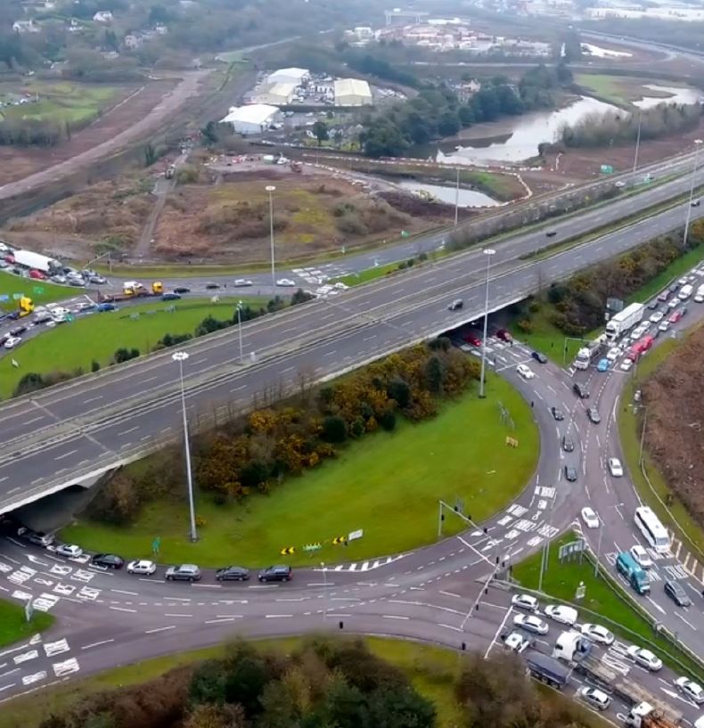
4.142
In more recent years, infrastructural work along the N40 has tended to focus on maximising the efficiency and throughput of the corridor with a number of interchange grade separation schemes completed The Dunkettle Interchange (Junction 11) represents the last at-grade junction on the N40 and is currently being upgraded to a free-flow junction.
4.143
The N40 Demand Management Study, which was published in 2017, recognised that future traffic demand on the N40 will need to be managed if this road and the Jack Lynch Tunnel are not to act as a constraint on development within the Cork Metropolitan Area.
4.144
The TII Demand Management Study identified a number of proposals under the following broad headings.
• Integrated Land use and Transportation
• Targeted Upgrades;
• Smart Motorway Interventions;
• Alternative Complementary Routes; and
• Fiscal Measures.
4.145
Measures such as those outlined above can have a positive impact on managing future demand on the N40, notwithstanding the complexity of the overall road network in the CMA and the limited alternatives to the Jack Lynch Tunnel. Cork City Council will support rollout of public transport, land use policy and traffic management measures in the short-medium term. Measures will not be introduced in isolation but only after due consideration of the impacts on access and movement across the City and suburbs and in parallel with the introduction of necessary appropriate alternatives to service affected traffic movements. The upgrade of the N40 South Ring Road to motorway status is one of the key recommendations of the study, primarily to limit its use to motorised vehicles and to remove the small number of cyclists, pedestrians and slow moving vehicles in the interests of road safety.
4.146
Cork City Council will support Transport Infrastructure Ireland (TII) to undertake traffic management and improvement studies focussed on the N40 to assess current capacity constraints and to identify potential future improvements to the operational safety of this key strategic route. Upgrades to the Dunkettle interchange have to a free flowing interchange have commenced.
4.147
The development includes the following elements of infrastructure:
• A series of direct road links between the N8, the N25 and the N40 and links to the R623 Regional Road in Little Island and Burys Bridge in Dunkettle;
• 1 grade separated junction arrangement at the existing N25 to the east of the existing Dunkettle Interchange;
• 4 roundabouts – 2 at the grade separated junction and 2 at tie-ins with the existing road network;
• 52 structures of various forms;
• Several culverts where the scheme crosses watercourses or intertidal areas;
• Intelligent Transport Systems;
• Pedestrian and cyclist facilities.

4.148
The Port of Cork is a port of national significance and a significant driver of economic development in the Cork region and this plan strongly supports the relocation of port facilities from South Docks and Tivoli to Ringaskiddy and other locations within Cork County.
Water-based Transport
4.149
The relocation of Port Facilities away from the City will free up significant landbanks for housing and employment and allow the creation of compact, vibrant urban neighbourhoods in Cork Docklands. This will be integral to the realisation of the significant population and housing ambitions for Cork contained in the National Planning Framework (NPF).
4.150
With the increase in land available due to the anticipated relocation of port operations, Cork City Council will consider measures to support waterbased transport in the City and wider Cork harbour area in conjunction with the NTA and Cork County Council.

4.151
Cork International Airport is an important strategic asset to the City and an important economic driver for the wider Southern Region. It plays a key role in terms of access to the region from Britain and other destinations in Europe in particular. Successive statutory plans set out a framework for the operational area of Cork International Airport. These were prepared for the purpose of facilitating the development of Cork Airport by identifying land for the future operational needs of the airport and safeguarding this land from inappropriate development. The Section on Cork International Airport in Chapter 10 of this Plan examines the future land use requirements of this facility and sets out policies to sustain it into the future.

4.152
Area Based Transport Assessments (ABTA) are one of a number of complementary assessment processes used in the preparation of land use plans, planning schemes and masterplans.
4.153
The core objectives of ABTAs are to ensure that the assessment of transport demand and its associated impact plays a central role in informing the overall scale of development for a particular area, as well as the mix of land uses, development location, density, phasing and design/ delivery of supporting transport infrastructure/ services across all modes of transport.
4.154
ABTAs place the integration of land use and transport planning at the centre of the Plan preparation process. In terms of policy integration from national down to local level, ABTAs can provide the link between national and regional transport policies and objectives into local level land use plans and significant development areas.
4.155
They also allow the identification of requirements at the earliest stages of local level planning, to support cross-sectoral issues relating to environment, employment, education, recreation, health and housing.
4.156
The Development Plan supports the use of Area Based Transport Assessments (ABTAs) which integrate national and regional transport policies and objectives into local level land use plans and significant development areas in the preparation of Development Frameworks for local areas across the City.
![]()
4.157
The viability and ultimate success of CMATS and its associated transport improvements will be underpinned by specific additional Development Management Standards. This will include the following:
• Traffic and Transport Impact Assessments.
• Workplace Travel Plans will be encouraged for new developments, large employers, schools and universities.
4.158
These are discussed in more detail in Chapter 11: Placemaking and Managing Development.
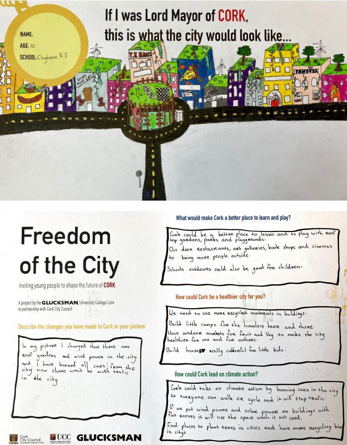
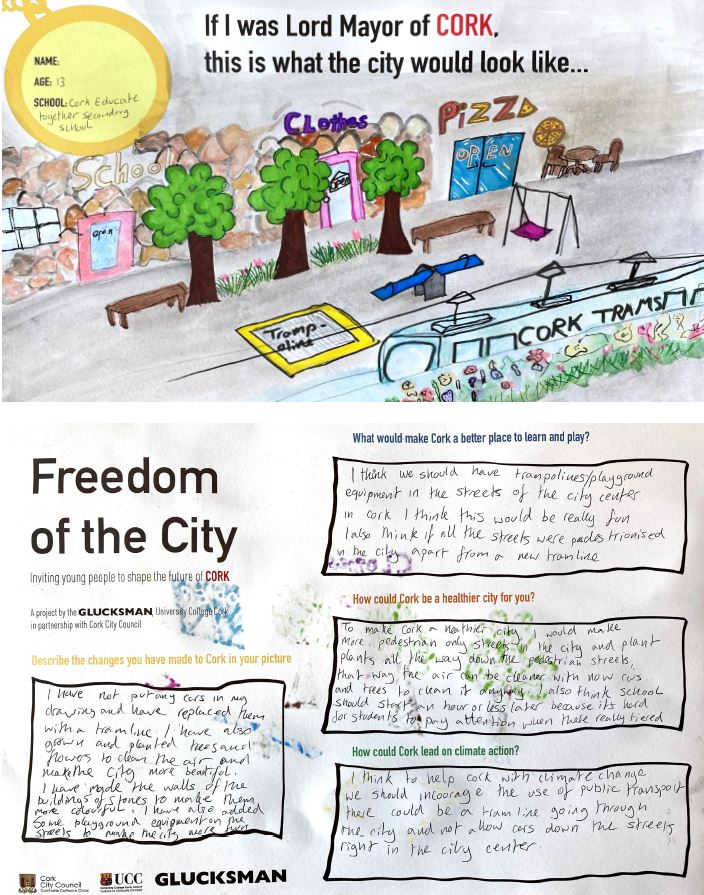
Young Peoples Photo 2nd prize IMAGE
|
To support the implementation of the Cork Metropolitan Area Transport Strategy (CMATS). To support international, national and regional connectivity by supporting the operation and development of Cork Airport and the relocation of the Port of Cork to Cork Harbour. To integrate land-use and transportation planning to improve movement for all across Cork City. To protect, improve and maintain the operation of national and strategic regional transport networks and assets. To promote and prioritise sustainable transport including active travel (walking and cycling) and public transport housing and employment development will be prioritised in locations where it can be served by walking, cycling and public transport. Cork City Council will support the delivery of multimodal travel integration, smart mobility and transport networks and services that are accessible for all. Proposals for new development in Cork City will be required to minimise the need for the private car, prioritise walking, cycling and public transport, be permeable, safe and secure for walking and cycling and where possible provide for filtered permeability. New developments will provide infrastructure for Electric Vehicles within the developments. Development proposals will provide for easy access to local amenities and education facilities. Proposals for new development will be required demonstrate their impact on the existing transport networks, commensurate with the nature and scale of the development. Mobility management plans will be required for developments that will accommodate a large number of people living, working or otherwise using the development. All new development proposals will be subject to maximum car parking standards to achieve greater modal shift and promote sustainable transport patterns. In locations where the highest intensity of development occurs, Cork City Council may consider an approach that caps car parking on an areawide basis by means of Area Based Transport Assessments (ABTAs). |

|
Objective 4.1 |
|
Objective 4.2 |
|
CMATSCork City Council will work in cooperation with the NTA, TII and Cork County Council to fully implement the Cork Metropolitan Area Transport Strategy subject to detailed engineering design and environmental considerations, including the projects and programmes in relation to walking, cycling, public transport, BusConnects, suburban rail, light rail, park and rides and roads infrastructure. |
Cork City Movement
|
|||
|
|
Objective 4.3 |
|
Objective 4.4 |
|
Strategic Location of
|
Active TravelTo actively promote walking and cycling as efficient, healthy, and environmentally friendly modes of transport by securing the development of a network of direct, comfortable, convenient, and safe cycle routes and footpaths across the city. To support the expansion of the Cork Bikes scheme. To accommodate other innovations such as electronic bikes, public car hire, and other solutions that will encourage active travel. To support the rollout of the NTA 5 Year Cycle Plan. To support and engage with the Safe Routes to School programme. |
|||
|
|
Objective 4.5 |
|
Objective 4.6 |
|
Permeability
a. All new development, particularly alongside the possible routes identified for public transport improvements, shall include permeability for pedestrians, cyclists, and public transport so as to maximise its accessibility.
|
Corridor & Route
|
|||
Contents
Observations
Observations
Submission Cork City Development Plan Amendments - Objections & Support
To Whom it May Concern,
I wish to register my support to the following amendments:
1.35
1.38
1.41
1.42
1.46
1.72
1.86
1.88...
Object to Amendments 1.241&1.247
Object to Amendments 1.241&1.247
Dear Sir\Madam,
I object to the above amendments in relation to new arterial road infrastructure in the south docklands area as it would ...
I wish to strongly object to the proposed amendments 1.241 and 1.247 to the City Development plan.
Hello,
I wish to strongly object to the proposed amendments 1.241 and 1.247 to the City Development plan.
There has been significant investment in removing arterial traffic from Cork...
I would like to object to amendments 1.241 and 1.247.
I would like to object to amendments 1.241 and 1.247. We need to maintain the green spaces in Cork City. We have all seen the benefits of pedestrianising the marina and the opening of marina part,...