


Hello,
This email is to object to the placing of any bridge which will allow cars to connect to the Atlantic Pond side of the Marina.
In particular, plans to allow...
6. Green and Blue Infrastructure, Open Space and Biodiversity
Closed1 Apr, 2022, 09:00 - 28 Apr, 2022, 23:59
Introduction
6.1
This Development Plan seeks to ensure that Cork City is a healthy, vibrant and attractive place to live, work and visit. To achieve this, it is important that biodiversity is protected and, where possible, enhanced and that the City reduces its carbon footprint. In short, the city must be better equipped to deal with climate change. Cork City’s biodiversity, green spaces and waterways play a very important role in helping to achieve this goal, and this role will become more important as Cork City accommodates ambitious levels of population and economic growth. This growth will be facilitated through the creation of a more compact city with a varied network of neighbourhoods, a diverse, vibrant and thriving biodiversity and an accessible, multi-faceted network of high-quality green spaces
and water bodies that yield a range of social, economic and environmental benefits.
6.2
This Chapter addresses separate but interconnected themes that are each addressed in turn as follows:
• Green and Blue Infrastructure
• Landscape
• Active Recreation and Open Space
• Biodiversity and the Natural Environment
6.3
A Green and Blue Infrastructure Study and an Active Recreation Infrastructure Study have been conducted to provide evidence to support the development objectives set out in this Development Plan.
Green and Blue Infrastructure (GBI)

6.4
Green and Blue Infrastructure (GBI) is the term used to describe the network of natural and semi-natural green and blue spaces and corridors in a given area including parks, woodlands, fields, hedges, lakes, ponds, gardens, coastal areas, cycle routes, rivers and water courses. A strong GBI network is essential to the quality of life and wellbeing of residents, businesses and communities, helping to
create and sustain places where people want to live and work. It is now recognised as a cornerstone within resilient cities, being a ‘must have’ rather than a ‘nice to have’.
6.5
Cork City Council has undertaken a GBI study to review Cork City’s green and blue assets and to consider how best to protect, enhance and link this network. The study has been prepared as part of a coordinated approach to delivering compact growth in line with NPF objectives. Figure 6.2 shows how the study applies an evidence-based approach to policy formulation that involved data gathering, extensive stakeholder engagement and a review of international good practice.
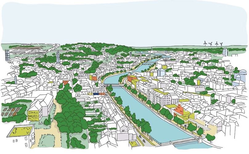
Figure 6.1: Protecting and Enhancing GBI in Cork City.

Figure 6.2: Stages in Cork City GBI Study and International Policy Context
6.6
Compact liveable growth includes the need to reduce human impact on the environment and transition to a low carbon city. The 8 strategic themes set out in Table 6.1 provide a framework for protecting and enhancing green and blue infrastructure during the plan period and beyond. The framework is supported by objectives set out to protect, enhance and manage green and blue infrastructure in the City in a coherent and integrated manner.
| Cork City’s Green and Blue Infrastructure Framework | |
| The Water Environment in Cork City is an integral component of the GBI network, playing a fundamental role in managing flooding and surface water drainage, maintaining water quality, and enhancing enjoyment of public spaces. The City’s rivers and catchments play centrals roles in a healthy GBI network. | |
| Cork City requires a functional and resilient Biodiversity network to transition to a low carbon environment, address flood risk and air quality pressures, maintain healthy food production, and to inspire and educate through access to nature. | |
| The Landscape and Harbour in Cork contribute to its wider setting, creating a unique sense of place. Identifying and delivering new GBI opportunities will conserve, enhance and increase the enjoyment of the environment as assets for both residents and visitors. | |
| A diverse GBI network offers many opportunities for Tourism, Culture, Recreation and Leisure. Protecting and enhancing Cork City’s GBI network will increase ecotourism and promote nature-based and heritage-based tourism. | |
| A well-planned GBI network in Cork City will help reverse the detrimental impacts of Climate Change ensuring the GBI assets unique to the City continue to provide valuable ecosystem services in the fight against extreme weather events and increasing global temperatures. | |
| Connectivity and Access to green and blue space and areas for recreation in the City provides a host of benefits to health and wellbeing, air quality, climate change and biodiversity and is central to sustaining active travel for all. | |
| An enhanced GBI network in Cork City offers major benefits for People, Community, Health and Wellbeing including opportunities for exercise, sport, amenity, recreation (including formal and informal play), social inclusion and community enterprise. | |
| Delivery of a well-planned GBI network offers Economic Value and Land Use Management opportunities that can localise economic benefits, promote inward investment, increase employment and stimulate wider economic activity in the City. |
Table 6.1: Cork City's Green and Blue Infrastructure Framework.

6.7
This Plan sets out a series of objectives to manage, protect and enhance the City’s green and blue infrastructure network during the plan period and beyond, in line with the Cork City Green and Blue Infrastructure Strategy set out above. These objectives are represented in the graphic and summarised in Table 6.2.
| Cork City’s Green and Blue Infrastructure Framework | |
|
The Water Environment To ensure Cork City’s green and blue infrastructure network is contributing to climate action and adaptation, the management of surface water and flood risk shall be considered at the outset of the design process. All development proposals shall integrate areas with potential for natural flood alleviation into their design frameworks for the site. |
|
|
Biodiversity The biodiversity of Cork City encompasses all the natural elements in the city and their interaction with each other. New development can create biodiversity-rich green and blue infrastructure by retaining and enhancing existing trees, plants and providing new wildlife corridors, buffer zones, ‘stepping stones’ or green bridges. This creates connectivity for flora and fauna species and natural movement and migration through the green and blue infrastructure network. The ‘Biodiversity and the Natural Environment’ section below sets out in more detail how this important consideration will be addressed in Cork City. |
|
|
Landscape and the Harbour Cork City’s landscape and harbour area provide a unique visual resource, including important visual linkages to the natural and built environment. Changes in land use need to be managed to protect or enhance these links. New green and blue infrastructure should be used to thread through the existing landscape and harbour connecting the urban area to its wider rural hinterland. |
|
|
Tourism, Culture and Recreation Cork City’s green and blue infrastructure form key direct and indirect assets, promoting and facilitating tourism, cultural, recreational and leisure activities. • Cork’s maritime history, and in particular its relationship with the River Lee, informed the location and form of built and cultural heritage features and the blueprint of the today’s City. • Cork City, as a gateway to the wider region and a destination, benefits from green and blue infrastructure forming the setting of the City and visitor attractions, contributing to the overall tourism offer of the City. • Cork City boasts a wide array of parks, walkways and open spaces. Cork City Council maintains a total of 607ha of these recreational and leisure assets. • Informal recreation is supported by more formal recreational green infrastructure facilities including golf-courses, playgrounds, multi-use games areas, skate parks and playing fields. In facilitating the growth of Cork City, there is a need to provide for the protection and enhancement of existing green and blue infrastructure facilities to successfully integrate them into an accessible network of recreational and leisure features. |
|
|
Climate Change and the Environment Green and blue infrastructure is and will continue to represent a key asset in mitigating climate change and impacts on the environment (addressing the causes) and supporting adaptation (addressing the effects and future-proofing the City to better cope with climate change). Tree planting performs a role in carbon sequestration whilst providing opportunities slow storm water flows, absorb water and provide urban shading which can offset solar gain and micro-climate impacts, particularly in urban environments. Wetlands also sequester carbon, store water and slow the flows of storm water, help improve water quality and provide habitat for biodiversity. Agriculture is the primary land-use in the hinterland and through sensitive management grassland has the potential to sequester carbon and facilitate biodiversity through provision of suitable habitats and corridors. |
|
|
Access and Connectivity Increasing active travel corridors across Cork City can reduce car use, ease congestion, improve air quality and help reduce carbon emissions. Green and blue infrastructure plays a crucial role in the provision and use of active travel routes. |
|
|
People, Communities, Health and Well Being Although all green and blue infrastructure is multifunctional, some features are more closely aligned with providing social, community, health and wellbeing benefits including parks, outdoor sports areas and children’s play facilities, allotments, spaces with tree cover and green travel corridors. Cork City has a diverse range of parks, walkways and open spaces with the Council maintaining over 607 ha of such spaces. Community food growing opportunities through allotments, community gardens and urban farms form important green and blue infrastructure assets, primarily because of their influence on health and wellbeing. |
|
|
Economic Value and Land Use Management Some of the economic value of our green and blue infrastructure assets can be quantified, such as Ireland’s natural capital of native woodlands which are worth between €100-140 million per year. However, the more indirect benefits, such as protecting and enhancing biodiversity, sequestering carbon, mitigating climate change, reducing flood risk and improving water and air quality, creating a high-quality sense of place, are more difficult to quantify, but their value to facilitating development in general and making our City a healthier and higher-quality place to live, visit and work is invaluable. |

6.8
The Cork City Green and Blue Infrastructure Study 2021 identifies emerging opportunities and interventions that have capacity to deliver a range of GBI outputs within the city. Figure 6.3 illustrates these opportunities and how they can support the establishment of healthy, resilient, wilder and destination spaces across Cork City. The opportunities identified act as a framework for enhanced delivery of green and blue infrastructure in Cork City.
6.9
Tables 6.3 and 6.4 set out a brief description of each opportunity, with further details provided in the Cork City Green and Blue Infrastructure Study 2021. The regional and metropolitan scale green and blue infrastructure opportunities listed (Table 6.3) are predominantly non-spatial – thematic or interpretive. Many of the city scale green and blue infrastructure opportunities (Table 6.4) are more area-specific and indicatively represented in “Figure 14.3 City Scale GBI Opportunities for Cork City” taken from the Cork City Green and Blue Infrastructure Study 2021 and included below. All opportunities listed require further assessment and input from
multiple stakeholders, including funding and other resources.
Figure 6.3: GBI opportunities and interventions in Cork City
| Regional and Metropolitan Scale Green and Blue Infrastructure Opportunities | |
| 1. Cork Metropolitan Area Water Quality Plan | Support the delivery of an Integrated Water Quality Plan for river catchments in Cork Metropolitan Area that assesses intensification of human activity and associated degradation of habitats and provides land use planning recommendations. |
| 2. Ecosystems Service Guide to enhance GBI Based Placemaking in the Southern Region | Be an active stakeholder in the delivery of An Ecosystems Service Guide to enhance GBI based Placemaking in the Southern Region including best practice initiatives and potential GBI projects in the region. |
| 3. Guide for Implementing Nature Based Solutions in the Southern Region |
Be an active stakeholder in the delivery of a ‘toolkit’ for the implementation of GBI interventions to act as a checklist for proposed development and standards for delivering NBS across the region. |
Table 6.3: Regional & Metropolitan Scale Green and Blue Infrastructure Opportunities (Click on Map for High Resolution Image)
| City Scale Green and Blue Infrastructure Opportunities (refer to map) | ||
| 1. |
Lee to Sea Greenway Biodiversity and Greening Plan |
Support the design and delivery of the Lee to Sea Greenway as a traffic-free corridor for movement, biodiversity and as a regional tourism asset within Cork City. Provide a corridor for wildlife movement, protection of natural resources and other GBI spaces where feasible. |
| 2. | City Docks and Tivoli Docks Urban Drainage Strategies | Develop Urban Drainage Strategies for City Docks and Tivoli Docks to integrate best practice climate change actions that combine water management with the creation and protection of a new GBI networks with amenity, recreation, wildlife and placemaking benefits that enhance the distinctiveness of Corks Docklands. |
| 3. | Glen Valley Park Project | Support the improvement of Glen Valley Park as a high value multifunctional GBI space providing an enhanced riverside amenity route connecting to residential, retail and employment zones in area and the delivering increased biodiversity, recreational and flood relief measures. |
| 4. | Cork City Tree Planting and Management Strategy | Prepare and deliver a Tree Planting and Management Strategy that promotes better protection of trees, increases provision of tree planting and woodland cover, faciltates reafforestation and promotes actions for wider tree planting and tree management within Cork City. |
| 5. | Vernon Mount Park Project | To support the provison of safe, off-road access from Vernon Mount to Tramore Valley Park that connects Grange/Frankfield to the city and, provides public access to the eastern wooded valley. |
| 6. | New City Parks in the North East and North West of the City | Support actions and funding applications to progress the development of two new City Parks in the North East and North West of the City that promote a range of both passive and active recreation and utilise GBI to enhance biodiversity and promote active travel. |
| 7. |
Rewilding, Rewetting and Reafforestation Projects |
Support actions and projects that promote and deliver rewilding, rewetting and reafforestation in Cork City to create best practice GBI asset that benefit communities, health and the environment and enhance species richness using ecologically- friendly management. |
| 8. | Activating Blue Corridors in Cork | Support actions and projects that improve and enhance the potential for water-based recreation within and along the River Lee and Cork Harbour including access points for recreational users. |
| 9. | Ecology, Biodiversity and Natural Heritage Data Project for Cork City | Adopt new approaches to overcome gaps in baseline data for ecology, biodiversity and natural heritage at the city level and develop a successful approach for its use at an early stage in development planning. |
| 10. |
Scoping an International / National / Regional GBI Tourist Attraction |
Support a scoping and feasibailty assesmsent for a new, large scale, GBI-based tourism attraction within Cork City. This GBI attraction shall promote Cork City as a key location in Ireland for tourism based on GBI and seeking to increase GBI and nature-based tourism in Cork City by 50% by 2040. |
| 11. | Promotion of Cork City as a destination for water-based recreation | Support actions and plans designed to enhance the provision of water based recreation within and along the River Lee and Cork Inner Harbour and deliver a high quality blueway within the wider harbour for active and passive recreation. |
| 12. | Update and Review of the Cork City Landscape Characterisation Strategy | Update the Cork City Landscape Strategy (2008) to provide a clear evidence base on the character and valued features of the Citys landscapes and provide information and guidance to inform the appropriate location, scale and design of new development. |
| 13. | City Centre Neighbourhood Parks Pilot Projects | Support the planning and design of multi-functional neighbourhood parks by exploring opportunities for proposals that implement active, low traffic GBI based public spaces within proposals for neighbourhood renewal. |
| 14. | Activate Greening Projects in Cork City Centre | Support the delivery of actions and projects that promote greening within the City Centre, including an audit designed to maximise opportunities to integrate GBI in the delivery of urban regeneration, public realm works, tourism, active travel, wayfinding and signage. |
| 15. | Reinstatement of the weir and canal system at Ballincollig Regional Park | To support a planned approach in the restoration of the partially collapsed weir on the Inniscarra bank and reinstatement of the canal system within Ballincollig Regional Park that enhances natural habitat, industrial heritage, recreational use and connectivity. |
| 16. | Decarbonising Zone (DZ) Pilot Project | Identify a DZ pilot project within Cork City and introduce a range of mitigation measures to address local low carbon energy, GHG emissions and climate needs that contribute to national climate action to help better understand challenges in decarbonising the wider city. |
Figure 6.4: City Scale GBI Opportunities for Cork City. (Click on Map for High Resolution Image)
Landscape

6.10
With the intensification of the City, its landscape and natural heritage assets are of huge importance to those living, working and visiting Cork. They are vital to quality of life, are non-renewable assets and help enhance the attractiveness and image of the city as
a place to live and work.
6.11
Cork City has an attractive physical setting formed by the Lee Valley and Estuary and the ridges rising to the north and south of the city. These features are supplemented by a range of public open spaces, parks, walkways, public and private spaces, trees and tree groups, and together form the green infrastructure of the city, which play a significant role in supporting biodiversity, such as mammals, birds, invertebrates, trees and plants.
6.12
The distribution of landscape, natural heritage and recreational assets is vitally important to creating an accessible city. Cork City Council will strive to create a network of natural heritage areas and recreational open spaces / amenity areas by promoting linkages and accessibility between these areas and by using walkways / cycleways to connect them where appropriate, and to encourage active transportation modes.
6.13
Cork’s landscape forms a key aspect of the character of the City, its urban towns, villages and suburbs. Landscape is defined as an area, as perceived by people, whose character is the result of the action and interaction of natural and / or human factors (European Landscape Convention).
6.14
Landscape shapes our image of a place, gives us a sense of place, an identity and can be a source of pride and inspiration, and so influence our wellbeing and quality of life. All aspects of our natural, built and cultural heritage come together in the landscapes we experience. Landscape is a finite resource but is constantly changing through natural processes and through human activity.
6.15
Cork City as a focus for economic development and population growth is under constant pressure of development. The challenge for Cork City Council is to manage the city’s landscape in a manner that facilitates economic growth and development while protecting and enhancing the city’s key landscape assets and resources.

6.16
A Cork City Landscape Study was commissioned by Cork City Council in 2008 to establish principles and provide the framework for protecting and enhancing the natural environment and positively managing its change, as well as providing the context within which the design of developments can take place in an appropriate manner. This Study referred to the pre-2019 City area, and Cork City
Council will undertake a revised landscape study that addresses the entirety of the administrative area including the urban towns, villages and suburbs.

6.17
Cork City Council seeks to protect and enhance the landscape character of the City by protecting the significant landscape elements that contribute to the general amenity of Cork City. This is achieved through a number of land use mechanisms in this Plan, including the designation of Land Preservation Zones (LPZ) and Areas of High Landscape Value (AHLV).
6.18
Planning applications within areas or on sites benefiting from such landscape protection must demonstrate that there is no resulting adverse impact on the landscape assets and character of the area, by means of a design statement that includes a landscape assessment and visual impact assessment the impact. The City Council may seek discretionary Environmental Impact Assessments on
development proposals that it considers would be likely to have a negative impact on the landscape.

6.19
Landscape Preservation Zones (LPZs) are areas zoned ZO 18 Landscape Preservation Zones (see Chapter 12 Land Use Zoning Objectives) in order to protect their character and amenity value. These areas are considered to be highly sensitive to development and as such have limited or no development potential. Typically, the landscape character of these areas combines distinctive landscape assets such as topography, slope, tree cover, setting to historic structures, open spaces and other landscape assets – see Table 6.5.
6.20
The objective of LPZs is to preserve and enhance the landscape character and assets of the sites. There is a presumption against development within LPZs, with development only open for consideration where it achieves the site-specific objectives set out in Tables 6.6-6.10. In exceptional circumstances, there may be limited scope for development to enable existing occupiers to adapt existing buildings to their evolving requirements, providing that the form or nature of development is compatible with the landscape character of the area. This might include a change of use or minor extensions.
| Reference | Assets Category |
| A | Topography - ridges, escarpments, slopes |
| B | Water / River Corridors - rivers, estuary, harbour, The Lough, Atlantic Pond, Docklands, Port of Cork |
| C |
Tree Canopy - Areas with existing woodlands or significant tree groups, or areas with potential for new woodlands. |
| D | Ecology - areas which provide a habitat for wild flora and fauna. |
| E | Visually Important Land (including Views and Prospects of Special Amenity Value, Potential Vantage Points and Locally Important Views) |
| F | Historic Core / Townscapes / Streetscapes |
| G | Landmarks / Natural Features / Cultural Landscape – land forming the setting to existing landmark buildings and/or protected structures / buildings of significance |
| H |
Public and Private Open Space footprint, including land with potential for Public Open Space |
| I | Institutional Open Space |
| J | Historic Landscapes (including monuments / historic routes) |
| K | Rural Character / Green Belt - proximity of rural and agricultural land uses to the city |
| L | Built Form |
| M | Public Realm |
| O | Gateways to the City |
| P | Bridges |
| Q | Pedestrian / Cycle Routes in the City / Access |
| R | Vehicular Access |
| S | The Railway in the City |
Table 6.5: Landscape Preservation Zone Landscape Assets Categories
| Reference | Landscape Preservation Zone (General Name) | Landscape Assets to be protected | Site Specific Objectives |
| North-West | |||
| NW 1 | Shanakiel Ridge (1) | G, A, E |
• To provide public open space as part of new neighbourhood park; • To allow a small amount of residential development to overlook this public open space (fronting westwards behind the existing houses) minimising the impact on the setting of Our Lady’s Hospital; • To retain limestone field boundary wall as landscape element and repair / reinstate where necessary; • To ensure landscape structure maximises the potential of the stream and other assets. |
| NW 2 | Shanakiel Ridge (2) / Our Lady’s Hospital / Saint Anne’s Hospital | G, A, C, E | |
| NW 3 |
Shanakiel Ridge (3) / Hyde Park / Shanakiel House |
C, E, A | |
| NW 4 |
Sunday’s Well (1) / Old Gaol |
G | |
| NW 5 |
Sunday’s Well (2) / Lee Riverside |
A, B, C, E, F | |
| NW 5 |
Sunday’s Well (2) / Lee Riverside |
A, B, C, E, F | |
| NW 6 |
Sunday’s Well (3) / North Mall Distillery |
B, C, D, E, G, I, Q |
• To create a publicly accessible riverside open space with significant ecological value as part of campus development; • To provide an additional public pedestrian bridge to access the development site at the eastern end of the distillery site from the Lee Maltings site; • To provide an additional public route along through the centre of the site along the Mill Stream. |
| NW 7 | Gurranabraher Ridge (1) / Mount Saint Joseph’s | E, G, C, A | |
| NW 8 |
Gurranabraher Ridge (1) Saint Mary’s Orthopaedic Hospital |
C, A, E, I |
• To increase tree coverage on the lower slopes of the hospital site and to protect and enhance the existing tree coverage at the boundary of the site; • To explore potential for publicly accessible vantage point. |
| NW 9 | Knocknaheeny Water Tower | G | |
| NW 11 | Farranferris College Ridge | B, D, E, C, A, J, G |
• To restore and enhance the Historic Landscape; • To seek re-use of college building and to allow development within its immediate environs consistent with the Protected Structure and landscape significance of the site; • To reinforce landscape structure on site, including new tree planting and retention of watercourse as landscape / ecology feature; • To allow development to replace existing structures to the north of the Seminary Building (see Area B of local area plan) with new buildings being in Institutional uses with limited ancillary local services; • To allow very limited development to the south of the seminary building for Institutional use (see amplification in Area D of the local area plan) |
| NW 11 | Farranferris Ridge (Upper) | A, B, C, D, E |
• To provide a passive amenity space which benefits from an enhanced landscape structure and significant tree planting; • To protect and enhance the watercourse and its setting. |
| NW 12 | Farranferris Ridge | G, H |
• To seek the development of a passive public open space to provide for the surrounding residential areas. |
| NW 13 |
Commons Road / Lover’s Walk Ridge |
C, G, F |
• To connect between Commons Road and Seminary Walk / Lover’s Walk |
| NW 14 | Blackpool Valley (West) Ridge Commons Road | K, A, C, E, O |
• To develop a woodland park on the southern valley slope to provide an attractive landscape feature at the gateway and to connect the rural landscape with the city; • To provide pedestrian linkages between residential areas at the top of the slope and Fitz’s Boreen and Sunbeam development area. |
| NW 15 |
New Mallow Road /Blackpool Ridge (West) |
K, A, C, E, O |
• To develop a woodland park on the southern valley slope to provide an attractive landscape feature at the gateway and to connect the rural landscape with the city; |
| NW16 | Lower Killeen’s Road | A, B, C, E, K, O |
• To conserve and enhance the lower portion of the ridge, including the existing hedgerow, by additional tree planting; • To conserve and enhance the landscape value of the upper portion of the ridge as an urban woodland; • To provide limited development in the middle portion of the ridge to provide long-term management of the whole ridge. Development should be in small-scale pavilion style inset in a strong landscape structure. |
| NW 17 | (Former) Good Shepherd Convent | C, G, H |
• To provide landscape structure and open space in any redevelopment. |
Table 6.6: Site Specific Landscape Preservation Zone Objectives (NW).

| Reference | Landscape Preservation Zone (General Name) | Landscape Assets to be protected | Site Specific Objectives |
| North-East | |||
| NE 1 | Bride Valley (1) |
A, B, C, D, E (from train) |
• To re-establish the River as a key element of the valley floor by providing a linear park with publicly accessible riverside treed walk. |
| NE 2 | Bride Valley (2) |
A, B, C, D, E (from train) |
• To re-establish the River as a key element of the valley floor by providing as linear park with publicly accessible riverside treed walk. |
| NE 3 | Bride Valley (3) |
A, B, C, D, E (from train) |
• To re-establish the River as a key element of the valley floor by providing a linear park with publicly accessible riverside walk with new tree coverage and linked spaces. |
| NE 4 | Blackpool Valley East | A, E, H |
• To re-establish the River as a key element of the valley floor by providing a linear park with publicly accessible riverside walk with new tree coverage and linked spaces. |
| NE 5 | Saint Patrick’s Hill | A, C, E, G | |
| NE 6 | Grattan Hill | C, G | • To connect between Commons Road and Seminary Walk / Lover’s Walk |
| NE 7 | Middle Glanmire Road (1)(Vosterburg) | C, G | |
| NE 8 | Middle Glanmire Road (2 (Convalescent Home) | C,G | |
| NE 9 | Middle Glanmire Road (3) (Hyde Park House) | C, G | |
| NE 10 |
Former Quarry, Lower Glanmire Road |
A, C, D, E, H | • To provide a pocket park to serve needs of Lower Glanmire Road area providing development of brownfield site and/or a community garden can be achieved to provide supervision of space. |
| NE 11 | Tivoli Ridge | A, B, C, D, E, O | |
| NE 12 | COPE School | A, E, G, I | |
| NE 13 | Ennismore | A, B, C, E, G, J |
• To reinstate the historic landscape setting of Ennismore House; • To seek development of new Neighbourhood Park (with public vantage point) to serve the needs of the North-East of the city; • To allow for a small amount of development at the northern edge of the proposed Neighbourhood Park in the event that the City Council considers this an essential part of any landscape masterplan to provide natural supervision. |
| NE 14 | Lota Ridge | A, B, C, E, G, J | |
| NE 15 | The Glen Ridge | A, C, D, E | |
| NE 16 | South Glanmire (Dunkettle) | A, B, C, D, E, |
This zone to the southern end of Glanmire includes: Given the extensive development proposed to adjoining lands, the mixed native riparian woodland should be extended to compliment the biodiversity and visual benefits of this zone.For these reasons, there is a presumption against development within this zone. |
| NE 17 | South East Glanmire | A, C, E, |
This zone to the southeast of Glanmire is essentially agricultural land which is in the form of rolling countryside and adjoins the M8 and Waterworks. This zone provides both localised and wider visual landscape amenity benefits including from the southern side of the River Lee / Blackrock area. There is potential for mixed native woodland to the southern and eastern parts of this zone. For these reasons, there is a presumption against development within this zone. |
| NE 18 | Lota | A, B, C, D, E, G, J, O |
This zone is visually important as it: • forms part of an attractive gateway entrance to the city, • is home to significant cultural heritage assets in the form of protected structures (including Lota House and Lotabeg House) and scheduled monuments, • provides setting to Tivoli Docks, • lies adjacent to the Glashaboy River (Cork Harbour Special Protection Area), • provides local biodiversity benefit and • forms part of the wider landscape setting from the southern side of the River Lee. There is potential to add to and extend mixed native woodland within and adjoining this zone for both visual landscape and biodiversity benefits. For these reasons, there is a presumption against development within this zone. |
Table 6.7: Site Specific Landscape Preservation Zone Objectives (NE).
| Reference | Landscape Preservation Zone (General Name) | Landscape Assets to be protected | Site Specific Objectives |
| South-West | |||
| SW 1 |
Inchigaggin Lane (setting of Inchigaggin House and Carrigrohane House) |
C, G |
• To preserve and enhance the setting of Historic Structures; |
| SW 1A |
Curragheen River / Carrigrohane Road / Lee River Valley |
B, C, D, E, H, K, O, Q |
• To retain lands as landscape assets and as part of the flood plain of the Curragheen and Lee Rivers. Existing uses may continue as non- conforming uses; medium to long-term objective of creating a public amenity area as part of the overall Curraheen/Lee Fields amenity area. |
| SW 2 | Glasheen River (3) / site | B, C, E | • To provide riverside walkway / cycleway. |
| SW 3 | Sacred Heart | A, B, C, E, G | |
| SW 4 |
South Channel (1) / Bon Secours |
A, B, C, E, G | • To provide riverside walkway / cycleway. |
| SW 5 |
South Channel (2) / Bon Secours Hospital Car Park |
B, C | • To provide riverside walkway / cycleway. |
| SW 6 |
South Channel (3) Perrott’s Inch |
A, B, C, E, G, Q | |
| SW 7 | South Channel (4) / UCC | A, B, C, E, G | |
| SW 8 | Bishop’s Palace | A, B, C, E, G, J | |
| SW 9 | Mardyke | B, E, H, J, M, P, Q | |
| SW 10 |
Model Farm Road / Wilton AFC |
C | |
| SW 11 |
High Street / Convalescent Home (former Reparation Convent) / Villa |
C, F | |
Table 6.8: Site Specific Landscape Preservation Zone Objectives (SW).
| Reference | Landscape Preservation Zone (General Name) | Landscape Assets to be protected | Site Specific Objectives |
| South-East | |||
| SE 1 | South Douglas Road Farmhouse | C |
• To protect the tree group by means of a TPO; • Consider inclusion of farmhouse on RPS. |
| SE 2 | Douglas Estuary | B, D, E, H | |
| SE 3 | Ravenscourt House | A, C, E, G | |
| SE 4 | Bessboro House | J, G, C, B, I |
• To reinstate Historic Landscape; • To seek use of grounds as a Neighbourhood Park in context of local area plan (H); • To allow development within the immediate environs to the north of Bessboro House consistent with the landscape and protected structure significance of the site. |
| SE 5 | Pond, Douglas Estuary | B, D, S | • To provide tree planting on this visually prominent area of land to screen the Retail Park. |
| SE 6 | RTE Mast, Ballinure Road / Douglas Estuary | B, D, E | • To provide significant tree planting on its northern boundary, to screen Retail Park. |
| SE 7 |
Castle Road Bank / Escarpment |
A, B, C, D, G |
• To introduce walkway / cycleway above waterline whilst protecting trees along escarpment. |
| SE 8 | Tir-na-nOg, Church Avenue (former family home of Frank Murphy architect) | A, B, C, G | |
| SE 9 | Dundanion House and Castle | A, B, C, G | |
| SE 10 | Convent Lawn (North) and small area east of Barrington’s Avenue | A, B, C, E, G |
• To explore potential of integration of this space into Marina Park / Atlantic Park as part of overall project. |
| SE 11 | Convent Lawn (South) | G | |
| SE 12 |
Blackrock Road Escarpment (1) / Franciscan Ministry of Saint Joseph’s Convent |
A, C, E | |
| SE 13 | SMA, Blackrock Road | G | |
| SE 14 | Temple Lawn House, Blackrock Road/Crab Lane | C, G | |
| SE 15 | House at top of Churchyard Lane | C, E | |
Table 6.9: Site Specific Landscape Preservation Zone Objectives (SE).
| Reference | Landscape Preservation Zone (General Name) | Landscape Assets to be protected | Site Specific Objectives |
| City Centre | |||
| CC 1 | Blackpool Valley Ridge |
A, C, E, J (Old Youghal Road historic city approach) |
• To provide a pocket park (as part of Bell’s Field / Lady’s Well Park) on these lands benefiting from development at the edge of the space to provide supervision, whilst maintaining east-west views across the site (between Bell’s Field and Shandon / western side of valley). • Upgrade Old Youghal Road and Lady’s Well steps / Fever Hospital Steps area. |
| CC 2 |
Blackpool Valley Ridge (East) / Richmond Hill |
A, C, E, F | |
| CC 3 | Westboro House | A, C | • Development of up to two houses between protected trees on Middle Glanmire Road is considered appropriate. |
| CC 4 | St Patrick’s Hospital Grounds | C, D, H | |
Table 6.10: Site Specific Landscape Preservation Zone Objectives (CC).

6.21
Areas of High Landscape Value comprise one or more landscape asset identified in the Cork Landscape Study 2008 and typically, combine one of the primary landscape assets (Topography, River Corridor, Tree Cover) with other landscape assets. AHLV are illustrated in the mapped objectives.
6.22
Areas of High Landscape Value display an intrinsic landscape character and a special amenity value. Development will be appropriate only where it results in a neutral / positive impact on the landscape. Although many AHLV consist of a built form and a strong landscape character, typically the built form is secondary to the landscape character.
6.23
New development in AHLV must respect the character and the primacy and dominance of the landscape. In particular, development on topographical assets such as steep sided slopes, escarpments and ridges is considered to be inappropriate due to the detrimental impact of site and excavation works on the landscape. There will be a presumption against development where it causes significant harm or injury to the intrinsic character of the Area of High Landscape Value.
6.24
The AHLV is an additional objective overlaying the land-use zoning objective. Development proposals must comply with the underlying land-use zoning objective. The key areas include the Montenotte / Tivoli Ridge; Shanakiel Ridge / Sunday’s Well Ridge; Blackpool Valley; Lough Mahon/ Douglas Estuary; River Lee / Curragheen River.
6.25
Cork City offers a visually striking landscape that combines urban settlements with rivers, ridges, spaces, streets, rural hinterland, as well as fantastic buildings that we are all proud of. The views of Cork that we experience help define our understanding of the City – its character and identity.
6.26
In general, the City is appreciated by most people from viewing locations along the River Lee and its tributaries and from elevated locations. Within rural areas outside of the City there also a number of scenic routes through attractive landscapes that are appreciated by large numbers of people.
6.27
Cork City Council seeks to manage development through its View Management Framework in order to protect the views and prospects of special amenity value and the amenities of places and features of natural beauty or interest, where these are not protected by other objectives of this Plan. These views are seen from places that are publicly accessible and well used and include significant buildings or urban landscapes that help to define Cork City at a strategic level.
6.28
These views represent at least one of the following:
1. Panoramas that offer expansive views of the City.
2. Linear views to landmark buildings.
3. River corridor views.
4. Scenic hinterland routes.
6.29
Panoramic viewing locations are either from places that are accessible to the public as public spaces or are accessible to the public. Within these views Strategic Landmark Buildings / Strategic Cityscapes and Strategic Landscapes are identified. Within the life of this Plan Cork City Council will seek to enhance key panoramic viewing locations by, for example, provide seating, wayfinding and interpretation information. Additional panoramic viewing locations offering special amenity value may be identified in future, for example in future public park developments or where public access arrangements can be agreed.
6.30
Strategic and local landmark buildings have been identified so that linear views of these buildings can be protected through the management of development. Strategic landmark buildings are those that are widely appreciated due to their visual prominence and the role that they play in helping people to orientate themselves within the City. Local landmark buildings are important within the City’s neighbourhoods due to their local visual prominence. While an illustrative list of local landmark buildings is provided, other local landmark buildings will emerge during the Plan period through the development management process, and where these are identified important linear views to these buildings will need to be taken into consideration.
6.31
Rivers corridors provide expansive views of the City and rural areas and are strategically important views along rivers, whether they are from quays, bridges or riverbanks. Development proposals visible from river corridors will need to be assessed in terms of their visual impact on the river corridor. This will be especially important where a development proposal is in the visual context of landmark buildings, Architectural Conservation Areas or landscape protection designations.
6.32
Within the Hinterland area a number of scenic routes of amenity value benefit from protection with the aim of ensuring that the natural beauty of these routes is maintained. The objective of the designation is to manage development along these routes in order to ensure that distinctive landscape value and quality is maintained.
6.33
These views are listed in Volume 3: Built Heritage Objectives.

6.34
Landscape with high landscape value or high landscape sensitivity are of Citywide or national importance. In the City Hinterland there are large areas of High Value Landscapes that are required to be protected. High sensitivity landscapes are vulnerable landscapes with the ability to accommodate limited development pressure. In this rank landscape quality is at a high level, landscape elements are highly sensitive to certain types of change. If pressure for development exceeds the landscape’s limitations the character of the landscape may change.
6.35
Within these high value landscapes considerable care will be needed to successfully locate development proposals without them becoming unduly obtrusive. Therefore, the location, siting and design of development proposals within these areas will need careful consideration and any such developments should generally be supported by an assessment including a visual impact assessment
which would involve an evaluation of visibility and prominence of the proposed development in its immediate environs and in the wider landscape.

6.36
Successive Cork County Development Plans have identified the importance of protecting prominent areas of the Hinterland which are of strategic importance to the purpose and function of the Hinterland and Hinterland settlements. These areas require the highest degree of protection because they are made up of the prominent open hilltops, valley sides and ridges that give Cork City its distinctive character and the strategic, largely undeveloped gaps between the main Hinterland settlements. These areas are reflected in Figure 6.5.


Figure 6.5: Prominent and Strategic Cork City Hinterland (Click on Map for High Resolution Image)

6.37
The City Hinterland contains many vantage points from which views and prospects of great natural beauty may be obtained over both seascape and rural landscape. This scenery and landscape is of enormous amenity value to residents and tourists and constitutes a valuable economic asset. The protection of this asset is therefore of primary importance in developing the potential of the City. Therefore, the plan identifies seven specific Scenic Routes consisting of important and valued views and prospects within the City.


6.38
Public Rights of Way provide accessibility but also represent economic, tourism and amenity assets in themselves. Cork City Council will seek to ensure existing public rights of way are preserved and maintained and any development that will adversely affect these routes will be resisted. During the lifetime of the Plan, opportunities to formalise new public rights of way to improve access to green
and blue infrastructure assets in Cork City will be encouraged. The omission of a public right of way from the Development Plan and its associated mapping shall not be construed as an indication that such a public right of way does not exist.
Active Recreation and Open
6.39
The quality and quantity of public realm in towns and cities is a key determinant of the quality of life that any place can offer its residents, workers and visitors. Open spaces are a key component of public realm.
6.40
Cork City strives improve public realm and open space to ensure that it is making Cork a more liveable city. This is important for placemaking and creating an attractive and a healthy city and supports the achievement of all of this Plan’s strategic goals.
6.41
Cork’s open spaces include parks of a variety of sizes, cemeteries, woodlands, sports grounds, river corridors, walkways, allotments, community gardens, historic landscapes and gardens.
6.42
Cork has a defined hierarchy of parks, as set out in Figure 6.6. This hierarchy assists in planning for new parks in the city to ensure that open space and recreational infrastructure is provided in accessible locations for the residents off Cork City.
Figure 6.6: Prominent and Strategic Cork City Hinterland Areas.
6.43
Cork City Council aims is to ensure that public open space is available to meet the needs and demands of the city. This will involve a combination of protecting, enhancing and providing new spaces. With an intensifying city it will also require a creative approach to meeting recreational and amenity needs, particularly in the historic areas of the city with a tighter urban grain.
6.44
The quality of public open spaces is paramount, in terms of design, accessibility, shared use, biodiversity, sustainable urban drainage systems and provision for allotments and community gardens. For development proposals that comprise or include open spaces, details of the proposed landscaping, hard and soft should be submitted as part of planning applications.
6.45
Public open space plays a vital role for people in providing exposure to nature, opportunities for physical activity, wellbeing and social interaction for all age groups, but especially children and young people. Public open spaces should be designed to be multi-functional in order to ensure that they are focal points for a broad spectrum of people and neighbourhoods as a whole, as well as ensuring excellent city landscapes.

6.46
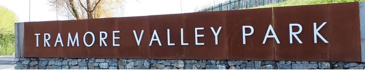
Cork City Council recognises the need for a network of large city parks of an appropriate size, scale and nature. Due to the limited opportunities for large open spaces within the city centre, these parks will mainly be located within or at the edge of the existing built up part of the City. The City Hinterland area will also provide opportunities where new parks can be developed in line with the Open Space Strategy. The city parks will combine large areas of well-connected open space to provide for active and passive recreational needs to meet the needs of the city hinterland population, including sectors of the city and areas of the north city environs and south city environs and beyond into the hinterland. Together the City Parks will form a ring of green around the built up part of the City, incorporating existing landscape assets, in perpetuity for the benefit of future generations. The proposed network of city parks is set out in Table 6.11.
| City Park | City Park Catchment | Project Status |
| Tramore Valley Park (TVP) | South Centre, Grange and Frankfield |
Park provided. Continued improvement according to Masterplan during lifetime of the Plan.
New pedestrian / cycle bridge over South Ring Road connecting Grange, Frankfield and Donny
New pedestrian/cycle access from South Douglas |
| Marina Park | Docklands and South-East |
Park Masterplan and planning permission. Phase 1 commenced. Phases 2 and 3 to be completed during life of this Plan. |
| North-West City Park, Hollyhill | North-West | Park Masterplan and planning permission during life of this Plan. |
| North-East City Park, Lota / Lotamore | North-East and Glanmire | Park Masterplan and planning permission during life of this Plan. |
| Ballincollig Regional Park | Ballincollig | Park fully operational. |
| Lee Fields City Park (expansion of existing Neighbourhood Park) | South West of the City | Park Masterplan and planning permission during lifetime of the Plan. |
Table 6.11: Proposed City Park Network

6.47
Cork City Council will seek to advance the provision of new parks in partnership with developers and the upgrading of existing parks and open spaces during the life of this Plan, as set out in Table 6.12.
City Park |
Projects |
| City Centre |
– Bishop Lucey Park upgrade; – Mahony’s Avenue (Saint Luke’s) Pocket Park; – Bell’s Field and Lady’s Well Park; |
| Docklands |
– Monaghan’s Road Linear Park – Kennedy Park / Kennedy Spine – Tivoli Docks Parks |
| South-West | – Curragheen River Park |
| South-East |
– Blackrock (Ursuline Convent) Neighbourhood Park – Bessboro Neighbourhood Park |
| North-West | – North-West (Knocknaheeny) Regeneration Parks and open spaces |
| North-East |
– Mayfield Neighbourhood Park, Ennismore, Middle Glanmire Road – River Glen Linear Park, extending from the River Glen Amenity Park to the NE City Park along the River Corridor |
| Blarney |
– River Martin Park and associated public walkway along the River Martin – Blarney Square – Inch Park – Clogheenmilcon Fen Bog in Blarney: enhancement and protection now in progress overseen by Cork City Council in collaboration with stakeholders. |
| Tower | – River Shournagh Amenity Protection and the enhancement and protection of linkages to the wider settlement |
| Glanmire |
– John O’Callaghan Park – Butlerstown River corridor protection and enhancement |
| Ballincollig | – River Maglin Park as part of South Ballincollig development |
| Ballyvolane | – Kempton Park protection and enhancement |
| Hinterland Villages |
– Kerry Pike: Protection and enhancement of walkway around GAA pitch – Killeens: Protection and enhancement of existing open spaces and pedestrian link to Blarney – Upper Glanmire: Protection and enhancement of existing open spaces |
Table 6.12: Other Park Open / Space Projects.

6.48
Cork City Council will prepare an Open Space Strategy to guide improvements to the open space network and prioritise investment decision sin order to ensure that Cork City offers equality of access to high quality open spaces for all of its neighbourhoods, as well as large city parks that serve multiple recreational needs. All open spaces form part of the wider green infrastructure, and parks and open spaces provide connectivity for biodiversity, woodlands, river corridors and floodplains, habitats, greenways and ecological
networks, as well as functional passive and active recreational infrastructure and focal points for communities.
6.49
The two key input studies that have been prepared to inform the Open Space Strategy are the Cork City Green and Blue Infrastructure Strategy (referred to above in this Chapter), and the Cork City Active Recreational Infrastructure Study. Additional inputs will be required as part of the Open Space Strategy, including a play strategy, an allotments and community gardens strategy, cemeteries strategy and a tree strategy.
6.50
The Open Space Strategy will aim to ensure that:
1. Cork City has a well-balanced provision of parks and larger open spaces to provide focal points for the city and its constituent neighbourhoods, with each park accommodating a range of activities suited to its context and purpose.
2. All areas of the City have an appropriate provision of local public amenity space and facilities to enable people of all ages to recreate, meet, enjoy and enable a healthy lifestyle.
3. Play provision meets the needs of all age groups to best practice standards in terms of quantity, quality and accessibility.
4. Playing pitch and active sports infrastructure meets the needs of Cork City’s population.
5. Flood waters are stored within Cork’s parks and open spaces.
6. Cork’s open space are effectively integrated into their green and blue infrastructure and biodiversity networks.
7. Allotments and community gardens are provided to meet the needs of the community.
8. Open spaces are designed to maximise their biodiversity potential so that people have access to nature close to where they live.
9. Streets within the City fulfil their potential for placemaking, sustainable urban drainage, biodiversity, and carbon offset as well as movement corridors.
10. Cork City’s open space and recreational assets are managed effectively, efficiently and smartly so that the maximum benefit for all in the common good can be gained from them, given finite space within the city and the finite monetary resources available.

6.51
Cork City Council has commissioned an Active Recreational Infrastructure Study to complete a survey, audit and assessment, and to provide guidance on:
• Strategic gaps in sporting provision.
• Deficits in infrastructure provision to meet the needs of the City.
• Active Recreational Infrastructure requirements to serve Cork City and its target growth to 2040.
• Water-based recreational infrastructure needs.
• Development Standards to guide requirements of planning applications.
6.52
The Development Plan will be updated to incorporate the outcome of the Active Recreational Infrastructure Study with regard to the following objectives:
• Land use zonings
• Outdoor sports infrastructure projects
• Indoor sports infrastructure projects
• Water-based recreation projects
• Development Standards
6.53
In order to ensure that sports grounds and facilities are protected, Cork City Council will ensure that adequate playing fields for formal active recreation are provided in new development areas and that existing sports facilities and grounds within the established urban area are protected, retained and enhanced. Cork City Council will aim to facilitate an increase in the number of playing pitches in the
City in order to maximise the widespread use of playing pitches and for playing pitches to be utilised seven days a week, subject to protecting adjoining residential amenity.

6.54
A key requirement in maximizing pitch use is to encourage and facilitate the development of artificial grass pitches for the use across a range of sports, clubs and organisations. The main advantages of artificial pitches will allow for greater durability, more efficient use of
space, increased usage and greater flexibility. The wider use of artificial grass pitches will define performance characteristics and will also mean that less maintenance is required for a given level of use when compared to natural grass.

6.55
There is an opportunity to develop a multi-use hub / sport model between different organisations. These hubs will not be restricted to a particular sport, club or organisation but will be open to the wider community.
Biodiversity and the Natural Environment
6.56
Cork City’s natural heritage includes flora, fauna,geology and landscape. This variety of life is often referred to as biological diversity or biodiversity. Wildlife habitats occur throughout Cork City and include rivers, recreation areas, gardens and graveyards with many mammals, birds, invertebrates, trees and plants having adapted to live alongside humans in the urban environment. Although buildings are not traditionally associated with biodiversity, they often support bird nests and bat roosts, and there is potential to promote greater integration of measures to support biodiversity in new buildings and their curtilage.
6.57
In May 2019 Ireland became only the second country in the world to declare a ‘climate and biodiversity emergency’. It followed the publication of the United Nations-backed report by Intergovernmental Science-Policy Platform on Biodiversity and Ecosystem Services (IPBES) ‘Global Assessment Report on Biodiversity and Ecosystem Services, 2019’ which concluded that around one million animal and plant species are now threatened with extinction, many within decades, more than ever before in human history. It is in this context that this Development Plan seeks to protect, promote and enhance Cork City’s natural heritage and biodiversity informed by the strategic goals set out below.
Strategic Biodiversity Goals |
|
| 1. | To protect and enhance designated areas of natural heritage and protected species and to adhere to all relevant biodiversity legislation; |
| 2. | To ensure that sites and species of natural heritage and biodiversity importance in non-designated areas are identified, protected and managed appropriately; |
| 3. | To create green and blue infrastructure network thereby creating ecological corridors linking areas of biodiversity importance; |
| 4. | To implement the recommendations of the GBI study and integrate green and blue infrastructure solutions into new developments; |
| 5. | To ensure all citizens are within 5km of a green and ideally wild space; |
| 6. | To protect and maintain the integrity and maximise rivers and watercourses within the city; |
| 7. | To protect and enhance the city’s trees and urban woodlands; and |
| 8. | To promote best practice guidelines for management, control and eradication of invasive alien species. |
Table: 6.13: Strategic Biodiversity Goals

6.58
The importance of natural heritage and biodiversity is made clear in the legislative framework that supports the protection of these assets at an international and national level. The Habitats Directive 92/43/EEC and Birds Directive 2009/147/ EC provide for the conservation of natural habitats, wild fauna and flora and wild birds of European importance. They also establish Natura 2000, a European network of important ecological sites comprising Special Areas of Conservation (SACs) and Special Protection Areas (SPAs). The Wildlife Act 1976 (as amended) provides for the protection of wildlife and the control of activities that may adversely affect wildlife and establishes the Irish network of Natural Heritage Areas. The United Nations Convention on Biological Diversity (1992) requires the preparation of national biodiversity strategies and action plans, while the Planning and Development Act 2000 (as amended) requires Development Plans to include objectives for the conservation of natural heritage and designated European Sites. The National Biodiversity Plan 2017-2021 contains targeted actions and objectives for Ireland’s approach to biodiversity. The All-Ireland Pollinator Plan (2021-2025) contains actions and objectives aimed at helping bees, other pollinating insects and wider biodiversity.

6.59
The Cork City Heritage and Biodiversity Plan (2021-2026) is currently in preparation and will be the third Heritage and Biodiversity Plan for Cork City. The overall aim of the Heritage and Biodiversity Plan is to protect, enhance and promote the heritage and biodiversity of Cork city and to place the care of our heritage at the heart of the community. It is an action plan that sets out a series of realistic and practical actions to protect conserve and manage our heritage over the next five years and a methodology on the implementation of these actions. It will include actions on archaeology, built, cultural and natural heritage, as biodiversity is an integral part of all elements of heritage. The actions from this Heritage and Biodiversity Plan will strengthen Cork City’s heritage and biodiversity and its economy, by supporting the tourism and the recreation sectors. The actions will also contribute to the health and wellbeing of our communities.

6.60
There are a number of habitats, flora and fauna within Cork City’s boundary which are protected under national and EU legislation. These are listed below and illustrated on “Figure 8.1 Designated Conservation Sites” taken from the Cork City Green and Blue Infrastructure Study 2021 and included in Table 6.14.
Strategic Biodiversity Goals |
|
| A. | Cork Harbour Special Protection Area (SPA) (Site Code: 004030) |
| B. | Great Island Channel SAC and pNHA |
| C. | Douglas Estuary proposed Natural Heritage Area (pNHA) (Site Code: 001046) |
| D. | Glanmire Wood pNHA (Site Code: 001054) |
| E. | Dunkettle Shore pNHA (Site Code 001082) |
| F. | Blarney Bog pNHA (Site Code: 001857) |
| G. | Ardamadane Wood pNHA (Site Code: 001799) |
| H. | Shournagh Valley pNHA (Site Code: 000103) |
| I. | Blarney Castle Woods pNHA (Site Code: 001039) |
| J. | Blarney Lake pNHA (Site Code 001798) |
| K. | Cork Lough pNHA (Site Code: 001081) and Wildfowl Sanctuary |
| L. | Ballincollig Cave pNHA (Site Code: 001249) |
| M. | Lee Valley pNHA - (Site Code: 000094) |
| N. | The River Lee is designated as a Salmonoid River from its source to Cork City Waterworks under the EC (Quality of Salmonid Waters) Regulations, 1988. |
Table 6.14: EU and National Designated Sites
6.61
Under the EU Freshwater Fish Directive the River Lee is designated as a Salmonoid River from its source to Cork City Waterworks. This imposes an obligation to maintain specific water quality standards and to control pollution. Species of fish found along its length include Brook, Sea Lamprey and Salmon. In addition, the River Lee and its banks provide habitats, feeding and resting grounds for a variety of protected species of birds, bats and other mammals such as the otter.
6.62
As with all Plan provisions, Objectives in this Section will be implemented subject to compliance with the Habitats and Birds Directives and other ecological protection objectives.
6.63
No plans, programmes, etc. or projects giving rise to significant cumulative, direct, indirect or secondary impacts on European sites arising from their size or scale, land take, proximity, resource requirements, emissions (disposal to land, water or air), transportation requirements, duration of construction, operation, decommissioning or from any other effects shall be permitted on the basis of this Plan (either individually or in combination with other plans, programmes, etc. or projects [1] ).
6.64
Any agricultural or fishing or aquaculture activities related developments would be considered subject to compliance with the Habitats and Birds Directives and in consultation with Inland Fisheries Ireland as relevant.

6.65
Certain plant, animal and bird species are protected by law. This includes plant species listed in the Flora Protection Order 2015 and animals and birds listed in the Wildlife Act 1976 (as amended), the EU Habitats Directive and the EU Birds Directive.

6.66
Natural heritage and biodiversity of Cork City is not just contained within designated areas alone but is found throughout the City. Many areas which do not have formal protection under legislation have a local natural heritage value in terms of the urban environment in which they are located, the plant and animal life that they support and the biodiversity that lies within them e.g. woodlands, hedgerows, rivers, private gardens, parks, sports grounds graveyards, institutional lands including religious grounds, hospitals, schools and universities.
6.67
Protecting areas in isolation from each other is neither appropriate nor effective. It is important that significant wildlife habitat areas and ecological corridors including rivers and their banks, trees and hedgerows which allow migration of flora and fauna between conservation areas which are essential for the dispersal and genetic exchange of wild species, are protected from inappropriate development and enhanced where possible, working with local stakeholders.

6.68
Rivers, waterways and wetlands are very important assets for Cork City, particularly the urban environment. Wetlands and waterway corridors are multi- functional in nature, as they:
• Support the preservation and enhancement of wildlife habitats and natural corridors.
• Provide important visual and recreational amenity.
• Allow for the provision and enhancement of open space, public amenities, recreational, leisure, maritime and cultural heritage and tourist activities and development.
• Provide for drainage and flood water storage.
• Perform a range of important functions, particularly wetlands, which include water filtration, flood attenuation and support a wide range of biodiversity.

6.69
Trees and woodlands make a valuable contribution to the biodiversity, landscape value of and health and well-being of its citizens as well as playing a role in climate adaptation and enhancing the aesthetics of the built environment and public realm thus benefiting the environmental, social and economic wellbeing of Cork City’s residents.
6.70
It is important to protect and maintain existing trees or groups of trees in the City, particularly those in private ownership and promoting new planting on public land. As set out in the Green and Blue Infrastructure Study, woodland habitat in Cork City is predominantly located in the north western fringe of the wider city, within the hinterland, Tower and Blarney and along the boundary fringe at Glanmire and Rochestown. Tree canopy coverage is estimated to be 14% in Cork City.
6.71
The Planning and Development Acts sets out the legal framework and procedures to make a Tree Preservation Order (TPO). Cork City Council has made a number of Tree Preservation Orders which are listed in Table 6.15 below. During the lifetime of the Development Plan, Cork City Council will continue to evaluate trees in the City and, where appropriate, make new Tree Protection Orders.
| Irish Distilleries, North Mall |
| Westboro, Middle Glanmire Road |
| Lakeview, Castle Road |
| Belgrave Square, Wellington Road |
| Ringmahon Road |
| Roseville, Old Youghal Road |
| Springmount |
| Rockmahon, Castle Road |
| Brookfield House (Village), College Road |
| Deerpark, Greenmount |
| Ardnalee, Middle Glanmire Road |
| Castletreasure, Douglas |
Table 6.15: Tree Preservation Orders in Cork City.

6.72
The Geology of Cork City is an integral part of our natural heritage and defines the landscape and layout of the city. The City has two unaudited County Geological sites (CGSs):
• Blackrock diamond quarry, Ballintemple, (GR 169400, 071400), under IGH Theme IGH 6 Mineralogy.
• St. Joseph’s section on Lee Road, (GR 164000, 071400), under IGH Theme IGH 10 Devonian.
6.73
Cork City Council recognises the need to maintain and preserve important features of geological interest in the City and will work with relevant stakeholders, as appropriate, to conserve the sites identified as being of geological interest.
IMAGE ROCKS

6.74
Invasive non-native plant and animal species can represent a major threat to biodiversity. They can negatively impact native species, transform habitats and threaten whole ecosystems with serious implications for the natural and built environment and the economy. Cork City Council will work with landowners, stakeholders and local communities to prevent the introduction and spread of alien invasive species.

6.75
In preparing this Draft Plan and developing objectives, Cork City Council has followed these Ecosystem Services2 Approach principles:
• Consideration of natural systems by using knowledge of interactions in nature and how ecosystems function.
• Taking into account the services that ecosystems provide, including those that underpin social and economic wellbeing, such as flood and climate regulation, resources for food, fibre, fuel, or for recreation, culture and quality of life.
• Involving people, those who benefit from theecosystem services and those managing them need to be involved in decisions that affect them. Public consultation has informed the preparation of this Plan, which will be refined before adoption, taking into account observations made on the Draft Plan during public display.
6.76
Cork City Council will promote an Ecosystem Services Approach, following the above principles, in its decision-making processes, including those relating to the preparation of statutory land use plans.
6.77
In recognition of the need to manage natural capital3, provisions have been integrated into this Plan that will contribute towards management of air quality, noise and light pollution, water quality and integrated river basin management.
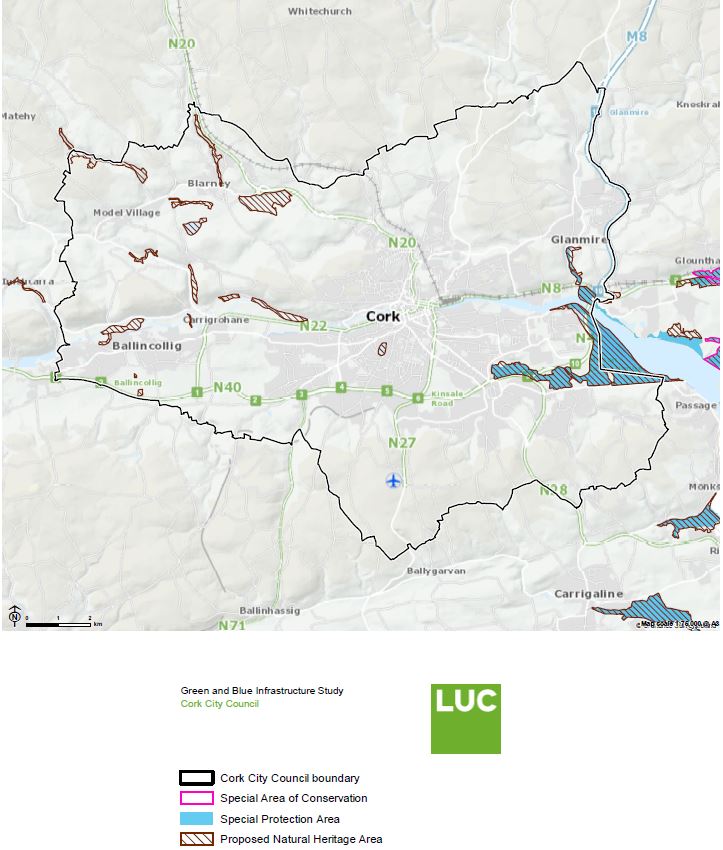
Photo Location: Mardyke Walk
|
To strengthen the green and blue infrastructure of Cork City. To protect and promote biodiversity and habitat connectivity and protect natural areas. To protect and enhance Cork City’s unique landscape character and maritime heritage. To ensure all of Cork City’s residents have access to open spaces, recreation and amenity facilities and natural areas. A strong green and blue infrastructure network is essential to the quality of life of Cork City’s residents and contributes towards the creation of places where people want to live and work. It is an objective of Cork City Council to achieve a healthy, green and connected City with high-quality and interconnected open spaces, parks, diverse natural areas and green and blue corridors. Proposals for new development in Cork City will respect and reflect the topography, landscape and ecology of the City, and will protect and enhance the City’s green and blue infrastructure by ensuring that development does not fragment existing networks of green and blue infrastructure. Proposals for new development will demonstrate how green and blue infrastructure, open space, sport and recreation, landscape and biodiversity are considered commensurate to the scale and context of the development in the development process. Large-scale developments will incorporate open spaces to contribute to the green and blue infrastructure in the City. |

|
Objective 6.1 |
|
Objective 6.2 |
|
Cork City Green & Blue
To manage, protect and enhance the Green and Blue Infrastructure assets of Cork City in line with the Cork City Green and Blue Infrastructure Strategy set out in the Development Plan, and to support the actions, opportunities and projects identified in the Cork City Green and Blue Infrastructure Study 2021.
|
Accessibility to the Green
a. Cork City Council will work with stakeholders in ensuring that green and blue infrastructure networks and spaces are accessible and safe for all. This includes seating, accessible toilet facilities, appropriate path gradients and surfacing, path widths and signage. |
|||
|
|
Objective 6.3 |
|
Objective 6.4 |
|
Access to Water ResourcesCork City Council will seek to work with stakeholders in facilitating safe, improved accessibility to the water environment including the River Lee and Cork Harbour and encouraging uses which optimise the amenity, tourism, recreation and leisure opportunities associated with this blue infrastructure without adversely impacting on the day-to-day economic functions of these assets. |
Temporary Green and
Where appropriate, support the use of temporary greening of sites awaiting development. Temporary greening shall make a positive impact to the local environment and overall amenity of the area, without prejudicing the effectiveness and viability for the longer-term use of the site, as set out in this plan.
|
|||
|
|
Objective 6.5 |
|
Objective 6.6 |
|
Trees & Urban Woodlanda. To protect and enhance the City’s tree and urban woodlands in public and private ownership. Cork City Council will seek to survey, map and maintain existing important individual and groups of trees, using Tree Preservation Orders as appropriate.b. To encourage the planting of new urban woodlands and trees where appropriate throughout the City and particularly where there are deficiencies in tree coverage as identified in the Cork City Green and Blue Infrastructure Study. c. To support the preparation of a City Tree Strategy which provides a vision for longterm planting, protection and maintenance of trees, hedgerows and woodlands. d. To support retaining existing trees and the planting of new trees as part of new developments subject to care on the species of tree and the siting and management of the trees to avoid conflict with transport safety and residential amenity in particular. e. To promote the planting of pollinator friendly native deciduous trees and mixed forestry to benefit biodiversity. |
Rivers, Waterway and
|
|||
|
||||
|
|
Objective 6.7 |
|
Objective 6.8 |
|
Carbon SequestrationTo work with landowners, communities and other stakeholders in supporting initiatives to increase carbon sequestration through the effective and sustainable use of undeveloped, vacant and agricultural land. This could include opportunities to explore protecting soil fertility, reducing erosion, increasing soil organic matter, re-wetting bogs and peatland and restoring degraded soils. |
Community Food
To support community food growing opportunities at appropriate locations in Cork City that include the enhancement of existing and the provision of new allotments, urban agriculture, community gardens and the incorporation of food growing opportunities into residential development schemes.
|
|||
|
|
Objective 6.9 |
|
Objective 6.10 |
|
Landscapea. To preserve and enhance Cork’s landscape character, key landscape assets and views and prospects of special amenity value.b. Landscape will be an important factor in all development proposals, ensuring that a proactive view of development is undertaken while maintaining respect for the environment and heritage generally in line with the principle of sustainability. c. To ensure that new development meets the highest standards of placemaking, siting and design. d. To protect those prominent open hilltops, valley sides and ridges that define the character of the Cork City Hinterland and those areas which form strategic, largely undeveloped gaps between themain Hinterland settlements from development. e. To discourage proposals necessitating the removal of extensive amounts of trees, hedgerows and historic walls or other distinctive boundary treatments. f. To support, as appropriate, any relevant recommendations contained in the National Landscape Strategy for Ireland 2015-2025. |
City Landscape
|
|||
|
||||
|
|
Objective 6.11 |
|
Objective 6.12 |
|
Landscape and
To ensure that the management of development throughout Cork City will have regard for the value of the landscape, its character, distinctiveness and sensitivity in order to minimize the visual and environmental impact of development, particularly in designated areas of high landscape value where higher development standards (layout, design, landscaping, materials) are required.
|
Landscape Preservation
To preserve and enhance the character and visual amenity of Landscape Preservation Zones through the careful management of development. Development will be considered only where it safeguards the value and sensitivity of the particular landscape and achieves the respective site-specific objectives, as set out in Tables 6.6 – 6.10.
|
|||
|
|
Objective 6.13 |
|
Objective 6.14 |
|
Areas of High
To conserve and enhance the character and visual amenity of Areas of High Landscape Value (AHLV) through the appropriate management of development, in order to retain the existing characteristics of the landscape, and its primary landscape assets. Development will be considered only where it safeguards to the value and sensitivity of the particular landscape. There will be a presumption against development where it causes significant harm or injury to the intrinsic character of the Area of High Landscape Value and its primary landscape assets, the visual amenity of the landscape; protected views; breaks the existing ridge silhouette; the character and setting of buildings, structures and landmarks; and the ecological and habitat value of the landscape.
|
Cork City View
a. To protect the strategic panoramic, linear, river prospect or scenic route views identified in this Plan and ensure that development proposals do not have an undue detrimental impact on these views. |
|||
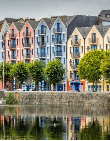
|
||||
|
|
Objective 6.15 |
|
Objective 6.16 |
|
Development on
a. To protect the character of those views and prospects obtainable from scenic routes identified in this Plan. |
Public Rights of WayTo preserve all public rights of way in Cork City, encourage opportunities to enhance existing or create new rights of way to improve access to green and blue infrastructure and prohibit development that would adversely impact the routes. |
|||
|
|
Objective 6.17 |
|
Objective 6.18 |
|
Open Space StrategyCork City Council will seek to prepare a citywide Open Space Strategy during the life of this Plan to ensure that Cork City has a framework to define strategy, projects and standards to ensure that Cork City will have an excellent network of open spaces to meet the needs of its residents. |
a. To protect, retain, improve and provide for areas of public open space for recreation and amenity purposes. There will be a presumption against development of land zoned Public Open Space for alternative purposes. b. There will be presumption against development on all open space in residential estates in the city, including any green area / public amenity area that formed part of an executed planning permission for development and was identified for the purposes of recreation / amenity open space, and also including land which has been habitually used as public open space. Such lands shall be protected for recreation, open space and amenity purposes. c. The development of open spaces should aim to enhance and protect natural features and views and be set in safe and secure environments with the emphasis on active open spaces accessible to and enjoyed by all sectors of the community. d. To follow an approach of qualitative as well as quantitative standards for open spaces providing high quality open spaces with high levels of access to recreation for local communities. e. Specific design outcomes should be framed in relation to the nature of spaces being created or enhanced (e.g. in relation to maintenance, nature exposure and connectivity, strategic landscape and social role). f. Support measures to green the city, including re-grassing of appropriate hard-surfaced areas in locations throughout the City. |
|||
|
|
Objective 6.19 |
|
Objective 6.20 |
|
City Parks and
|
Active Recreational
a. To ensure that all residents have access to neighbourhood scale outdoor and indoor active sports recreational infrastructure within their neighbourhood or in accessible locations. |
|||
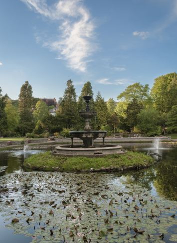
|
||||
|
|
Objective 6.21 |
|
Objective 6.22 |
|
River Use and
|
Natural Heritage and
a. To protect, promote and enhance Cork City’s natural heritage and biodiversity. |
|||
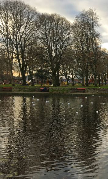
|
||||
|
|
Objective 6.23 |
|
Objective 6.24 |
|
Designated Sites and
|
Information to be
|
|||
|
|
Objective 6.25 |
|
Objective 6.26 |
|
Non-designated Areas of
|
Alien Invasive SpeciesTo support the implementation of measures to control and prevent the introduction, establishment or spread of ecologically damaging alien invasive species (e.g. Japanese Knotweed and Himalayan Balsam). |
|||
|
|
Objective 6.27 |
|||
Areas of Geological
|
||||
Freedom of the City Art Competition
-
1- Except as provided for in Article 6(4) of the Habitats Directive, viz. There must be: a) no alternative solution available, b) imperative
reasons of overriding public interest for the project to proceed; and c) Adequate compensatory measures in place.
-
2- Ecosystems are multifunctional communities of living organisms interacting with each other and their environment. Ecosystems provide
a series of services for human well-being (ecosystem services) either directly or indirectly contributing towards human wellbeing.
- 3- Renewable and non-renewable resources (e.g. plants, animals, air, water, soils, minerals).
Contents
Observations
Observations
Objection to the placing of any bridge which will allow cars to connect to the Atlantic Pond side of the Marina.
Objection to any building of new roads over the river leading to docklands/over Marina Park
Hello,
I wish to make the below submission to the City Development Plan:
I wholly object to any building of new roads over the river leading to docklands/over Marina Park.
The...
Proposed Amendment to Draft City Development Plan 2022-2028
To whom it concerns:
I object in the strongest of terms to amendments 1.241 & 1.247 of the
City Development Plan.
As a resident of Ballintemple, and a regular user...
Proposed Amendment Ref. 1.135 to Objective 6.17
Please see enclosed submission
Greenbelt should be protected
Dear Madame/ Sir
I am against this planning permission.
There is such a diverse wildlife here from buzzards, owls, herrons, foxes and many more here around us. We should...