


See attached documents for submission.
9. City Centre, Suburbs, Towns and City Hinterlands
Closed26 Jun, 2020, 00:00 - 21 Aug, 2020, 16:00
9.1. Introduction

Cork City has recently expanded its administrative boundary1. The resulting increase in population, to over 210,000 persons, also resulted in a fivefold increase in the city’s total area, to 187km². Cork City is now defined as a Medium Sized European City2.
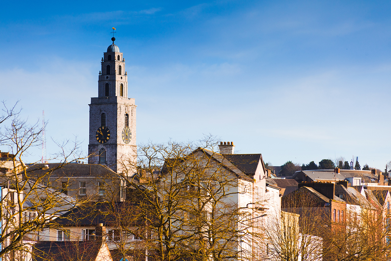
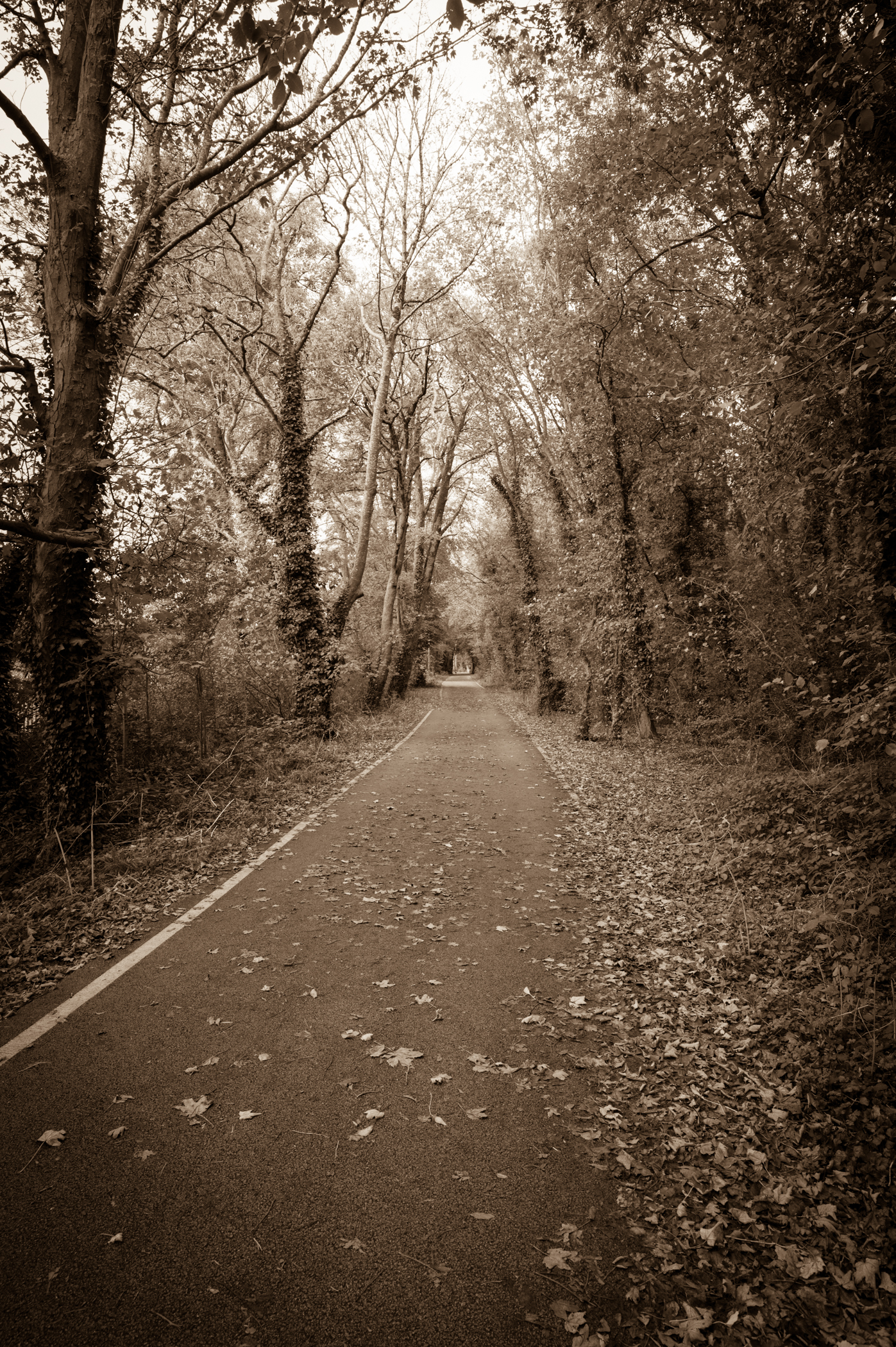
The distinctive character of the city is created through a combination of its natural and built form. Built on estuarine islands in the marshy valley of the River Lee, the city gradually expanded up the steep hills rising to the north and south of the city centre and then into its hinterland. Its overall character therefore derives from a combination of its natural landscape and topography, its built fabric and its location on the river at a point where it forms a number of waterways.
The urban character of Cork City is reflected in a wide range of material assets, and is better understood by looking in greater detail at the nature of the city centre, the range of neighbourhoods in the city suburbs and the character and form of the city’s urban towns and wider hinterland area. Recent development that has happened, or are currently underway, is also resulting in further transformation within these ever changing areas.
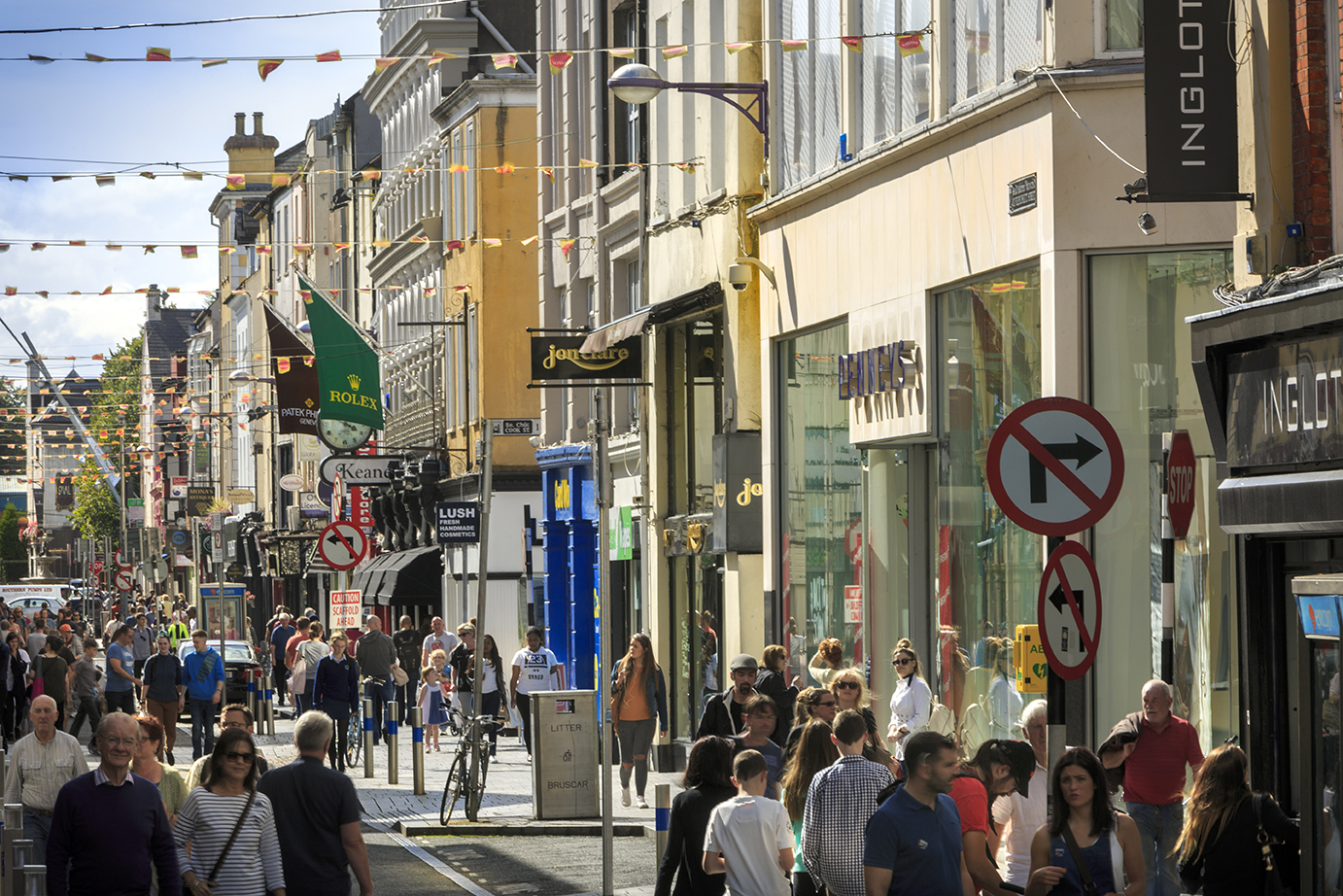
9.2. City Centre
Cork City Centre is the largest urban centre in the region, with a diverse and vibrant living environment, at the heart of the Cork Metropolitan Area. The City Centre can be broken down into the following sub areas:
- Heart of the City (the City Centre Island)
- Shandon Area
- McCurtain Street/St. Luke’s Area
- North City Docks
- South City Docks
- South Parish Area
- Main Street/South Gate Area
With a population of over 24,000 persons, the City Centre accounts for 12% of the city’s total population. Its density is nearly four times greater than that of the total city. The Shandon and South Parish areas are the most densely populated, accounting for half the total population living in the City Centre. Cork City Centre has a young population, with over half being aged between 25-44 years. More than half of all residents live in rental accommodation, with a much lower numbers of young families or retired households, when compared with the rest of the city.
Cork City Centre has seen a number of significant regeneration and urban renewal projects over the last five years, bringing new life into the city centre. Recent examples include:
- A mixed-use development, currently under construction at Horgan’s Quay that includes 30,000m² of office space, 325 residential units, a hotel, shops and restaurants;
- Navigation Square is a next generation office development at Albert Quay, providing over 33,000m² of office space, with phase one now complete and in use;
- Student accommodation developments are currently under construction at Victoria Cross (255 bedspaces) and within the Beamish and Crawford site (417 bedspaces) and
- A large increase in Third Level spaces, including: UCC’s Centre for Executive Education in the former Cork Savings Bank on Lapp’s Quay and UCC’s and MTU’s Cork Centre for Architectural Education (CCAE) on Douglas Street.
The Cork City Centre Strategy (2014) sets out clear aims to further revitalise the City Centre through improvement and development, better management based upon partnership of stakeholders and increased marketing of the City Centre’s offer3. Annual action plans are part funded to help implement the strategy. An overall review of the strategy is due to be completed later in 2020, to feed into the next City Development Plan.
Further consolidation and regeneration of the City Centre, will underpin its role as the vibrant, living and working heart of the city. As outlined in Section 4 above, the regeneration of the City Docks as a high quality, mixed use sustainable waterfront with new urban quarters and transformational projects will be a major catalyst for further investment and regeneration of the City Centre.
9.3. City Suburbs
With over 30 identifiable neighbourhoods, Cork City Suburbs offers a variety of vibrant community, social, employment and cultural activities to its residents and the wider area. Given the topographical nature of the city and the natural boundaries created by its major transport corridors, the City Suburbs naturally divides into the following four geographical areas:
- North West Suburb
- North East Suburb
- South East Suburb
- South West Suburb
With over two thirds of the total population, the City Suburbs is home to the largest population base within the city. The area remains heavily dependent on private transport, with 63% of residents using their car/van/etc to get to work or education and only 9% using public transport.
A. North West Suburbs
The North West Suburbs has experienced significant changes in the last decade. Blackpool has added large scale mixed retail, office, leisure and residential developments with a number of other prominent sites still available for further regeneration. The North-West Quarter Regeneration plan for Knocknaheeny and Hollyhill is well underway, while new mixed tenure housing is proposed on a City Council owned site at Old Whitechurch Road. The North West Suburbs has been identified for significant public transport intervention as part of CMATS4 including a new commuter railway station and high frequency bus routes.
B. North East Suburbs
Growth in the North East Suburbs has been somewhat limited in recent years, mainly due to topographical and infrastructural constraints. The area is bookended to the north by hilly and often steeply sloping terrain, with low lying floodplains to the north east providing a natural buffer with Glanmire. The Ballyvolane Urban Expansion Area (UEA) is the main area identified for future growth within this area, through a mix of housing, employment and commercial uses. This area has been earmarked for significant public transport improvements as part of CMATS. These will improve connectivity across the wider city, but future development in the area is also constrained by the lack of other physical infrastructure.
C. South East Suburbs
The population of the South East Suburbs has grown rapidly in recent years, reflecting its close proximity to Cork City Centre and its growth as employment base. In tandem with this growth there has been a notable rise of peak hour congestion. The area is identified for significant public transport interventions as part of CMATS, including a potential light rail route from Mahon to Ballincollig, via the city centre and priority bus corridors from Douglas to the City Centre. Douglas is at the heart of the South Eastern Suburbs and is the focal point for surrounding residential areas of Rochestown, Frankfield, Donnybrook and Grange. Mahon is the largest neighbourhood in the area, with significant population employment and economic activity. There has been a growth in high-tech employment in Mahon, with the completion of the City Gate and City Gate Park office developments, alongside the development of a new private hospital. Mahon Point, a conventional shopping centre with ancillary retail park, has a wide regional catchment. These uses have increased the number and frequency of car borne journeys to and from this area and its peak time congestion.
D. South West Suburbs
Significant growth in housing and population has occurred in the Southwest Suburbs over the last ten years, including lands around Mathew Hill where development continues apace. Given its close proximity to the city centre and the range of large employers (e.g. UCC, MTU and CUH) and local services, demand for further population and housing growth is high. Permission was granted in 2019, for the redevelopment of the Wilton shopping centre, including additional retail, hotel, cinema and office space. The lands surrounding the Tramore Road and Kinsale Road are largely home to a light industrial and wholesale uses. Given its strategic location, this area may have potential for future urban renewal, if suitable high quality public transport services can be provided. The former Dairygold site has been earmarked for a possible primary health care centre and residential development, and would be a catalyst for wider regeneration and urban renewal of the area.
The characteristics and wide variety of neighbourhoods within the four suburban areas located around Cork City Centre offer a diverse range of opportunities to further enhance liveability within the city. Investment in the regeneration and consolidation of the city suburbs will however require a range of well planned mixed use urban renewal projects that fully integrate high quality, architectural and urban design responses to achieve sustainable development that properly reflects the existing characteristics of these neighbourhoods.
9.4. Urban Towns
There are four urban towns in Cork City, each with a population of 2,000+ persons: Ballincollig, Glanmire, Tower and Blarney. The nature, scale and characteristics of these towns differ greatly. Ballincollig and Glanmire are larger towns, located on the edge of the city suburbs, with a wide range and mix of uses. Both are expanding, mainly through new residential development on the edge of each settlement. Tower and Blarney are located further to the northwest of the city, being separated by the city hinterland. Tower is largely a residential area, built around a small village centre. Blarney has a smaller population base and is centered on the historic Blarney Castle, a major tourist attraction within the region.
(i) Ballincollig
Ballincollig has a population of 18,159 persons, being one of the largest towns in the Southern Region. With a modern and vibrant main street, the town’s large shopping centre and historical riverside Regional Park are two of its most popular attractions. The town is a significant tech-business employment base, being home to both VMware and Dell EMC. Ballincollig has a young population base. Nearly a quarter of the town’s total population is aged 0-14 year olds. Pre-school going families make up 12% of the town’s total households. The town is very car dependent with only 6% of people using public transport to travel to work or education, and 12% walking or cycling.
Ballincollig experienced significant growth up until the recent economic downturn. The town continues to experience housing growth, with pockets of greenfield land currently being developed. Additionally a number of brownfield and infill sites are coming on stream. There remains significant vacancy within the town centre. The Maglin Urban Expansion Area has potential for a large amount of new residential development, but has notable transport and drainage constraints, which Cork City Council is currently working with landowners and developers to address. Major transport and connectivity improvements are planned under CMATS,
including a future Light Rail corridor, connecting to Cork City Centre and onto Mahon. Within this context, Cork City Council will examine the suitability of sites in and around the town to meet future housing, employment, community and neighbourhood needs.
(ii) Glanmire
Glanmire has a population of 9,903 persons and is located in the northeast of the city, north of Tivoli Ridge. The town is positioned within the steep river valley of the Glashaboy and Butlerstown rivers, with agricultural lands to the southwest. Employment and economic activity is largely focused on the retail and services sector, including Hazlewood shopping centre. Glanmire’s population base is largely made up of young families, with 58% of all households being preschool, early school or adolescent families. Despite its bus connections and close proximity to the city centre, only 6% use public transport to get to their place of work or education.
There is a large amount of lands zoned for future development within Glanmire. The Ballinglanna Urban Expansion Area, located to the south east of the town centre, is currently under construction and will add a significant number of new dwellings. Whilst some other development has occurred, the future expansion of Glanmire is heavily constrained by difficult topography and the location of low-lying agricultural lands to the southwest, which are susceptible to flood risk. These constraints have largely prevented the settlement from merging with the northern suburbs of the city, while helping to preserve a distinct identity for the town. Major transport and connectivity improvements are envisaged for Glanmire in the form of the Metropolitan Cork Cycling Strategy and other CMATS projects. The location and nature of future development in Glanmire will need to be examined in the context of the issues outlined above, and in accordance with national and regional planning guidance.
(iii) Tower
Tower has a population of 3,274 persons and is situated in the northwest corner of the city, 11km from the city centre. The town is located on an elevated ridge and developed rapidly in the earlier part of the 20th century around a smaller village. Tower has experienced significant population growth since the start of the 1990’s and is now mainly a residential settlement. The town is set within visually prominent steep slopes that form catchments for rivers and streams feeding in into the River Lee to the south. Tower has a young population with 38% of the total being aged between 0- 24 years old. The majority of households living in the town are young families, with over half being pre-school, early school or adolescent families. The town is extremely car dependent with 85% of the population travelling by private means (car, van, motorbike, etc.) to their place of work or education. While planning permissions have been granted for residential developments in recent times, Tower is somewhat constrained by the topography of the area and associated flood plain to the east. Large areas to the south and west have also experienced significant flood risk. The potential for additional development in Tower needs to be examined in the context of these constraints and the need to balance development with local services and sustainable transport targets for the wider Cork area.
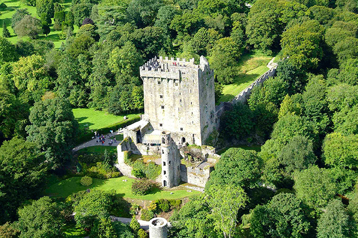
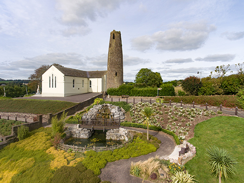
(iv) Blarney
Blarney has a population of 2,550 persons and is located in the northwest of the city, 8km from the city centre. The historic Blarney Castle and the former Woolen Mills are the focal points for the town, being major tourist and commercial attractions, drawing large numbers of visitors on an annual basis. In more recent times, new employment opportunities have arisen through the ongoing development of the Blarney Business Park, located to the North East, with direct access onto the N20 Cork-Limerick national road. Blarney has an older population base, with one in five residents being aged 65 years or older. The town is also extremely car dependent with only 4% of people using public transport to travel to work or education, and 3% walking or cycling.
The population of Blarney has remained somewhat static, with large areas of zoned land undeveloped within the town. This is due in part to infrastructural constraints. Stoneview, a large area of residential and employment zoned land immediately to the north of the town, requires large scale roads and utilities infrastructure investment to facilitate development in this area. CMATS provides for a suite of public transport interventions for Blarney, including a new train station at Stoneview. The potential for additional development needs to be examined in the context of these constraints and the need to balance development with the tourism potential, the need for local services and wider sustainable transport targets for Cork.
9.5. City Hinterland
The City Hinterland is made up of the lands outside the City Centre, the City Suburbs and the four urban towns. The area is mainly rural in character with large tracks of agricultural lands, but also contains a number of smaller settlements like Kerry Pike and White’s Cross. Cork Airport is located to the southern end of the hinterland area. The airport acts a central hub for the city, metropolitan and region from a transport, connectivity and economic view point. The adjoining Cork Airport Business Park is a large scale employment base within the region and is home to a wide range of businesses. There are a number of large industrial parks and warehouses within the City Hinterland area, mostly located on lands adjacent to the city.
The City Hinterland has a population of 11,546 persons, accounting for only 5% of the overall population living in the City. The area has the largest land mass but the lowest population density and is largely rural in character. The City Hinterland has an older population base with 44% being aged 45 years or older. One in ten of all households in the area are retired couples/persons living alone. The City Hinterland is also extremely car dependent with only 4% of people using public transport to travel to work or education, and 6% walking or cycling.
Some residential sites located in the small settlements of the City Hinterland are currently being developed. There is also a significant amount of one-off housing development in this area. Future provision of such house types will be examined in the context of national policy for rural areas under strong urban influence. The potential for additional development in the City Hinterland needs to be examined in the context of the local and environmental characteristics of the area. There will be a requirement to balance any future development with the wider needs of Cork City to achieve compact growth and more sustainable transport patterns, while ensuring environmental preservation and the retention and enhancement of the urban and rural character of the wider city.
9.6. Key Questions
- How do we provide more residential and employment opportunities within each of the City’s sub areas? What types of uses should go where and what scale should they be?
- How do we increase residential densities within the city, while respecting the scale and quality of existing built and natural heritage?
- How do we address issues of retail vacancy and dereliction in the City Centre and other urban and neighbourhood centres?
- What are the most important issues facing suburban areas like Douglas, Mahon, Ballyvolane, Blackpool and outer settlements such as Ballincollig, Glanmire and Tower?
- What are the important issues facing the City Hinterland area within the time period of the next City Plan and beyond? How do we best plan for these?
- 1- On May 31, 2019 Cork City expanded to nearly five times its former size and the population of the city grew by 85,000 to 210,000: https://www.corkcity.ie/en/council-services/public-info/boundary-extension/history-and-legislation/
- 2- Regional Focus, RF 01/2012, European Commission
- 3- Cork City Councils CORE Partnership, the City Centre Steering Group and the City Centre Co-ordinator are three examples of city centre initiatives aimed at implementing the City Centre Strategy (2014): https://corkcitycentre.ie/
- 4- Cork Metropolitan Area Transportation Strategy (CMATS) is a €3.5bn investment package for Cork including commuter rail, bus corridors, light rail, park and rides, walking and cycling infrastructure and road networks.
Contents
Materials
References
Observations
Observations
Rezoning of land, in Tower, Blarney, to 'Residential Low Density'.
See attached document for submission.
Zoning at lands at Raheen, Clash Road, Ballincollig.
See attached document for submission.
Zoning at Lands at Clash Road, Ballincollig
See attached document for submission.
City Center, Suburbs, Towns and Hinterland
Maybe larger spaces can be turned into a mall worn open space and give opportunity for retail companies to rent a small space instead of the entire building. Smaller, local companies, for example...