


Chapter 10
Key Growth Areas & Neighbourhood Development Sites
Main points
We find the Tivoli area development plan to be of the highest...
10. Key Growth Areas & Neighbourhood Development Sites
Dúnta26 Iúil, 2021, 09:00 - 4 D.F., 2021, 16:00
Introduction
10.1
Building on the strategic growth objectives set out in Chapter 2, this Chapter focuses on key growth areas identified in the Core Strategy and the Growth Strategy. Where the Core Strategy and Growth Strategy provide overarching direction for city growth, this Chapter provides more area and sitespecific detail. The growth proposed is in line with the Core Strategy, being proportionate to the scale of the area and its ability to accommodate new development.
10.2
Objectives within this chapter are area specific. All other relevant development objectives are covered within their respective chapter. This Chapter shall therefore be read in conjunction with the rest of the Plan, including the land use zoning and objectives maps. In the event there is any ambiguity, the objectives set out in the Core Strategy take precedence.
The following key growth areas are addressed in this Chapter:
Strategic Consolidation
|
Hinterland and
|
|||
|
1. City Centre 2. City Docks 3. Tivoli Docks 4. Cork International Airport |
20. Kerry Pike 21. Killeens 22. Upper Glanmire 23. Hinterland |
|||
Urban Towns |
Neighbourhood
|
|||
|
5. Ballincollig 6. Blarney 7. Glanmire 8. Tower |
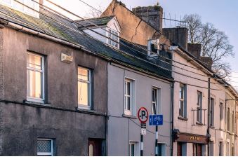
Site No. 1 Avenue de Rennes
Site No. 2 Barry’s Field, Church Street
Site No. 3 Blackpool Retail Park, Site No. 4 Castle Road, Ballincollig Site No. 5 Dunkettle, Glanmire
Site No. 6 Former Vita Cortex Plant, Site No. 7 Land North of Ballinlough Road
Site No. 8 Land North of South Douglas Site No. 9 Lee Garage, Model Farm Road Site No. 10 Meadow Rise |
|||
City Suburbs |
||||
|
9. Ballyvolane East and West 10. Blackpool / Kilbarry 11. Douglas 12. Farranferris 13. Hollyhill 14. Mahon 15. NE and NW Regional Parks 16. NW Regeneration Area 17. Sunday’s Well 18. Tramore Road / Kinsale Road 19. Wilton |
||||
1. City Centre
Introduction
10.3
The City Centre is the historical, cultural and commercial heart of Cork. Its success is vital to the wellbeing of the entire City and wider region. It projects a vibrant image for Cork internationally, attracting investment and is an important location for urban living, employment, education, tourism, culture, public services and the principal location for retail and hospitality in the region. The shift in focus towards urban living and compact development presents an opportunity to build on these assets and, through good management, will play a key role in delivering on the future, sustainable growth of Cork City. This section focuses primarily on the City Centre Island, from MacCurtain Street and Shandon north of the River Lee to the South Parish area and Barrack Street to the south. At the heart of this is St. Patrick’s Street, serving as the main shopping street for the south of Ireland. With fluctuating trends in retail and the challenges faced by the COVID-19 pandemic, it will be important to ensure it retains its draw and relevance into the future. Issues affecting the City Centre are pervasive, therefore other Chapters in this Plan are of relevance and provide relevant development guidance.
10.4
The vision for the City Centre is to fulfil its potential as a vibrant, diverse place to live, work and visit, recognising its key importance to the success of the City and wider region. It will be developed in a sustainable manner while maintaining its historic, cultural, economic and social character.
The City Centre in Context
10.5
Cork City Centre will play a key role in delivering on the National Planning Framework’s (NPF) ambitious targets of achieving compact growth and preventing the continued expansion and sprawl of cities and towns out into the countryside. The way of achieving this is by making better use of under-utilised land and buildings. The Core Strategy of this Plan aims to accommodate an additional c.3,500 people in the City Centre by 2028, a growth of 15% from the Census 2016 baseline figure of 22,732. This is to be achieved by a combination of regeneration (new build) and consolidation (reuse of the existing built fabric).
10.6
The Cork Metropolitan Area Strategic Plan (MASP) aims to promote the City Centre as the primary location at the heart of the metropolitan area and region. It notes how globally, city centres are increasingly sought-after as the locations of choice for investors for a combination of living, working and high quality of life opportunities. Some of the ways to capitalise on this include:
• Upgrading and developing the public realm, inner-city parks (including Bishop Lucey Park), urban amenity areas, linear amenity areas (that optimise waterfront settings), and further embracing the river as a key asset, home for biodiversity, and amenity within the City Centre,
• Acquisition of and planned development of strategic inner-city sites to facilitate regeneration of vacant and underutilised areas,
• Mechanisms to promote redevelopment of strategic city blocks and the upgrading and reuse of existing buildings,
• Investment in retrofitting infrastructure and services (physical, social and recreational) to improve quality of life for communities,
• Support continued investment in the cultural assets of the city, including the Crawford Art Gallery, theatres, museums and other cultural attractions / activities,
• Celebrate the rich built heritage of the City Centre.
10.7
As outlined in the Cork City Socio-Economic Summary Profile (2020) there is a clear distinctiveness to the population living in Cork City Centre when compared with the rest of the City:
• Residents of the City Centre tend to be younger adults with over half aged 25-44 years,
• The City Centre appeals to the ‘pre-family’ category of the population, however there are fewer families and younger people under-18 living in the City Centre,
• The City Centre is highly internationalised, with 42% of the population categorised as ‘non-Irish’,
• The most densely populated areas of the City Centre are Shandon and South Parish,
• More people walk, cycle or use public transport to work or education in the City Centre than other areas throughout the City.
Sustainable Residential Neighbourhood
10.8
One of the main aims of this Plan is to provide for the regeneration and consolidation of the City Centre by increasing its residential population and improving its potential as a desirable place to live. As can be seen from the profile above, it is the most environmentally sustainable, residential location in the City, therefore it represents an opportune location for future growth, situated at the heart of the City’s travel networks.
10.9
One the major assets of the City Centre is its vibrant mix of uses and it is also an objective to enhance its role as an employment, cultural, learning and entertainment destination along with its residential function. It is currently not meeting its full potential as a place to live, work and spend time but there are opportunities to redress this balance. One of the main ways of achieving this will be through the sustainable reuse of existing sites and buildings. Cork City Council will use its powers through active land management initiatives to address vacancy, dereliction, and underutilisation of property in the City Centre. Incentives such as the Living City Initiative, the Repair and Lease Scheme and built heritage grants will be promoted and augmented to ensure older and historic buildings are brought back into use. New homes should also cater for a wide range of age groups and be socially inclusive. More homes in mixed use areas will be encouraged by increasing residential uses on upper floors, which are often lying vacant at present. Considering the significance of much of the City Centre’s built fabric, the development of new or infill sites must respect its architectural and historical character, be of a complementary scale and grain to adjacent buildings and appropriate to its context. In order to welcome more families to live in the City Centre, it is crucial that it is promoted as a child-friendly place with improved and additional parks and playgrounds catering for their needs.
10.10
The safety and security of residents and visitors is also a key consideration by encouraging safe streets and an attractive public realm with active frontages providing surveillance and overlooking. The importance of Cork’s maritime heritage and enhancement of the waterfront will also be a key objective in increasing its attractiveness as a place to meet and spend time. The range of community and social services available in the City Centre will also need to be enhanced to cater for its increased residential population.
Retail and Commercial
10.11
The City Centre functions as a vibrant employment and commercial centre, being the most important retail destination in the region and the key employment centre in the Cork Metropolitan Area, with c. 20,000 people working in the City Centre Area in 2016. There is currently an attractive mix of retail uses in Cork City Centre. However, with the future of the retail market being somewhat uncertain, it will be important to diversify the range of uses in the City Centre. Leisure activities and hospitality uses, for example, are playing an increasing role in attracting people to urban centres. In order to recognise the importance of the City Centre as a retail destination a Core Retail Area has been designated to support its function as a destination for comparison shopping. While ground floor uses will continue to be restricted to mainly comparison shopping on Primary Retail Frontages such as St. Patrick’s Street in order to protect its retail function, some complimentary uses will also be permitted in exceptional circumstances, where it can be demonstrated that these uses will enhance the main retail function of these streets. It is important to continue to support a comparison goods function which is under-provided for in the City Centre. It is also intended to restrict residential uses, retail offices, general offices, hot food takeaways and bookmakers, betting shops at ground floor level on Secondary Retail Frontages. Residential and other uses will be encouraged on upper floors to improve footfall and activity in the evening time.
10.12
While the City Centre has experienced losses in the retail sector in recent years, there have been overall net gains in employment from office-based sectors, including high value clusters such as fintech, ICT and professional and internationally traded services. It is therefore important to continue to support office development in the City Centre, including the development of supported space for start-ups and co-working hubs. The retention of office uses on South Mall to support a mix of large, medium and small business will also be promoted. Non-office uses at ground floor level on South Mall will only be open for consideration in the part of the street east of Morrison’s Street on the south side and east of Beasley Street on the north side. Non-office uses on upper floors of heritage buildings will be open for consideration where they do not have a negative impact on the area or the heritage asset. Uses that will be considered favourably in this circumstance are residential, hotel or serviced accommodation.
Quality Attractions and Night-Time Economy
10.13
The City Centre has a wide range of cultural, entertainment and leisure attractions including cafés, bars, restaurants, cinemas, theatres, music venues, libraries, galleries and museums. It is a centre for domestic and international tourism and Cork City Council will work with key stakeholders to improve the cohesiveness and appeal of key attractions in Cork City and enhance the overall City Centre experience. It is also aimed to expand the draw and offer of the Cultural Precincts at Shandon and South Parish including targeted measures such as investing in Shandon and Elizabeth Fort as well as promoting the historic spine that connects these areas along Shandon Street, North and South Main Street and Barrack Street. Leisure uses will also play an increasing role in the vibrancy and attractiveness of the City Centre.
10.14
A key part of ensuring the vibrancy of the City Centre is ensuring that activity is not limited to daytime but includes a diverse range of activity into the evening and night-time. This diverse range of social, cultural and economic activity is referred to as The Night-Time Economy (NTE). A healthy night-time economy is inclusive and appeals to all sectors of society such as family-oriented activities, festivals, street entertainment, night markets and pop-up shops. Opening museums, cultural institutions and retail units into the evening time is important as well as more traditional activities that are enjoyed at night-time such as cafés, bars and restaurants.
10.15
A Night-time Economy Taskforce was established by the Department of Tourism, Culture, Arts, Gaeltacht, Sport and Media in 2020 to prepare a report, on how best to serve those who work in, and wish to engage with, a vibrant night-time culture. Cork City Council is playing a central role in this process with the Lord Mayor of Cork a member of the Taskforce. Cork City Council will also continue to assess ways to advance and improve night-time entertainment and creative offerings. Cork City has a vibrant and growing food scene including the English Market, which could offer potential opportunities, focusing on the delivery of an authentic local food experience, working with local producers, restaurants, food service providers and food markets.
10.16
The issue of safety and security will be a key feature ensuring public spaces are well designed and properly lit. While a certain level of noise is associated with the night-time economy, Cork City Council will consider reasonable measures to ensure that music and other noise generated as part of the night time economy is managed as much as possible through improved sound-proofing, operational management and regulatory controls. It should be recognised that the night-time economy will have to coexist with an increased residential population and as such developments will be controlled and managed through the Development Management process, where there is likely to be negative impacts on residential amenity or the established character of the City Centre.
Cork City Centre Strategy 2014 and Cork City Centre Revitalisation Action Plan 2021-2025
10.17
Significant progress has been made in recent years in terms of the overall approach to managing the City Centre. The Cork City Centre Strategy was prepared in 2014, to set out objectives for its renewal and regeneration. A partnership was established, comprising representatives from key City Centre stakeholders including the City Council, business, security, transport groups with residents represented by the elected members. This was underpinned by operational structures and resources of Cork City Council.
10.18
Cork City Council has commissioned a new fiveyear action plan (Cork City Centre Revitalisation Action Plan 2021-2025) to address the land use and economics of Cork City Centre, and ensure it is developed as a vibrant and viable core to Metropolitan Cork. This will beused to guide the ongoing efforts of building the City Centre’s attractiveness as a place to live, work and visit. This is set within the context of addressing the challenges of COVID-19, along with continuing to improve the fabric of the City Centre by addressing dereliction, vacancy and underutilisation of space. The Strategy will be available in Quarter 2, 2021.
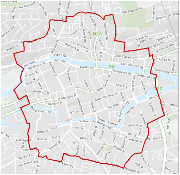
Figure 10.1: Study Area Boundary of Cork City Centre Revitalisation Action Plan 2021-2025
The Cork Metropolitan Area Transport Strategy (CMATS) 2040 and City Centre Movement Strategy
10.19
The Cork Metropolitan Area Transport Strategy (CMATS) aims to reduce dependency on the private car, while increasing the appeal ofsustainable transport options. It recognises that pedestrian access to the City Centre island is inhibited in some areas by a limited number of pedestrian bridges, substandard crossing facilities and high volumes of vehicular traffic and speeds on approach roads. It builds on the work on-going through the City Centre Movement Strategy (CCMS), which has an overarching objective to prioritise pedestrian, cyclist and public transport movement and reduce through vehicular traffic volumes and speeds. ‘Walkability’ improvements are envisaged over the lifetime of the Strategy and include re-allocation of road space in favour of pedestrians in the City Centre and quayside areas, matching crossing facilities with pedestrian desire lines, and the re-timing of signals to reduce pedestrian wait times. Access between the City Centre, Kent Station and the Parnell Place Bus Station will be enhanced through the provision of traffic-free bridges and pedestrian-friendly upgrades to the existing walking network.
10.20
The Strategy has also determined that an East-West Transit Corridor is best served through the provision of a new Light Rail Transit (LRT) tram system running from Ballincollig to Mahon through the City Centre. Within Cork City Centre, streets will have more of a place-based function and will require a greater emphasis on liveability. It is intended to create a more attractive experience in the City Centre, while enhancing facilities for pedestrians and cyclists, prioritising public transport, whilst still allowing access into off-street car parks and designating driving routes into the city.
10.21
The next scheme to be progressed through the CCMS will be the northern quays and MacCurtain Street area (MacCurtain Street Public Transport Improvement Scheme). Cork City Council continues to progress with the provision of additional bicycle parking and lanes. Other projects on-going include the “Re-imagining Cork City” programme launched in July 2020 in response to Covid-19 but including some very positive longer-term measures such as significant pedestrianisation, cycle routes and bicycle parking.
image
Transformational Project: The Grand Parade Quarter
10.22
The redevelopment of the block bounded by Grand Parade, South Main Street, Christ Church Lane and the River Lee to the south, represents an opportunity to bring new life to the western end of the City Centre. Cork City Council will progress plans to develop a new city library and rejuvenate Bishop Lucey Park to open it up to the wider city. It is intended to be an inclusive space of both active and passive recreation, while embracing its urban context as a soft green space for the city. It will also improve access and interconnectivity between Grand Parade and the planned Cork Events’ Centre to the west. Public realm works are also planned along Tuckey Street and South Main Street. This project will provide a mix of cultural activity, job creation and housing, bolstering the attractiveness of the City Centre as a place to live, visit and invest in.

|
Objective 10.1 |
|
Objective 10.2 |
|
Strategic City Centre
|
Living in the City
|
|||
|
|
||||
|
|
Objective 10.3 |
|
Objective 10.4 |
|
City Centre Infill
|
City Centre Office
|
|||
|
|
Objective 10.5 |
|
Objective 10.6 |
|
City Core Retail AreaTo support the function of the Core Retail Area as the primary location for comparison shopping in the region. |
City Centre Land Use on
|
|||
|
|
||||
|
|
Objective 10.7 |
|
Objective 10.8 |
|
City Centre Land Use
|
City Centre TourismTo support the City Centre as a destination for national and international tourism and to expand the draw and offer of the City Centre. This will include targeted measures to enhance these historic areas such as investing in Shandon and Elizabeth Fort and promoting the historic spine linking these areas along Shandon Street, North and South Main Street and Barrack Street. |
|||
|
|
Objective 10.9 |
|
Objective 10.10 |
|
City Centre Leisure
|
City Centre Night-time
|
|||
|
|
Objective 10.11 |
|
Objective 10.12 |
|
City Centre Transport,
|
City Centre Public Realm
a. To enhance and properly maintain the public realm and improve the pedestrian experience for all the city’s users including children, families, the elderly and the disabled. |
|||
|
|
Objective 10.13 |
|
Objective 10.14 |
|
City Centre Maritime
|
City Centre Grand Parade
|
|||
|
|
Objective 10.15 |
|
Objective 10.16 |
|
City Centre Culture
|
City Centre Heritage
|
|||
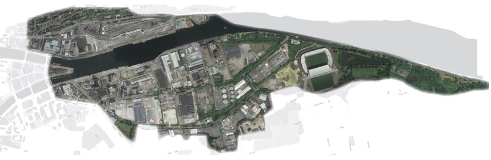
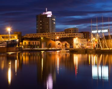
2. City Docks
Figure 10.2 City Docks and Marina Park
Introduction
10.23
Cork’s 147 hectare City Docks is the largest regeneration project in Ireland and will bring significant investment to Cork between now and its build out The regeneration of the City Docks is central to the ambition for Cork set out in the National Planning Framework and will provide significant strategic value and local benefits. The ambition for the City Docks is to be an exemplar development for regeneration and design quality in Europe.
Vision and Role of City Docks
10.24
The City Docks will be:
• A new sustainable neighbourhood in the centre of Cork City that benefits from excellent placemaking, with people-centred streets and spaces;
• A great place to live and work: an extension to Cork City Centre and a key destination for the economic, cultural, educational, commercial, civic and social vibrancy of the City;
• A green lung for the City that optimises the use of the River Lee, green and blue infrastructure and nature-based solutions.
10.25
The City Docks has the capacity to accommodate c.10,000 homes and a residential population of between 22,500 and 25,000 people. It also has the capacity to accommodate c.400,000 sqm of non-residential space and 20,000-25,000 jobs with potentially 3,000 students in further and higher education institutions. The City Docks therefore has the capacity to accommodate approximately 20% of the population growth target for Cork City to 2040. The role of the City Docks therefore reflects its vision: a strategically significant new sustainable residential neighbourhood, an extension to the City Centre with a strong economic role and a sustainable green lung for Cork.
10.26
The development of the City Docks will be grounded in the values established by the NPF’s National Strategic Outcomes and the UN Sustainable Development Goals. More specifically the City Docks core values will be:
• Authenticity, equality and inclusivity;
• Liveability;
• Design-led placemaking;
• Environmental responsibility;
• Active travel;
• Fun, with programmed animation and ‘meanwhile’ uses.

10.27
This Plan provides a strategic policy that will form the basis for the development of the City Docks. Cork City Council will seek to prepare urban design masterplans for the City Docks to update the urban design strategy for the development of the area. Following completion of the masterplans, Cork City Council may seek to prepare Character Area Guidance to guide the development of individual sites or areas in the City Docks. Cork City Council will also seek to update the Docklands Public Realm Strategy Policy Documents during the lifetime of this Plan. The masterplans will be prepared with key stakeholders including Irish Rail / CIE.

10.28
It is an ambition of Cork City Council that the development of the City Docks is an exemplar development. The City Docks will be developed as a neighbourhood for people. The City Docks will have a strong sense of place built around a range of factors:
• Exemplar ambition (see Objective 10.18);
• A place for people (see Objective 10.19);
• The River Lee (see Objective 10.20);
• Character areas (see Objective 10.21);
• Building on its uniqueness (see Objective 10.22);
• Integration into its surroundings (see Objective 10.23);
• Climate resilience (see Objective 10.24);
• High quality amenities including Marina Park (see Objective 10.25);
• A high quality public realm and key streets (see Public Realm section, below, and Objective 10.32):
A Place for People
10.29
A key component of the development of the City Docks will be an over-riding ambition that it is developed as a place for people (see Objective 10.19). This will influence:
• A land use strategy that seeks to ensure that there will be a strong presence of people and activity around-the-clock, combining residential, community and destination uses;
• The active promotion of meanwhile uses to encourage people to come to the City Docks and make it part of their city experience, giving the City Docks an economic and people profile that can be responded to in future developments;
• The design of all streets and spaces so that they optimise placemaking value and provide the arena for people to enjoy the opportunities presented by spaces, for meeting and also to carry out functional trips;
• The public realm will be designed to ensure that all age groups are given equal consideration and universal design and security principles are applied;
• All streets will be designed to give highest priority to pedestrians and cyclists, with many streets being Pedestrian and Cycle Streets.
10.30
The River Lee is the key physical asset of the City Docks, the river corridor itself being a manmade structure and product of civic design from the eighteenth and nineteenth centuries. The river corridor is therefore a built heritage asset, will also be a key focal point for people to gather and enjoy, and is also a biodiversity asset.
10.31
The River Lee space will need to integrate the following into its public realm:
• Strategic walkways / cycleways (“greenways”);
• Quayside Amenity Areas (including passive and active recreation, seating, focal points, etc.);
• Bridges and their approaches / abutments;
• Flood defences that are integrated into the public realm, and embraces both the heritage of the area and the amenity of the river;
• Access to the river to enable a significant expansion in water-based recreational activity, reflecting Cork’s cultural heritage;
• Built heritage assets to maintain the identity of the wharfs / docklands.
10.32
The River Lee will be framed by development on its north and south sides. On Kennedy Quay the quayside amenity area will be maintained at a depth of c.30m, allowing the building line of the development sites fronting onto the quay to be brought forward by a variable width, and subject to retention of built heritage assets. The building line on Horgan’s Quay will frame the space that is now Horgan’s Quay to ensure that the Quayside Amenity Area is deep enough to provide a range of needs according to the public realm strategy. A new Quayside Amenity Area will be provided as part of the development to the east of Water Street.
10.33
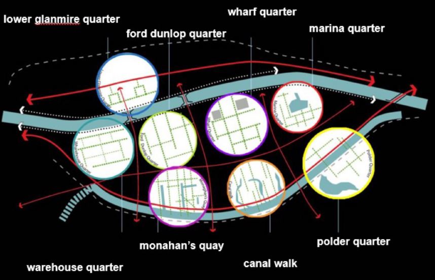
The City Docks is comprised of character areas that were generated through the Docks Public Realm Strategy 2012. These character areas present the opportunity to provide a coherent urban structure for City Docks, with each area having its own identity and urban design qualities. Figures 10.3a illustrates' the eight-character areas. Each area will each have its own coherent character, informed by their land use, density, building height, housing mix, public realm and a range of other factors. The character areas are capable of being implemented in phases that would allow infrastructure to be phased to meet the needs of each area.
Figure 10.3a City Docks Character Area Concept.

Figure 10.3b City Docks Character Area Boundaries (Click on Map for High Resolution Image)
10.34
The City Docks contains a wide range of built heritage assets that tell the story of the area, including:
• The quay walls;
• Port related buildings, including those at Custom House Quay and the Odlums building;
• Railway buildings;
• Industrial buildings, including the Ford Factory developed from 1917, and its internationally significant collection of buildings; and
• Buildings that relate to the development of the Lower Glanmire Road.
10.35
There are many built heritage assets within the City Docks. Most of the structures considered to be of significance are former industrial architecture, railway and port related in origin, with some residential and commercial buildings. This gives the City Docks a special significance to Cork as it reflects the origin and role of the City and the development of the city eastwards from the historic centre. These assets are listed in Volume 3 of this Plan and most are included on the National Inventory of Architectural Heritage.
10.36
The Odlums Mill and warehouse complex is on the RPS (PS856) and NIAH (20506406). The complex of buildings front onto Kennedy Quay / Mill Road / Marina Walk, and are a visual landmark in the docks area, being visible from many parts of the city. The buildings are architecturally distinctive and remain largely intact. Objective 10.22 sets out the City Council’s objectives for its development.
10.37
The Ford Factory complex is a designated Architectural Conservation Area (see Volume 3: Specific Built Heritage Objectives).
10.38
The design of the quayside will need to appropriately frame those built heritage assets that front onto the sequence of key spaces on the River Lee, including the Ford Factory and Odlums buildings.

10.39
The City Docks will be integrated into its surroundings in terms of its pedestrian and cycle connections to create a permeable and seamless environment.

10.40
Climate resilience is addressed in Chapter 5 Climate and Environment. The City Docks will be developed to be a climate resilient neighbourhood by incorporating Use, where appropriate, sustainable urban drainage systems (SUDS) and through and achieving an ambitious mode split that prioritises walking, cycling and public transport over other modes. These will have a significant benefit for climate resilience and in terms of placemaking by designing streets that are not dominated by vehicular space and on-street parking.

10.41
Marina Park will be a new City Park to serve the City Docks, the City Centre, and the South-East Suburbs. Ultimately, it will also be accessible to the North-East of the City via the Eastern Gateway Bridge. Marina Park will provide for passive recreational needs primarily, as well as accommodating:
• Flood storage capacity;
• Páirc Ui Chaoimh / Centre for Excellence;
• An LRT corridor;
• River-based recreational activity;
• Biodiversity areas;
• The Eastern Gateway Bridge; and
• Ancillary car parking
10.42
The Marina Park is being delivered according to the Marina Park Masterplan 2013 (subject to amendment).

10.43
The South Docks Local Area Plan 2008 established principles for the development of a network of streets and spaces, which was expanded upon by the Docklands Public Realm Strategy (see section, below).
10.44
The revised street network (see ABTA) limiting vehicular access, requirements for sustainable urban drainage systems (see South Docks Drainage Strategy, below), extensive street tree planting, and a range of other generators, will mean that the standard street typologies will need to be updated during the life of the Plan. In the interim period the Docklands Public Realm Strategy Street Design Guide will be applied.

10.45
The City Docks land use strategy reflects the City Docks Vision to develop an extension of the City Centre, a new sustainable residential neighbourhood and to create a green lung for the City. Table 10.1 sets out the land use zoning objectives and key development components proposed.
Land Use Zoning Objectives |
Character Area |
|
|
City Centre extension |
ZO 6 City Centre |
Lower Glanmire Custom House Quay Warehouse Quarter (west) |
|
New Residential |
ZO 2 New Residential neighbourhoods Housing, employment, neighbourhood services, community hub, education, health services, cultural activities, sports and recreation, amenity and open space. |
• Lower Glanmire • Wharf Quarter • Marina Walk • Monahan’s Quay • Canal Walk • Polder Quarter |
| ZO 8 District Centres |
• Ford Dunlop Quarter / Canal Walk |
|
| ZO 9 Neighbourhood and Local Centres |
• Ford Dunlop Quarter • Polder Quarter / Marina Walk |
|
| ZO 13 Education |
• Monahan’s Quay (Primary) • Canal Walk (Primary) • Marina Walk (Post-Primary) |
|
| A Green Lung | ZO 16 Public Open Space |
• Marina Park • Kennedy Spine N+S / Kennedy Park • Monahan’s Road • The Marina • Centre Park Road • School Square |
| ZO 17 Sports Grounds and Facilities |
• Monahan’s Quay • Canal Walk • Polder Quarter • Marina Park (New) |
|
| ZO 19 Quayside Amenity Area |
Horgan’s Quay / Water Quay Custom House Quay Kennedy Quay |
Table 10.1: City Docks Land Use Strategy.

10.46
Land use zoning objectives are set out in Chapter 12 Land Use Zoning Objectives. For those areas zoned ZO 5 Mixed Use Development the target mix of uses are set out in Character Areas, below.
10.47
The following are specific land use objectives that pertaining to the City Docks.
• Western Neighbourhood / Local Centre: This urban centre is not zoned but its centrepoint should closely correlate to the LRT route / stop. Whilst CMATS 2040 and the City Docks ABTA 2020 have assumed a tram route this will need to be confirmed by the TII LRT Alignment Study due for publication in 2022. Three route options are currently being considered. The Neighbourhood / Local Centre should comply with ZO 9 Neighbourhood and Local Centres and provide a focal point for commercial / community services for this western City Docks area with the proposed tram stop at its heart. An indicative location is provided in Map 2: Development Objectives.
• Live Uses at Ground Floor Level – Live ground floor frontage will be considered appropriate within the Mixed-Use Zone area and the zoned District Centre and neighbourhood centres. Live ground uses can bring positive benefits to key locations, such as:
– Horgan’s Road;
– Centre Park Road
– Monahan’s Road;
– The Water Street Link Street;
– Key corners; and
– Frontage onto key spaces.
10.48
Outside of these areas live ground floor uses will not be permissible, in order to promote a high quality of residential amenity on all other street frontages and front doors to homes onto the street.
10.49
Live ground floor uses within the New Residential Neighbourhood areas could be provided in the form of: local commercial and community services; retail showrooms, live-work units (with workspace at ground floor level); workspaces (light industrial activities, such as commercial studios for artists / makers), or small retail offices.
10.50
Retail warehousing: will be open for consideration, only where it can be demonstrated in a retail impact assessment that there is sufficient retail warehouse capacity and that such uses will not have a detrimental impact on the city centre or other retail centres, as a live ground floor use at the edge of the District Centre in the ZO 5 Mixed Use Development zone, in accordance with the provisions of the ZO 12 Retail Warehousing zoning.
10.51
Catalyst Uses: The City Council is seeking to develop a range of catalyst developments to bring life and interest to the City Docks. These will be most appropriate in the area benefitting from the Mixed Use LUZO but will be open for consideration in the New Residential Neighbourhood areas where the City Council considers the strategic significance of the proposal has been demonstrated and reasonable levels of residential amenity can be maintained.
10.52
Existing light industrial (and related) uses: Cork City Council will work with its partners to find solutions to the relocating of existing low intensity light industrial (and related) uses currently located within the City Docks. The City Council is proposing that new light industrial estates would be developed in locations around the City (see Chapter 7: Enterprise and Employment) to accommodate businesses that would seek to relocate from the City Docks. Within the City Docks small-scale light industrial uses (e.g. workshops) will be compatible with other uses where they occupy ground floor space within mixed-use buildings on non-residential street frontages.
| 2022-2028 | Up to 2040 | |
| Homes Target | c. 3,000 | 10,000 |
|
Forecast Average Household Size |
2.3 1 | 2.3 |
|
Students Forming Part of the Total Residents |
Max 10% of Population Purpose-Built Student Accommodation Bed Spaces. | Max 10% of population Purpose-Built Student Accommodation Bed Spaces. |
Table 10.2: City Docks Housing Targets.

10.53
Housing must be provided in accordance with Chapter 3 Delivering Homes and Communities. The strategic targets for the City Docks are set out below in Table 10.2, above.

10.54
Cork City Council’s ambition for the City Docks is that it should be developed as a new City Centre neighbourhood that it is attractive to live in for a broad spectrum of household sizes and dwelling type choices Cork City Council will aim to ensure that residential frontage at ground floor level is comprised of own-door family units, as far as possible. This will ensure that frontage is fine grain and benefits from frequent front doors, as well as ensuring that family homes are on lower floor levels accessible to communal and public open space for children. A range of block, building and dwelling typologies are possible to achieve this configuration.
10.55
The Dwelling Size Mix for the City Docks is set out in Chapter 11 Placemaking and Managing Development.
10.56
In order to ensure that the City Docks is developed as a balanced neighbourhood a maximum of ten percent of the population shall be students, and therefore purpose-built student bed spaces / studios shall comprise a maximum of 10% of homes developed.

10.57
Cork City Council aims to ensure that the City Docks is developed as a balanced and sustainable residential neighbourhood that is inclusive, in accordance with national policy and best practice.

10.58
Community Infrastructure will be provided in accordance with the objectives set out in Chapter 3 Delivering Housing and Communities.

10.59
There are three zoned Education sites with the aim of meeting the primary and postprimary educational need of the City Docks. Additional educational development, such as higher educational institutes, is most likely to be accommodated within the land designated for Mixed Use development.
10.60
Two primary school sites are likely to accommodate between 2-4 primary schools and one post-primary school is likely to accommodate between 1 and 2 post-primary schools. Sports pitch needs will be met off-site within lands zoned for Sports Grounds, which are located adjacent / proximate to the proposed school campuses. These will be public facilities benefitting from optimised use and are could be all weather pitches.
10.61
Some school buildings and facilities (e.g. indoor sports halls) will be encouraged to be made available for public usage and located accordingly in the school campuses. It is Cork City Council’s preference to see the development of a Community Hub within or adjacent to one of the school campuses in order to maximise the value for money for public investment.
10.62
Cork City Council will work collaboratively with the Department of Education and Skills to enable the delivery of schools in a timely fashion to meet the needs of the catchment.

10.63
Community Hubs are multi-purpose facilities that present a community focal point and provide value for money for the public purse. They combine a range of specific community uses with space that is available for rent and can be used for a variety of purposes. Further details can be found in Chapter 3 Delivering Homes and Communities. Within City Docks it is envisaged that a Community Hub will be developed to meet the needs of the new neighbourhood. Cork City Council will seek to prepare a Community Hub Feasibility Study during the lifetime of the Plan. The Hub will likely combine a library, community centre, indoor sports facilities, primary care and youth facilities. It is possible that the hub could co-locate and have synergies with a school campus, neighbourhood centre or potentially a swimming pool or other community infrastructure.

10.64
The City Docks Neighbourhood aims to meet the needs of the community as far as possible. This includes meeting the active recreational needs of the neighbourhood for residents and workers, and also any strategic sporting requirements suited to the City Docks location. There are already nationalstandard sports facilities in City Docks in Páirc Ui Chaoimh and the Centre of Excellence.
10.65
Within the City Docks Cork City Council will support the provision of sports pitches at four locations:
• Kennedy Spine (south);
• Monahan’s Park (south of the western primary school);
• Ardfoyle Convent Lower Grounds; and
• Marquee Road / Centre Park Road / Monahan’s Park
10.66
Cork City Council aims to provide and manage these facilities to meet the needs of the area and to ensure optimisation of use. Other full size sports grounds will be accessible to the City Docks by public transport, walking and cycling.
10.67
Within the City Docks individual developments will provide communal active recreational infrastructure facilities in the form of multi use games areas (MUGAs), outdoor gyms, indoor gyms, and other facilities in accordance with Chapter 11 Placemaking and Managing Development. Cork City Council will integrate similarly small-scale public facilities into the public realm in accordance with the public realm strategy, which envisages that a range of facilities will potentially be provided, including MUGAs, skate parks, outdoor water play areas for children, play areas, a floating swimming pool, and more. The provision of an indoor pool will be subject to a feasibility study.
10.68
The River Lee provides the focus for river-based activity in the City. The Marina accommodates a number of existing rowing clubs, with potential for the development of additional boating facilities including clubhouses and slipways. The north side of the river also has the potential to provide river access at the Castleview Terrace slipway on Lower Glanmire Road. The north side of the river also has the potential to provide river access at the Castleview Terrace slipway on Lower Glanmire Road.
Density, Development
Capacity, Building
Height and Tall
Buildings
10.69
This section provides an overview of the development capacity of the City Docks based upon an assessment of the net developable area (allowing for deductions of schools, sports grounds, open spaces, quayside amenity areas and strategic street corridors).
10.70
Table 10.3 sets out the development capacity of the City Docks which is estimated to be c. 1,100,000 square metres (sqm), of which c. 768,000 sqm are residential and 322,000 sqm of non-residential floorspace, equating to 400,000sqm when combined with current planning commitments.
| Character Area | Indicative Floorspace Capacity | Indicative plot ratio - Floor Area Ratio (FAR) | Residential Floorspace % | Non-Residential Floorspace % |
Lower Glanmire Quarter |
50,000 | 2 | 90 | 10 |
Warehouse Quarter |
75,000 | 2.25 | 30 | 70 |
Ford-Dunlop Quarter |
210,000 | 2.25 | 30 | 70 |
Wharf Quarter |
175,000 | 2.25 | 85 | 15 |
Marina Walk |
90,000 | 2.5 | 90 | 10 |
Monahan’s Quay |
165,000 | 2 | 90 | 10 |
Canal Walk |
160,000 | 2 | 80 | 20 |
Polder Quarter |
160,000 | 2.25 | 95 | 5 |
City Docks |
1,085,000 | 2.25 | 65 | 35 |
Table 10.3: City Docks Development Capacity to 2040
10.71
This yields a total of c. 10,000 dwellings when combined with current planning commitments.
10.72
Cork City Council and the proposed Docklands Delivery Office will support the development of the City Docks and will monitor the output of developments to update targets accordingly.
10.73
The density strategy for the City Docks seeks to ensure that development in City Docks is to an average of 225 dwellings per hectare (dph), with a density range that increases in intensity from south-to-north across the South Docks. Table 10.4 below sets out the density and building height strategy. These densities and heights are targets, and there may be justification to deviate from these targets where it can be demonstrated that it is in the interests of good placemaking and design principles.
10.74
The strategy is based upon the recommendations from the Cork City Urban Density, Building Height and Tall Buildings Study 2021. Chapter 3: Delivering Homes and Sustainable Communities sets out the density strategy for the whole city.
| Character Area | Target Residential Density | Building Height (Residential Storey Equivalents) | |
| Dwellings Per Hectare2 | General | General Range | |
Lower Glanmire Quarter |
200 | 6 | 4-8 |
| North of Centre Park Road / Waterfront | |||
Warehouse Quarter |
n/a | 7 | 6-10 |
Ford-Dunlop Quarter |
n/a | 7 | 6-10 |
Wharf Quarter |
250 | 7 | 6-10 |
Marina Walk |
250 | 7 | 6-10 |
Polder Quarter (east) |
250 | 7 | 6-10 |
| South of Centre Park Road / West of Marquee Road | |||
Monahan’s Quay |
200 | 6 | 5-8 |
Canal Walk (north) |
200 | 6 | 5-8 |
South of Monahan’s Road |
|||
Monahan’s Quay (south) |
150 | 5 | 4-7 |
Canal Walk (south) |
150 | 5 | 4-7 |
Polder Quarter (south) |
150 | 5 | 4-7 |
| City Docks | 225 | 7 | 5-10 |
Table 10.4: City Docks Residential Density and Buildings Height
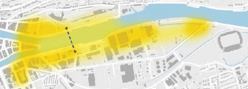
Figure 10.4: City Docks Zones Appropriate for Tall Buildings

10.75
The City Docks has been identified in the Cork City Urban Density, Building Height and Tall Building Study as an appropriate location for tall buildings because it is suited to higher urban density and building height, and has limited sensitivity to height at a strategic level. Figure 10.4 illustrates the area considered suitable for tall buildings (refer to Chapter 11 Placemaking and Managing Development).
City Docks
Area-Based Transport
Assessment (ABTA)
10.76
The City Docks Area-Based Transport Assessment (ABTA) (2020) was prepared by Cork City Council as a development plan input study. The City Docks ABTA is a Final Draft document and presents the key transport findings and recommendations of the Area-Based Transport Assessment process and should be read in conjunction with the supporting reports produced at key stages. The Draft ABTA is firmly rooted in the National Planning Framework, the RSES and best practice in docklands regeneration.
10.77
The Draft ABTA’s innovative and ambitious approach will enable a step change in how people move around the City Docks and wider Metropolitan Cork Region. The approach prioritises walking, cycling and public transport as the instinctive modes of choice, and disincentivises the use of the private car for short trips. In line with international best practice, transport orientated development underpins the City Docks’ regeneration, facilitating the creation of liveable and connected neighbourhoods.
10.78
High-quality place-making allied to sustained investment in strategic public transport, will underpin the vision of the City Docks as a vibrant, mixed-use and attractive waterfront urban area to live, work, play and invest in.
10.79
The key components of the City Docks Draft ABTA are:
• Mode Split targets
• City Docks Transport Network
• Clear Street Hierarchy
• High quality walking and cycling Networks
• Transit-Orientated Development
• City Docks Bridges
• Demand Management

10.80
The City Docks mode split is ambitious and reflects the vision for the City Docks as a City Centre neighbourhood, with a 75% mode share for walking, cycling and public transport. The breakdown of the AM Peak Mode Share is set out below in the infographic located at the bottom of this page.
10.81
Achieving this mode split will require the full suite of Draft ABTA components to be delivered, including extensive pedestrian / cycle priority, the LRT, limiting car parking and confining vehicular access to specific streets.
AM Peak Mode Share

![]()
10.82
The development of the City Docks transport network was undertaken to align with future land use for the City Docks and the wider Cork Metropolitan Area to ensure close integration of land use and transport proposals.
• The vision is for walking and cycling to be the primary modes of choice within the City Docks. Pedestrian and Cycle Streets will provide strategic north-south movements through the City Docks and act as a network of quietways for pedestrians and cyclists. The Greenway Routes along the North and South quays will facilitate strategic east-west movements.
• BusConnects Cork will provide a significant step-change in public transport connectivity with destinations across the Cork Metropolitan Area. Transport Orientated Development will play a critical role in enabling low-carbon development, by creating walkable neighbourhoods focused around public transport stops and stations.
• A new Light Rail Transit (LRT) corridor will bisect the South Docks through Centre Park Road and includes five new stations that cover the catchment area of the entire City Docks. The highest intensity of land uses will be around the LRT stations.
• Three new City Docks Bridges will provide multimodal connectivity between the North and South Docks, and Tivoli Docks.
• Kent Station will be the epicentre of activity in the North Docks and will play a significantly increased role as a multi-modal interchange hub with the LRT corridor, the enhanced Cork Suburban Rail Network, InterCity services and BusConnects services.
10.83
The City Docks Transport Network will comprisea combination of:
• Kent Station interchange and the suburban rail;
• Light Rail Line;
• Arterial Streets
• Bus lanes / bus priority;
• Link Streets;
• Local Streets with filtered permeability;
• Transition Zones (see DMURS) from faster design speeds to lower design speeds within the City Docks;
• Pedestrian and Cycle Streets; and
• Cycle / Pedestrian Greenway on the quays.
10.84
The Draft Cork City Docks ABTA includes an Indicative Transport Network that sets out the ambition for the City Docks. This will be applied to the Masterplans (see Objective 10.17: Masterplans) to be prepared to confirm precise street locations and street role within the intent of the overall vision and framework for the transport network.
Figure 10.5: City Docks Zones Appropriate for Tall Buildings
![]()
10.85
The City Docks street network is based upon a clear street hierarchy consistent with the Design Manual for Urban Roads and Streets (DMURS). It has been configured to prioritise pedestrian, cyclist and public transport users for internal movements and to facilitate external connectivity by all transport modes. Arterial and Link routes are multi-modal facilitating movement by a range of road users. The design of Local streets and Filtered Permeability techniques will reinforce pedestrian and cyclist priority and place-making with design speeds set at 30kph (or lower) in line with best DMURS practice. High-quality public realm elements such as traffic calming, lighting and seating, are also required to emphasise the liveability of the City Docks. This will be further supported using Sustainable Drainage Systems (SuDS) and soft landscaping features including trees, swales and rain gardens to adapt the street network for climate change.
10.86
The vision is for walking and cycling to be the modes of choice within the City Docks. Walking and cycling are embedded into the City Docks Transport Plan from the outset, based on the street user hierarchy principles set out in the Design Manual for Urban Roads and Streets (DMURS). A comprehensive network of walking and cycling routes and Quietways will be supported by highquality public realm and the concept of Healthy Streets™. Strategic Greenways utilising the quaysides will be frontloaded to embed active travel and recreational benefits from the outset, including the closing of The Marina to through-traffic.
10.87
The regeneration of the City Docks is envisaged as a transit-oriented development. Public transport provision and capacity underpins the development of the City Docks in a coherent and logical manner that is consistent with CMATS. The early implementation of high frequency bus services is a critical enabler for the City Docks. Cork City Council will work with the NTA to promote the provision of routes and services to meet transport need.
10.88
The following are the integral building blocks of the City Docks public transport network:
• A dedicated LRT corridor running east-west through Centre Park Road and connecting to the City Centre (see Chapter 4 Transport and Mobility).
• An enhanced role for Kent Station as interchange between LRT, rail and BusConnects Cork.
• Enhanced Cork Suburban Rail services.
• The Draft Cork City Docks ABTA builds upon the CMATS bus network to serve the City Docks. The bus network to be delivered will be defined by the NTA through the Bus Connects Cork Study. The City Docks ABTA proposes continuous various bus priority corridors:
o N8 to Albert Quay via the Eastern Gateway Bridge and the Monahan Road / Victoria Road;
oLower Glanmire Road serving Kent Station.
o An inbound bus lane along the re-aligned Horgan’s Road.
• A (longer-term) bus gate at the section of Monahan’s Road near the junction with Maryville.
• Greater levels of permeability to the surrounding area.
10.89
The Draft Cork City Docks ABTA Indicative Transport Network diagram identifies the transport role of the proposed streets in the City Docks, with Centre Park Road identified as the preferred LRT route through the City Docks. The Cork LRT Alignment Feasibility Study, which will determine the route of the tram, is currently being prepared by Transport Infrastructure Ireland (TII). It is anticipated that this study will be completed in 2022.

10.90
The Draft City Docks ABTA proposes three new bridges that will provide multi-modal connectivity between the City Docks and Tivoli Docks and wider connectivity to Metropolitan Cork. The nature of the public transport role of the bridges is subject to NTA confirmation through the LRT Alignment / Bus Connects Cork Studies:
• Kent Station Bridge: A new bridge to connect Kent Station to the South Docks for walking, cycling and public transport.
• Eastern Gateway Bridge: Multi-modal bridge catering for bus, cycle, pedestrian and general traffic movements; and
• Water Street Bridge: Pedestrian and cycle only.

10.91
Car parking standards based upon the Draft ABTA Car Parking Zones will be applied to the City Docks area, taking into account factors such as finite street capacity, development capacity of the area and mode split targets. Car Parking Standards are set out below in Table 10.5. Cork City Council will seek to engage with applicants for major development proposals to identify solutions for car parking provision where the public transport infrastructure and services envisaged for Docklands has not yet been provided, subject to the overall long-term achievement of the maximum capacity targets set out in the Draft ABTA.
10.92
Smart demand management measures are required to achieve and surpass sustainable mode share targets over-and-above that of public transport provision alone. Investment in strategic sustainable transport measures will be complemented by innovation in parking management in line with international best practice, including Mobility Hubs, Park and Rides, Resident Parking Zones, disabled parking and EV charge point provision.
10.93
Car-free and low-car developments will be supported in tandem with Mobility as a Service (MaaS) systems such as low emission car clubs, bike sharing systems and cargo bikes to provide residents, employees and visitors to the City Docks with alternatives to private car ownership and usage.
10.94
Development proposals should consider the potential for other demand management measures, including Construction Logistics Centres serving multiple development sites in the City Docks as a whole, in collaboration with other developers. Construction Logistics Management Plans should be submitted with proposals for development considering this issue.
10.95
Mobility Hubs are planned to be part of the residential parking offer for the City Docks for residential development. Each facility is envisaged to accommodate around 300 car parking spaces and combine car parking with car-share and multimodal facilities to accommodate users of other modes of transport, such as cycling and public transport. Mobility Hub parking spaces will be deducted from the available maximum parking provision for each Draft ABTA Car Parking Zone and will therefore reduce the amount available for individual developments. Cork City Council will seek to prepare a feasibility study for mobility hubs and multi-modal facilities.
10.96
Offices will be assumed to have an employment density of 1 person per 16 gross sqm.
Figure 10.6: Car Parking Zones and Maximum Parking Provision. (Click on Map for High Resolution Image)
| Parking Zones | Destination Parking | Residential Parking (Spaces Per Unit) | |
| 1 Space Per | 1 Bed | 2/2+ Bed | |
| North Docks | 20 Employees (5% provision) | 0-0.15 | 0-0.3 |
| South Docks City Transition | 20 Employees (5% provision) | 0-0.15 | 0-0.3 |
| South Docks Central | 7 employees (14.3% provision) | 0-0.2 | 0-0.4 |
| South Docks East | 6 employees (16.66% parking) | 0-0.25 | 0-0.5 |
Table 10.5: Maximum Car Parking Standards
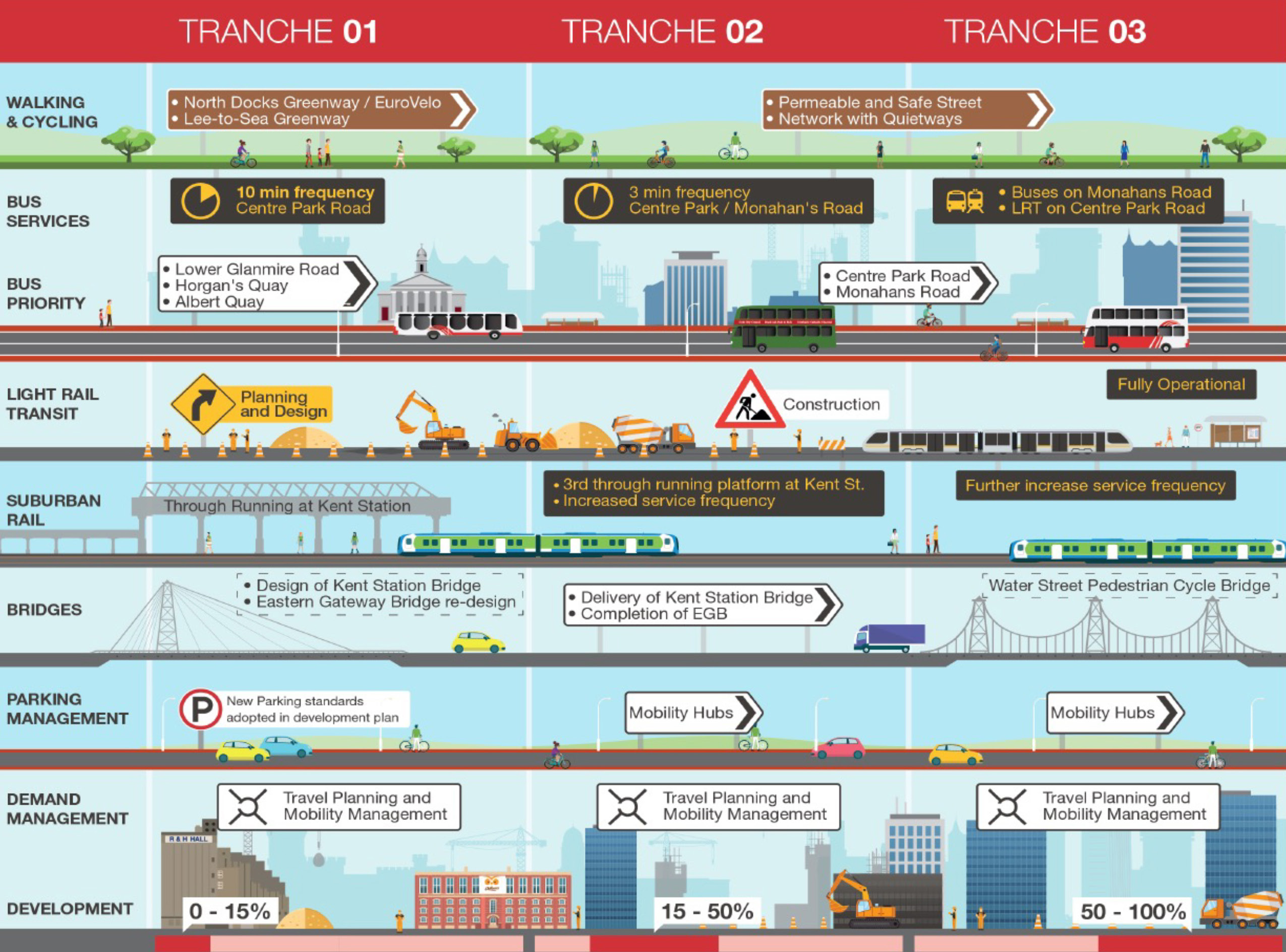
Figure 10.7 Phasing of Mobility and Transport (Click on Map for High Resolution Image)
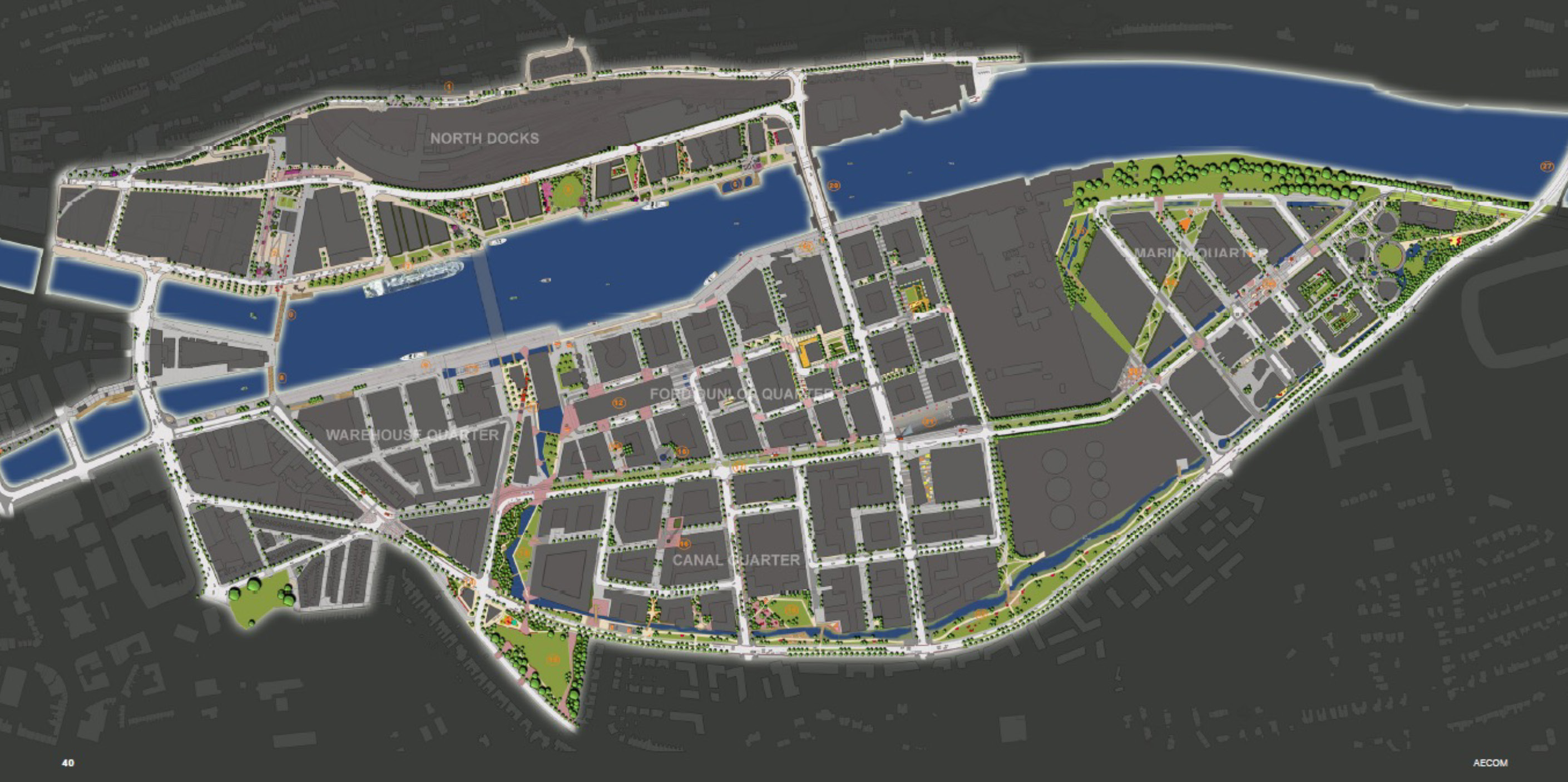
Figure 10.8: Phasing of Mobility and Transport (Click on Map for High Resolution Image)
Public Realm /Public
Open Space
10.97
Cork City Council will seek that the City Docks will have exemplar public realm and public open spaces befitting of a City Centre extension and new sustainable neighbourhood. The City Docks will include strategically important open spaces and public realm to provide for the passive and active recreational needs of the neighbourhood and to provide focal points for social interaction and pedestrian and cycle routes:
• Marina Park – The Marina Park Masterplan 2014 is being delivered in three phases by Cork City Council.
• Quayside Amenity Areas on Horgan’s Quay (including extension),, Custom House Quay, Albert Quay and Kennedy Quay.
• Kennedy Spine – A linear park extending from Kennedy Park to Kennedy Quay and also on Horgan’s Quay to the north of the River Lee.
• Monahan’s Road Park – A linear park that combines swales with open space and landscape to create an attractive park place for predominantly passive recreation.
• Centre Park is a new linear amenity park at the heart of the City Docks that will provide for the passive amenity needs of the high density sustainable residential neighbourhood, as well as including a tree-lined linear swale, a pedestrian / cycle street and the LRT.
• Active Recreational Infrastructure (ARI) – sports grounds to provide facilities to meet the active recreational needs of the City Docks within the neighbourhood and close to homes, schools and places of work will be provided by Cork City Council. These facilities will be complemented by facilities outside of the City Docks but accessible by walking / cycling and public transport, including the possibility of additional ARI in accessible locations, such as Mahon. In addition, within the City Docks ARI needs will be met by indoor facilities, multi-use games areas (MUGAs), specialist sports provision, water-based activity infrastructure, a skate park, and potentially a swimming pool or lido.
10.98
Developments will be required to provide (at least) 15% of their net developable area as public open space. Developments will be required to incorporate small-scale ARI (e.g. MUGAs / sports halls) commensurate to the scale of the proposed development and to meet the needs of the community. Outdoor facilities can be provided within public open spaces, streets, communal courtyards or at rooftop level.
10.99
The strategic public realm, such as Marina Park and the quaysides, will generally be provided over-and-above the 15% Public Open Space requirement to be provided by developments themselves.
10.100
Key spaces to be provided by developers within their site development strategies will include:.
• Kennedy Spine is a new urban amenity park extending from Kennedy Park to the Kent Station lands, the park combines urban zones with green open space, and will provide key views from the South Docks to the Saint Luke’s / Montenotte ridge and Saint Luke’s Church. This will be provided by developers as part of their 15% open space provision.
• Marina Park – River Lee Spine – This north-south green spine will extend from Marina Park and the River Lee waterfront, and is derived from the South Docks Drainage Srategy (see below). The north south green route broadly along the line of Marquee Road and the boundary of the ESB and former Tedcastle sites. This will require urban blocks to be set back to frame a strong urban landscape and tree corridor, and the provision of public open space within site masterplans to respond to this significant public realm opportunity. The space will need to incorporate flood volume storage within the landscape (see para. 10.106 and Objective 10.34).
10.101
Public space (open space, sports grounds, streets or otherwise) will be provided through:
• The direct provision of spaces by developers as part of a 15% provision (including Kennedy Spine North and South, Quayside Amenity Areas, Station Square, Centre Park Square and smaller incidental greenspaces provided within developments), in accordance with the provisions of Chapter 11: Placemaking and Managing Development;
• The development / improvement of public open spaces through the Development Contributions Scheme (including Mahony’s Avenue Park to meet the needs of the Lower Glanmire Quarter);
10.102
Cork City Council completed the Docklands Public Realm Strategy in 2012 which included a public realm masterplan and urban design guidance, and:
• Arts Strategy and Guidelines
• Lighting Strategy and Guidelines
• Paving Strategy and Guidelines
• Street Furniture Strategy and Guidelines
• Planting Strategy and Guidelines
• Waymarking Guidelines
• Detailed Design for each character area and key streets and spaces at 1:200 and 1:100
10.103
The South Docks Drainage Study (2021) provides key changes to the context to the Docks Public Realm Strategy 2012, including:
• A SUDS Drainage system that utilises nature-based (green infrastructure) solutions to mitigate, convey and store storm water, including swales on Centre Park Road and Monahan’s Road and storage within open spaces.
• A new landscape concept to be integrated into the Public Realm Masterplan.
10.104
Cork City Council will update the Docklands Public Realm Strategy to take into account the evolving context during the lifetime of this Plan, including the South Docks Drainage Strategy 2021, the Cork Metropolitan Area Strategy 2040 , LRT Alignment Study 2022, and Design Manual for Urban Roads and Streets 2019.
10.105
Centre Park Road will have a corridor width of 32m (consistent with the South Docks Local Area Plan 2008 corridor and the Docks Public Realm Strategy) and building lines will be required to be set-back to frame this key street. The nature of the corridor will vary along its length responding to the LRT stops, and with Centre Park at its heart.
South Docks Drainage
Strategy 2021
10.106
Cork City Council has prepared a South Docks Drainage Strategy (2021) to inform development in City Docks (hereafter referred to as “the Strategy”).. The objective of the Strategy is to provide a long-term placemaking vision that is flexible, environmentally responsible and climate-resilient, particularly to potential changes in sea level and rainfall intensity. The Strategy is based on a sustainable urban drainage solution approach to provide the drainage network and conveyance and mitigation of water. The aim is to provide water features on Centre Park Road and Monahan’s Road that form an integral part of the urban landscape. Cork City Council is anticipating that the report will be finalised in July 2021 following completion of a final work package relating to Residual Risk Assessment.
10.107
The Strategy provides an integrated landscape and sustainable blue-green drainage concept design, combining a number of key components:
• The Kennedy Spine Park that provide flood storage for c.1500 cubic metres of flood storage integrated into a park that will combine soft and hard landscapes reflecting the vision for this key park;
• An east-west green spine along Centre Park Road (West of Marquee Road), incorporating an open swale that is designed to accommodate 1,000 cubic metres of flood storage;
• An east-west green spine along Monahan Road, incorporating an improved drainage ditch / open swale;
• A north-south green spine between Marina Park and the River Lee Frontage. The north south green route broadly along the line of Marquee Road and the boundary of the ESB and former Tedcastle sites. This will will incorporate an open swale and/or storage areas rather than closed pipe systems to allow for storage at a more elevated level and to provide an amenity aspect.
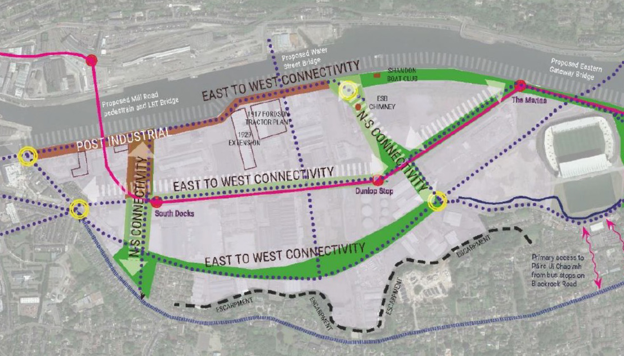
Figure 10.9: South Docks Drainage Strategy Placemaking and Landscape Concept (Click on Map for High Resolution Image)
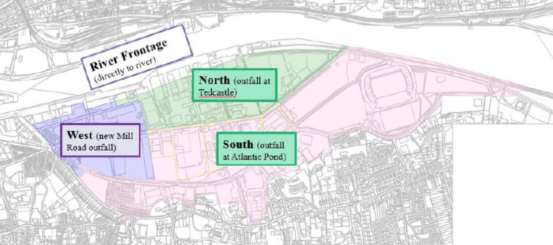
Figure 10.10A: South Docks Drainage Catchments Overview. (Click on Map for High Resolution Image)
10.108
The Strategy provides the following:
• Drainage catchments that reflect the capacity of the network to deal with pluvial flooding (see Figure 10.10A, above);
• A surface water drainage network based upon SuDS / nature-based solutions, with limited conveyance by grey infrastructure (see Figure 10.10A, below);
• A perimeter flood defence from tidal and fluvial (river) flood risks, including a transition from the standard perimeter defence of 4.35m OD at the proposed Kent Station Bridge to the proposed Flood defence levels of 3.6m OD at Albert Quay.
• Minimum ground level and finished floor levels (FFLs) with ground levels as close to existing levels as possible to mitigate against pluvial (cloudburst) flood risk.
• A requirement for surface water flood storage volume of 2,900 cubic metres to ameliorate surface water run-off in extreme flooding events in addition to that provided within the public realm at Kennedy Spine, Centre Park Road, Monahan Road and Marina Park / Atlantic Pond. This flood storage will need to be provided across three locations, and Cork City Council will confirm the distribution of the flood volume between the three sites during 2021 prior to the publication of the Proposed Amendments. Site acquisition is likely to be required for each of the three options:
o The Marina Park – River Lee Spine in the area north of Centre Park Road. This would be integrated into public open space;
o The Marina Park – River Lee Spine west of Marquee Road; and
o The proposed public open space to the south of the Atlantic Pond and north of Ardfoyle Convent, which will form part of the Marina Park.
• The Strategy indicates that there may be a requirement for a surface water pumping station in the future to meet the challenge presented by climate change, with a site of a total c.250sqm being required to accommodate this infrastructure. The Strategy identifies a possible location for this facility on the proposed extension to the Atlantic Pond area to be a public open space / flood volume storage location. The suitability of this and other locations for the pumping station will need to be identified during the life of the Plan.
10.109
A perimeter flood defence will need to be integrated into the design for the North Docks and included in the North Docks Masterplan to be prepared. This will be based on the principle of using SUDS, public realm, embracing the river and developing amenity as part of the drainage and flood defence for the North Docks.

10.110
To minimise storage and future-proof the proposed drainage system, it is necessary to marginally increase ground levels at low points by circa 500mm with localised maximum increases of up to 1m. This ground raising will be required over a small area of the South Docks and will ensure minimum ground levels of between 0.7m and 1m above Ordnance Datum (OD).
10.111
To ensure that proposed buildings are at low risk of surface water flooding, it is proposed to set minimum finished floor levels (FFL) at least 300mm above the predicted 1 in 100 year pluvial flood level, which varies across the docks.
10.112
It is recommended that this minimum level apply only to Water Compatible Development and Less Vulnerable Development as defined by the Flood Risk Planning Guidelines2, and subject to site specific flood risk assessment demonstrating appropriate flood mitigation strategy.
10.113
Highly Vulnerable Development shall be positioned above the 1 in 200 year tidal flood level, including appropriate allowances for climate change, residual risk (breach and overtopping) and freeboard. It is envisaged that minimum FFL along the quayside would be set at or above the proposed polder defence level of +3.8m - +4.35m OD, except for the western transition from Albert Quay where a minimum FFL of +3.8m OD can be accommodated due to constraints imposed by existing streetscapes.
10.114
Proposed Minimum Finished Floor Levels are provided in Figure 10.10b and in the Character Area Guidance, below. The proposed ground levels are set out in Appendix One of the South Docks Drainage Strategy currently being completed.
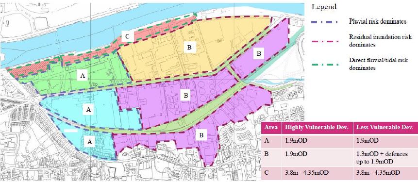
Figure 10.10B: South Docks Minimum Finished Floor Levels
Development Management controls
SuDS and Site run-off
10.115
It is proposed that all private developments will provide on-site storage for surface water, to prevent overwhelming of the capacity of the proposed public system during extreme events and thus share the burden of providing the necessary storage volume. The gradual implementation of this storage will incrementally reduce the pressure on the public drainage system, thus providing flexibility in the relative timing of the delivery of both public and private sector developments and infrastructure.
10.116
It is proposed that there will be a split responsibility for surface water storage between private and public lands by requiring all developments to limit discharges to the public system to an absolute maximum of 68l/s/ha (approximately 50% of design peak brownfield runoff rate for critical storm event) irrespective of tidal phase.
10.117
Development proposals will have to demonstrate site run-off flow rates of 50% of greenfield run-off rate to the public SuDS. Developments will be required to ameliorate the private 50% rainfall on-site utilising sustainable urban drainage system solutions (see Objective 9.4: Sustainable Urban Drainage Systems and para. 11.259).
Basements and structural design strategies
10.118
Based on the findings of the preliminary hydrogeology study completed as part of the Strategy, it will be vital to protect the integrity of the existing aquitard (alluvium) soil layer as part of the proposed redevelopment of the South Docks. The nature of the ground conditions and height of the buildings will require piling, and so the detailing of this in a way which maintains the integrity of the clay layer is vital. Equally, deep excavations for basements should be avoided.
10.119
Development proposals must demonstrate that piling / structural design avoids penetrating the aquitard soil layer in any planning application.
Guidance for the
City Docks Character
Areas
10.120
The City Docks has been divided into character areas to enable the creation of coherent precincts with distinct characters to create strong places and neighbourhoods (see Character Areas, above). The key guidance for each character area is set out below.
10.121
The guidance may be updated by masterplans prepared during the lifetime of the Plan. This guidance is indicative and development proposals must demonstrate high quality placemaking and must comply with other objectives of this Plan. It should be noted that building heights are expressed in residential storey equivalents.
10.122
All finished floor level guidance provided in Tables 10.6 to 10.13 are subject to final levels pending the completion of the South Docks Drainage Strategy.

10.123
The land use targets reflect the intended nature of the City Docks, including a city centre extension and a residential neighbourhood. The targets provide an overview for the Character Area.
10.124
Applicants for development proposals must demonstrate how the proposal contributes towards the achievement of the land use targets for each character area.
10.125
Deviations from the land use targets may be considered on their merits where justified, including where:
1. a proposed development is of strategic significance.
2. a proposed development is a catalyst development of civic significance
3. a proposed development is deemed to be of exceptional design quality.
| Indicative Plot Ratio | Target Dwellings / Ha | General Building Height | Building Height Range | Car Parking Zone |
| 2 | 200 | 6 | 4-7 | North Docks |
| Ground Plane Levels | Finished Floor Level (Min) | Target Land Use Split % | Key Infrastructure | Key Links To Be Provided |
| Existing |
+3.85m Until Flood Defences Provided |
Residential |
New Horgan's Road Horgan's Quay & Flood Barrier Kennedy Spine Park & Mahony's Avenue Park Kent Station Bridge Water Street Bridge |
Water Street to Lower Glanmire Road Horan's Quay Greenway |
| 90 | ||||
| Non-Residential | ||||
| 10 |
Table 10.6: Lower Glanmire Road Quarter
| Indicative Plot Ratio | Dwellings Per Hectare | General Building Height | Building Height Range | Car Parking Zone |
| 2.25 | n/a | 7 | 6-10 | South Docks Transition |
| Ground Plane Levels | Finished Floor Level (Min) | Target Land Use Split % | Key Infrastructure | Key Links To Be Provided |
| Existing |
+3.85m OD until flood defences provided. Please refer to Figure 10.10B for levels following provision (north of flood barrier. |
Residential |
Waterfront flood barrier Albert Quay
Centre Park Road Kent Station Bridge |
Kennedy Quay Greenway Transport Network |
| 30 | ||||
| Non-Residential | ||||
| 70 |
Table 10.7: Warehouse Quarter.
| Indicative Plot Ratio | Dwellings Per Hectare | General Building Height | Building Height Range | Car Parking Zone |
| 2.25 | n/a | 7 | 6-10 | South Docks Transition and Mid |
| Ground Plane Levels | Finished Floor Level (Min) | Target Land Use Split % | Key Infrastructure | Key Links To Be Provided |
| Min +0.7m OD |
+3.85m OD until flood defences provided. Please refer to Figure 10.10B for levels following provision of flood barrier. |
Residential |
Kennedy Quay flood defence barrier Kent Station Bridge Water Street Bridge Catalyst developments at Odlums Buildings & Fordson Building Albert Quay Kennedy Quay Centre Park Road Kennedy Spine |
Kennedy Quay Greenway Water Street Extension Pedestrian / Cycle Street |
| 30 | ||||
| Non-Residential | ||||
| 70 |
Table 10.8: Ford Dunlop Quarter
| Indicative Plot Ratio | Dwellings Per Hectare | General Building Height | Building Height Range | Car Parking Zone |
| 2.25 | 250 | 7 | 6-10 | South Docks: Mid |
| Ground Plane Levels | Finished Floor Level (Min) | Target Land Use Split % | Key Infrastructure | Key Links To Be Provided |
| Min +0.7m OD |
+3.85m OD until flood defences provided.
|
Residential |
Kennedy Quay Centre Park Road - Water Street Link Water Street Bridge |
Kennedy Quay Greenway Water Street Extension Pedestrian / Cycle Street |
| 85 | ||||
| Non-Residential | ||||
| 15 |
Table 10.9: Wharf Quarter
| Indicative Plot Ratio | Dwellings Per Hectare | General Building Height | Building Height Range | Car Parking Zone |
| 2.5 | 250 | 7 | 6-10 | South Docks East |
| Ground Plane Levels | Finished Floor Level (Min) | Target Land Use Split % | Key Infrastructure | Key Links To Be Provided |
| Min +0.7m OD |
+3.85m OD until flood defences provided. Please refer to Figure 10.10B for levels following provision of flood barrier. |
Residential |
Post Primary School Centre Park Road Eastern Gateway Bridge |
Kennedy Quay Greenway |
| 90 | ||||
| Non-Residential | ||||
| 10 |
Table 10.10: Marina Walk
| Indicative Plot Ratio | Dwellings Per Hectare | General Building Height | Building Height Range | Car Parking Zone | ||||
| 1.75 | North | 200 | North | 6 | North | 5-8 | South Docks Mid | |
| South | 150 | South | 5 | South | 4-6 | |||
| Ground Plane Levels | Finished Floor Level (Min) | Target Land Use Split % | Key Infrastructure | Key Links To Be Provided | ||||
| Min +0.7m OD |
+3.85m OD until flood defences provided. Please refer to Figure 10.10B for levels following provision of flood barrier. |
Residential |
Kennedy Spine and sports grounds Sports Grounds Monahan's Park Centre Park Road Primary School Campus and related park / informal sports ground |
Link Street Pedestrian / Cycle Street connections to Blackrock Road |
||||
| 90 | ||||||||
| Non-Residential | ||||||||
| 10 | ||||||||
Table 10.11: Monahan's Quay
| Indicative Plot Ratio | Dwellings Per Hectare | General Building Height | Building Height Range | Car Parking Zone | ||||
| 1.75 | North | 200 | North | 6 | North | 5-8 | South Docks East/Mid | |
| South | 150 | South | 5 | South | 4-7 | |||
| Ground Plane Levels | Finished Floor levels (minimum) | Target Land Use Split % | Key Infrastructure | Key Links To Be Provided | ||||
| Min +0.7m OD |
+3.85m OD until flood defences provided.
Please refer to Figure 10.10B for levels following provision of flood barrier.Highly Vulnerable Uses |
Residential |
Centre Park Road Sports Ground Monahan's Park Primary School Campus |
Link Street Pedestrian / Cycle Street connections to Blackrock Road |
||||
| 80 | ||||||||
| Non-Residential | ||||||||
| 20 | ||||||||
Table 10.12: Canal Walk
| Indicative Plot Ratio | Dwellings Per Hectare | General Building Height | Building Height Range | Car Parking Zone | ||||
| 1.75 | North | 250 | North | 7 | North | 6-10 | South Docks East/Mid | |
| South | 150 | South | 5 | South | 4-7 | |||
| Ground Plane Levels | Finished Floor levels (minimum) | Target Land Use Split % | Key Infrastructure | Key Links To Be Provided | ||||
| Min +0.7m OD |
+3.85m OD until flood defences provided.
Please refer to Figure 10.10B for levels following provision of flood barrier. Highly Vulnerable Uses |
Residential |
Sports Ground Monahan's Road Extension Monahan's Park Eastern Gateway Bridge |
Monahan's Road Extension | ||||
| 95 | ||||||||
| Non-Residential | ||||||||
| 5 | ||||||||
Table 10.13: Polder Quarter.
Infrastructure
Programme and
Delivery Strategy
10.126
Cork City Council has a clear understanding of the infrastructure programme and the infrastructural projects that are necessary to unlock the potential of the City Docks and to create a sustainable neighbourhood. The URDF award in March 2021 confirms the main infrastructure delivery programme. The City Council will seek to deliver those key infrastructure projects set out in Table 10.14 during the lifetime of the Plan. In its site assembly role to enable infrastructure delivery the City Council is committed to utilising CPO powers under relevant legislation (e.g. the PDA 2000, as amended), as required.
| Programme Stream | Project | Project Lead | URDF |
| Masterplans and Studies | North Docks and Kent Station Masterplan (including Public Realm) | CCC Irish Rail | Y |
| South Docks Urban Design and Masterplan (including Public Realm) | CCC | Y | |
| Mobility Hub Feasibility Study | CCC | Y | |
| District Heating Feasibility Study | CCC | Y | |
| Cork Light Rail Transit (LRT) | LRT Route Alignment Study | TII | N |
| Approved Transport Infrastructure | Monahan’s Road Extension | CCC | Y |
| Albert Quay block | CCC | Y | |
| Parks | Marina Park: Phase 1 | CCC | Y |
| Marina Park: Phase 2 | CCC | Y | |
| Marina Park: Phase 3 | CCC | Y | |
| Flood Resilience | Quay walls repair and Perimeter Protection | CCC | Y |
| Strategic Surface Water Drainage and SuDS Network | CCC | Y | |
| New Surface Water Storage Volume in addition to planned parks and SuDS network | CCC | Y | |
| Pumping Station (feasibility study) | CCC | Y | |
| City Docks Bridges | Kent Station Bridge | CCC | Y |
| Eastern Gateway Bridge | CCC | Y | |
| Water Street Bridge (Design and Tender) | CCC | - | |
| Strategic Streets/ Parks | Monahan Road and Park | CCC | Y |
| Centre Park Road and Centre Park | CCC | Y | |
| New Horgan’s Road (to replace Quay) | CCC | Y | |
| Local collector Roads | CCC | Y | |
| Community Infrastructure | Community Hub (library, community hall, youth facilities, sports, and possible medical centre) | CCC | Y |
| Sports pitches | CCC | Y | |
| Sporting infrastructure: Water-based | CCC | Y | |
| Indoor swimming pool / indoor sports | CCC | N | |
| Playgrounds | CCC | Y | |
| MUGAs | CCC | Y | |
| Swimming Pool | CCC | N | |
| Parks | Kennedy Park | CCC | Y |
| Kennedy Spine North | CCC | Y | |
| Mahony's Avenue | CCC | Y | |
| Public Realm | Horgan’s Quay | CCC | Y |
| Kennedy Quay | CCC | Y | |
| Others | CCC | Y | |
| Public Art and Cultural Programme | CCC | Y | |
| Utilities | Common ducting on all new streets and key street upgrades | CCC | N |
| Electricity: Undergrounding of cables to Power Station ESB / CCC N from Montenotte | ESB / CCC | N | |
| Water: To be defined | Irish Water | N | |
| Waste Water: To be defined. | Irish Water | N | |
| Gas: Pressure Conversion Chamber | Bord Gais / Ervia | N |
Table 10.14: City Docks Infrastructure and Delivery Programme
Delivery

10.127
The City Docks will be delivered in the three development tranches set out in Table 10.15.
| Tranche 1 | Tranche 2 | Tranche 3 | ||
|
Development Proportion |
0% - 18% | 19% - 50% | 51% - Build Out | |
| 19%-30% | 31%-50% | |||
| Zoning Tier | Tier 1 | Tier 2 | Tier 3 | Tier 3 |
| Public Transport | Bus Services | High Quality Bus Services | High Quality LRT will need to be operational to enable Bus Services | |
|
Key Infrastructure Bundles |
Riverside Walkway /
Existing infrastructure
|
Enabling infrastructure set out in Infrastructure Strategy, below. |
High Quality LRT will need to be operational to enable Bus Services | |
|
Supporting Community Infrastructure |
Community Infrastructure to meet needs of development |
Primary & Post-Primary Community infrastructure to meet needs of emerging neighbourhood |
Community Infrastructure to meet needs of neighbourhood |
|
Table 10.15: City DocksDevelopment Tranches
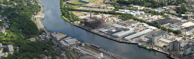
10.128
The actual timing for the completion each tranche will be subject to a wide variety of factors. Cork City Council’s target is to achieve the build-out of the City Docks between 2021 and 2040 but recognises that this may not be achievable.

10.129
Catalyst developments will be essential to make the City Docks a successful urban development project and to develop the identity and socio-culturalcommercial profile of the City Centre Extension and new City Centre Neighbourhood. A Number of catalyst developments have already been completed or are in the process of being delivered, including:
• Parc Ui Chaoimh and Centre for Excellence
• Marina Park;
• Horgan’s Quay mixed use development; and
• Navigation Square office development
10.130
Cork City Council will seek to work with its partners to deliver a range of catalysts to create anchor projects for the City Docks There is great potential to combine or group catalyst uses around focal points / buildings and to create economies of scale. Catalyst developments might include:
• Educational, cultural, tourism, commercial and community developments;
• The waterfront pedestrian / cycleways (greenways);
• Key public realm, active recreation and meanwhile use projects;
• The City Docks bridges; and
• Visitor attractions.

10.131
The City Docks will be developed over a long period. It is important to integrate the Docks into the City by creating attractions and destination uses. It is also important to give vacant sites and buildings appropriate productive uses. International best practice suggests a number of ways to achieve this:
• Programming events to bring life to the City Docks.
• The creation of temporary parks, public spaces and nurseries.
• The development of “meanwhile uses”.
• The development of public art and lighting programmes.
10.132
Cork City Council will explore options and aim to work with its partners to achieve the effective integration of the City Docks into the wider Cork City and the Cork Metropolitan Area, including the productive use of vacant sites and buildings.
10.133
“Meanwhile uses” are a range of temporary uses on land and property awaiting longer-term development. Examples of meanwhile uses could Include: culture and creative uses; community uses; business spaces; retail, hot food, cafes, housing and workshops. Development proposals for meanwhile uses will be assessed against the development objectives and standards set out in Chapter 11 Placemaking and Managing Development.
10.134
The meanwhile use of a site must not result in an unacceptable impact on residential amenity or prevent development sites from being brought forward for development in a timely fashion. Parameters for any meanwhile use, particularly its longevity and associated requirements, should be established from the outset and agreed by all parties.
10.135
The time period for meanwhile uses will vary and temporary permission may be renewed with consideration for site circumstances. Consideration will be given to starting the time period for the temporary permission for the meanwhile use from the date of occupation rather than the date of planning permission, in order to support the viability and delivery of more costly developments (e.g. housing development).
|
|
Objective 10.17 |
|
Objective 10.18 |
|
Masterplanning
Cork City Council will seek to prepare masterplans during the lifetime of this Plan for the following: |
City Docks ExemplarIt is an objective of Cork City Council to promote the development of the City Docks as an exemplar new urban neighbourhood, regeneration project, waterfront development, climate resilient development, green mode split community, lifetime design and design quality. During the lifetime of the Plan Cork City Council will investigate the potential for a design review process to ensure excellence in design and will develop a City Docks Architectural Policy. |
|||
|
|
Objective 10.19 |
|
Objective 10.20 |
|
City Docks ExemplarIt is an objective of Cork City Council to ensure that the City Docks is developed as a place for people by ensuring that placemaking is at the heart of all development proposals and that the needs of people of all ages, abilities and backgrounds are considered in development proposals. |
The River Lee
a. To ensure that the River Lee is maintained as a defining feature of the City Docks. |
|||
|
|
Objective 10.21 |
|
Objective 10.22A |
|
City Docks Character
|
City Docks Built Heritage
It is an objective of Cork City Council to |
|||
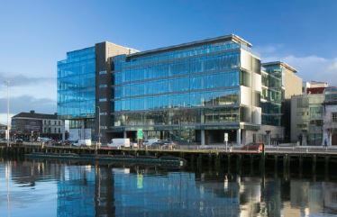
|
||||
|
10.22A |
|||
Development of the Odlums buildings
It is an objective of Cork City Council to • Ensure that key design challenges are resolved in the development of proposals, including the need for a quantum of floorspace that balances development feasibility and built heritage value, flood resilience, flood defences on Kennedy Quay, proposals for a new Kent Station Bridge, the need for an appropriate lighting strategy to ensure that the building provides a visual focal point after dark, creating a strong relationship with Kennedy Quay and a range of other factors; • Conserve and enhance the Odlums Buildings in accordance with the policies set out in Chapter 8: Heritage Culture and Arts and Chapter 11: Placemaking and Managing Development; |
||||
|
|
Objective 10.23 |
|
Objective 10.24 |
|
Integration into its
|
City Docks A Climate
|
|||
|
|
Objective 10.25 |
|
Objective 10.26 |
|
Marina Park• To support the provision of Marina Park. |
Specific Land Use
|
|||
|
|
||||
|
|
Objective 10.27 |
|
Objective 10.28 |
|
Dwelling Size Mix
a. To ensure that the City Docks is developed to accommodate a variety of dwelling sizes to support the development of a balanced neighbourhood. |
Balanced Community
|
|||
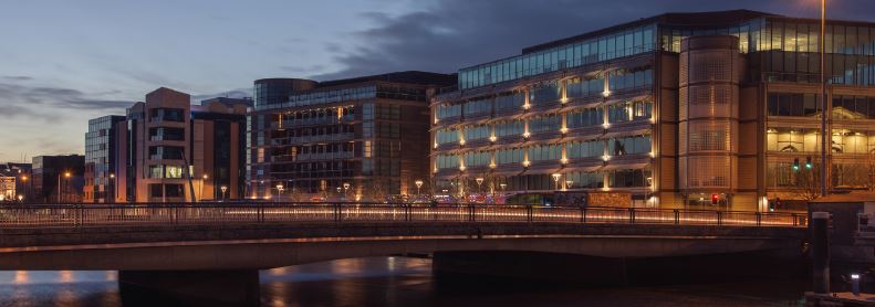
|
||||
|
|
Objective 10.29 |
|
Objective 10.30 |
|
City Docks Community
|
Active Recreational
|
|||
|
|
Objective 10.31 |
|
Objective 10.32 |
|
Draft Cork City Docks
|
Public Realm and
|
|||
|
|
Objective 10.33 |
|
Objective 10.34 |
|
South Docks Drainage
|
Perimeter Flood Defence and Flood StorageTo provide a perimeter flood defence to protect the South Docks from tidal and fluvial flooding building on, where appropriate, SUDS, amenity and heritage while embracing the river. To provide a perimeter flood defence necessary to protect the North Docks from tidal and fluvial flooding and incorporate this into the North Docks Masterplan and Public Realm Strategy. To ensure the provision of appropriate levels of flood volume storage on sites and development to incorporate that provision with compatible uses and urban landscape design in accordance with best practice. |
|||
|
|
Objective 10.35 |
|
Objective 10.36 |
|
City Docks Infrastructure
|
Development PhasingCork City Council will work with its partners to seek to ensure that the enabling infrastructure to unlock the potential of the City Docks in each development tranche is delivered in a timely fashion. |
|||
|
|
Objective 10.37 |
|||
City Docks Programming
|
||||
3. Tivoli Docks
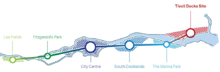
Figure 10.11: Unlocking and Reconnecting Tivoli Docks
Context and Vision

10.136
Tivoli Docks is a nationally significant urban regeneration opportunity. The NPF and RSES recognise that, together with City Docks, its regeneration is inextricably linked to the delivery of compact growth in line with the ambitious population and employment growth targets set out for Cork City up to 2040.
10.137
Tivoli Docks is located on the northern bank of the River Lee, 2.5km to east of the city centre. Measuring 61.5 hectare’s, it has the characteristic of an island bordered by 3km of water frontage to the south and east, the Cork-Cobh rail-line and Lower Glanmire Road (N8) to the north and the Glashaboy River to the east.
10.138
Formed on reclaimed land in the mid 1800’s, extensive dredging carried out up to 1914 further increased the site area. Cork Harbour Commissioners, and more recently the Port of Cork, developed Tivoli into a working port with lift-on lift-off, roll-on roll-off services and bulk delivery and storage facilities. The site is also home to numerous non-port related industrial uses, including car storage and industrial manufacturers.
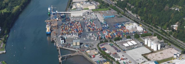
Figure 10.12: Ariel View of Tivoli Docks.


Figure 10.13: Vision for the Regeneration of Tivoli Docks. (Click on Map for High Resolution Image)
10.139
The vision for Tivoli Docks is to deliver an international exemplar of sustainable waterfront regeneration by 2040 through:
1. Resilient design and best practice regeneration to Unlock and Reconnect this nationally strategic industrial island back into the city and harbour.
2. Designing a Piece of the City that reflects the areas unique landscape character, respects Tivoli Ridge and mirrors the Marina’s parkland waterfront.
3. Creating Distinct Neighbourhoods through a network of mixed uses, public spaces and an active waterfront and enabling diverse neighbourhoods rich in community and culture.
4. Transport Orientated Design (TOD) that delivers a high-quality transport system including a central train station, a central bus corridor, waterfront greenway and transport mobility hubs.
5. A 3km Waterfront Destination with continuity of access and mix of public uses providing generous spaces and a variety of setbacks designed for social and recreational interactions on land and water.
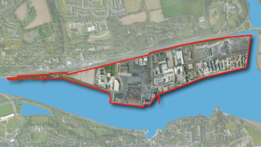
Figure 10.14: Tivoli Docks - Existing Context.
Placemaking

10.140
In 2019 Cork City Council commissioned AECOM and Butler\Cammoranesi to carry out an Urban Design and Landscape Framework Plan (UDLFP) for Tivoli, including surveys and analysis of the areas rich set of assets. Table 10.16 provides a summary of key issues arising from an assessment of the development potential of Tivoli Docks.
10.141
Drawing on international best practice urban regeneration, the plan sets out a hierarchy of places and spaces based on the sites characteristics and the need to deliver compact liveable growth. The work provides the starting point for many of the objectives for Tivoli Docks set out in this Plan, including analysis of the sites capacity to deliver new homes, neighbourhoods, jobs, community and cultural facilities, transport infrastructure, and active/passive spaces.
10.142
Following on from this, Cork City Council has drafted the Tivoli Docks Area Based Transportation Strategy (ABTA), including an integrated transport and movement strategy. Alongside this draft transport strategy, Cork City Council has prepared the Tivoli Docks Urban Density and Building Height Strategy (UDBHS).
10.143
As part of all these processes, 16 Design and Development Principles have been established to guide the current and future regeneration of Tivoli Docks over the short, medium and long term. These principles are set out below, and they continue to act as the bench markers for regeneration in Tivoli Docks.
Strenghts |
Weaknesses |
Opportunities |
Threats |
|||||
History & Heritage |
Views Towards Blackrock Castle On the rivers south bank, and dating back to the 16th century when it offered protection to the city Industrial Cranes on Waterfront 2 40 Tonne container cranes, catering to the cargo ships that arrive and depart up to ten times a week |
River Lee Poses Spatial Barrier Though a great environmental and recreational assett, the River Lee poses a spatial barrier to movement and growth Existing Site Infrastructure is Unsuitable for Public Access As found currently, much of the industrial infrastructure is unfit for public access or habitation |
Water-based Transport Modes With over three kilometres of waterfront, the river offers a great transport opportunity High Observation Point Opportunities Each of the two towers stand over the site, the riverfront and the region, with prominent views outwards |
Fluvial and Tidal Constraints Corks dynamic river corridor has posed a threat to economic development in various other sites, particularily the South Docks. Though Tivoli is less prone to flood risk, the prospect od rising water levels and heavy rain in a tidal harbour is a consideration for any future development |
||||
Economic & Commercial |
Onership of Site Port of Cork's vast ownership of the site makes its management as a significant site assett Road and Rail Connection Opportunities Various multi-modal corridors are located directly north of Tivoli Docks, offering strong transport connections |
Seperation from Urban Core of Cork City At over two kilometres from the city centre, it is recognised that the development of Tivoli Docks will feel the pressure from existing economic successes and reputations further west in the urban core of Cork City |
Neighbourhood-Scale Urban Centres Due to the prospective phasing of development a series of scalable neighbourhood cores are envisaged Additional Train Station on Existing Regional Rail Network The existing train line leading eastwards of Kent Central Station is directly adjacent to Tivoli Docks |
Land Contamination from Seveso Sites Both the FloGas and CalorGas sites pose a health and safety risk to contextual development Economic Challenge from Proximity to City Centre It is imperative to develop a unique place to live, work and visit that will not be detrimental to the city centre |
||||
Ecology & Environmental |
Lota Park Special Protection Area and Proposed NHA Cork Harbour SPA (Site code 4030, as dictated by the NPWS) is reognised as a protected environmental asset and is home to twenty-four species of bird. Lota Park to the east of Tivoli Docks is a significant part of this protected wildlife network |
Strong Prevailling Coastal Winds Cork's exposure to the strong south-westerly winds, and the exposed position of Tivoli Docks in particular, create a difficult environment for human comfort Tidal Mud Flats Though environmentally significant to the River Lee, the existing mud flats offer low visual or amenity interest |
Public Riverfront Access Adopting the broader river front as a programmed and accessible urban space offers great potential Augmentation of Valuable and Protective Wildlife Corridors Green Corridors of environmental value would benefit with their expansion into and within Tivoli Docks |
Challenging Waterfront Microclimate Wind and rain are amongst the many local environmental conditions that will make a challenging microclimate Environmental Systems may Restrict Settlement and Infrastructure Options A variety of environmental assetts are directly adjacent to the site (river, Lota Park, Millenium Park) |
||||
Spatial & Structural |
South-facing Riverfront Aspect Benefiting from the sunshine throughout the day, and offering unimpeded views of the river and south bank Flat Site Very little topographic change exists on the site, creating a simple baseline for any prospective development |
Few Areas of Landscape Quality within Site There is a limited number of quality open space areas currently at Tivoli Docks Limited Connections to Existing Trails Various amenity trails and excursion opportunities exist in the wider context of Tivoli, though few connect in |
Wider Bridge Connections to Docklands Connecting the development site across the River Lee and towards the city centre provides a new gateway Augmented Open Space and Trail Network Various trails along the River Lee and wider Cork Harbour can be pulled towards and into Tivoli Docks |
Detachement from Road Network due to Rail Line Though the train line offers strong public transport connection opportunities, its proximity to the site and the road network is a threat to the simplicity of developing at-grade road connections |
||||
Table 10.16: Assessing the development potential of Tivoli Docks (AECOM & Butler\Cammoranesi, 2019).

(A) Resilient Design
1. Low Carbon Society: Design a low carbon environment using sustainable densities, transportation, environmental infrastructure and construction methods.
2. Energy Conservation and Diversification: Maximise solar gain through smart design. Integrate renewal energy sources. Investigate the application of a district heating system.
3. Climate Change: Integrate Green and Blue infrastructure at every level to maximise the delivery of biodiversity and minimise impacts of flooding and climate change.
4. Adaptable Spaces: Create a mix of private and public spaces designed to be adaptable for a range of current and future uses delivering a flexible and resilient built environment.
(B) Movement and Character
5. Site Access: Create a highly permeable place designed for people including strategic access that limits private car usage and prioritise sustainable and active travel modes.
6. Multi-Modal Movement: Deliver a fully integrated and sustainable multi-modal transport network that offers choice and convenience.
7. Neighbourhood Character: Create three new vibrant neighbourhoods rich in community and culture and interconnected through a network of uses, public spaces, parks and waterfront.
8. Waterfront Focus: Design buildings, public spaces, and setbacks that create a unique, safe, generous and highly desirable 3km long waterfront and greenway linking land and water.
(C) Neighbourhood and Built Form
9. Settlement Grid: Design a medium to fine urban grain flexible and adaptable to future change. Create spaces and streets that respond to the site’s unique setting, views and prospects.
10. Adjacency and Accessibility: Design for 10-minute walkable neighbourhoods including a mix of uses that link private, semi private and public spaces encouraging high levels of social interaction.
11. Mixed-Use Centres: Apply the Tivoli UDBHS to create three mixed use centres at Tivoli Central, East and West providing local neighbourhood and community uses and spaces.
12. Density and Height: Apply the Tivoli UDBHS by using a mix of site-specific densities and landmark buildings based on the urban framework plan and the areas unique landscape character.
(D) Places and Spaces
13. Landscape Character: Respond to Tivoli’s unique setting by designing buildings, streets and spaces that sit into its natural setting, including Tivoli Ridge and the wider harbour.
14. Connectivity: Deliver high quality transport including a central train station, a central bus corridor, a pedestrianised waterfront and greenway and onsite transport Mobility Hubs.
15. Hierarchy: Design a hierarchy of streets and spaces connected through a network of buildings, public spaces, parks and waterfront.
16. Attraction: Design a highly attractive place including a multi-functional waterfront with civic, cultural and recreational attractions connecting land to water.
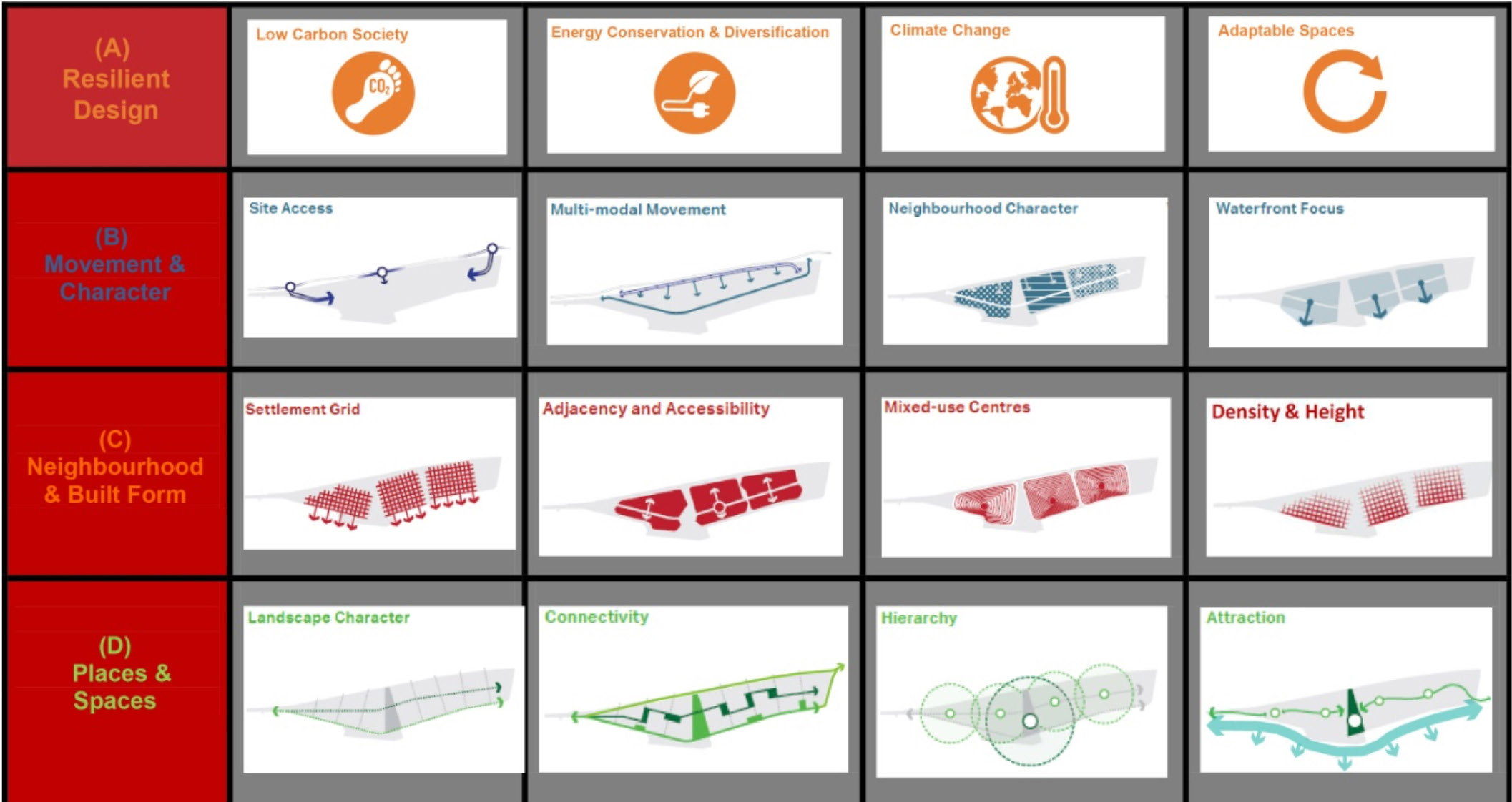
Figure 10.15: Tivoli Docks Design and Development Principles (Click on Table for High Resolution Image)

10.144
The objectives and details set out in this plan, alongside supporting documents, provide the framework for long-term regeneration in Tivoli Docks. More detail is required to ensure best practice delivery. The preparation of a placemaking and public realm strategy is an important element, detailing design standards for safe, inclusive and engaging public spaces and streets.
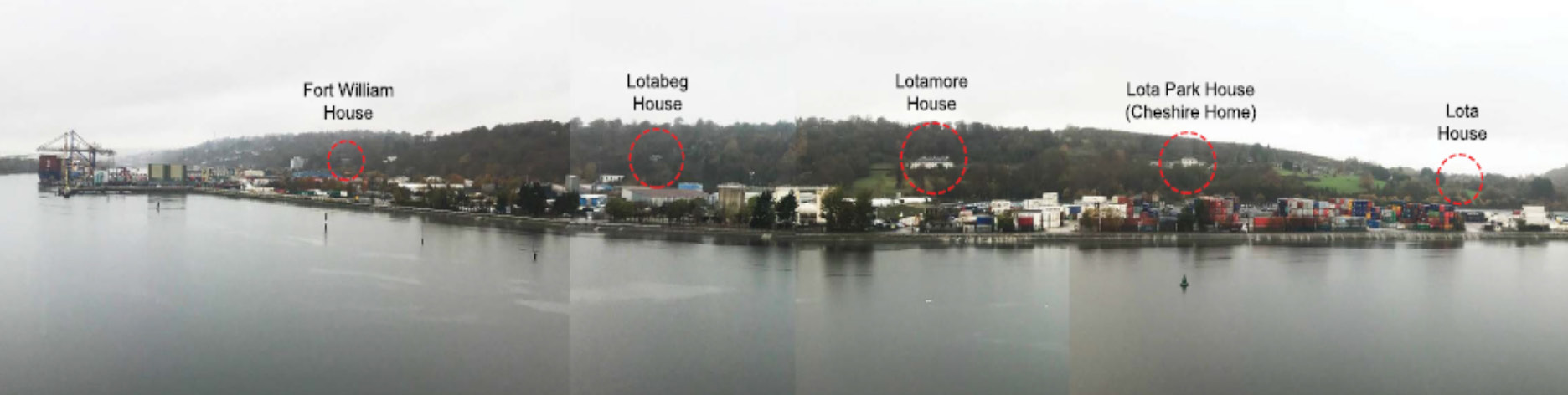
Figure 10.16: The Merchant Houses on Tivoli Ridge (Click on Map for High Resolution Image)
10.145
As a minimum, the strategy should provide clear design guidance for:
• Developing Tivoli Docks as an international exemplar for sustainable waterfront regeneration that enhances its unique location.
• A hierarchy of active streets, the waterfront, public spaces, parks and connecting spaces
• High levels of pedestrian, cycle and public transport connectivity achieved between Tivoli, the City Centre, the City Docks and the wider city and harbour.
• Protection and enhancement of the area’s existing natural landscape, heritage and amenities including increased biodiversity, green and blue infrastructure and integration of the sites water management system.
• Spaces designed for safe passive and active recreation including; play and events, heritage, arts and culture.
• Spaces and activities that leverage the area’s maritime heritage.
• Design guidance for high-quality materials, street furniture and lighting that create safe, engaging and usable public spaces and streets.
• Specifications for undergrounding service infrastructure and utilities, waste management, smart technologies and place naming.
10.146
Other key policy documents include:
• The Cork Metropolitan Area Transport Strategy (CMATS) 2040
• Tivoli UDBHS (2021)
• Cork City Green and Blue Infrastructure Study (2021)
• Guidelines on Sustainable Residential Development in Urban Areas
• The Urban Design Manual
• Quality Housing and Sustainable Communities – Best Practice Guidelines
• The Design Manual for Urban Streets and Roads
• The National Disability Strategy
Transport and
Connectivity
10.147
Cork City Council has drafted an Area Based Transport Assessment (ABTA) for Tivoli Docks. The Draft ABTA is in accordance with the Cork Metropolitan Area Transportation Study (CMATS) and is accompanied by supporting reports. In line with international best practice, the Draft ABTA provides an innovative approach prioritising walking, cycling and public transport as the instinctive modes for movement within Tivoli Docks and the wider area.
10.148
The Draft ABTA applies the principle of Transport Oriented Development (TOD) by setting out a 70% sustainable mode share target. This target is based upon best practice case studies and is consistent with the vision to prioritise walking, cycling and public transport usage. To ensure deliverability, the target was tested against the ABTA’s movement plan during the optimisation and refinement stage. The target represents a step change in planning sustainable travel in Cork, requiring significant investment in infrastructure supported by demand management measures.
10.149
TOD plays a critical role in enabling a low-carbon development. A new central train station serving the entire catchment area, will provide highfrequency services to/from strategic employment locations at Cork City Centre, Little Island and Carrigtwohill. A central bus corridor, deliveredunder the BusConnects programme, will provide high-frequency services to the Cork City Centre, UCC, MTU and wider city. The waterfront greenway, and other walking and cycling routes connecting the station and central bus corridor, will bolster interchange possibilities.
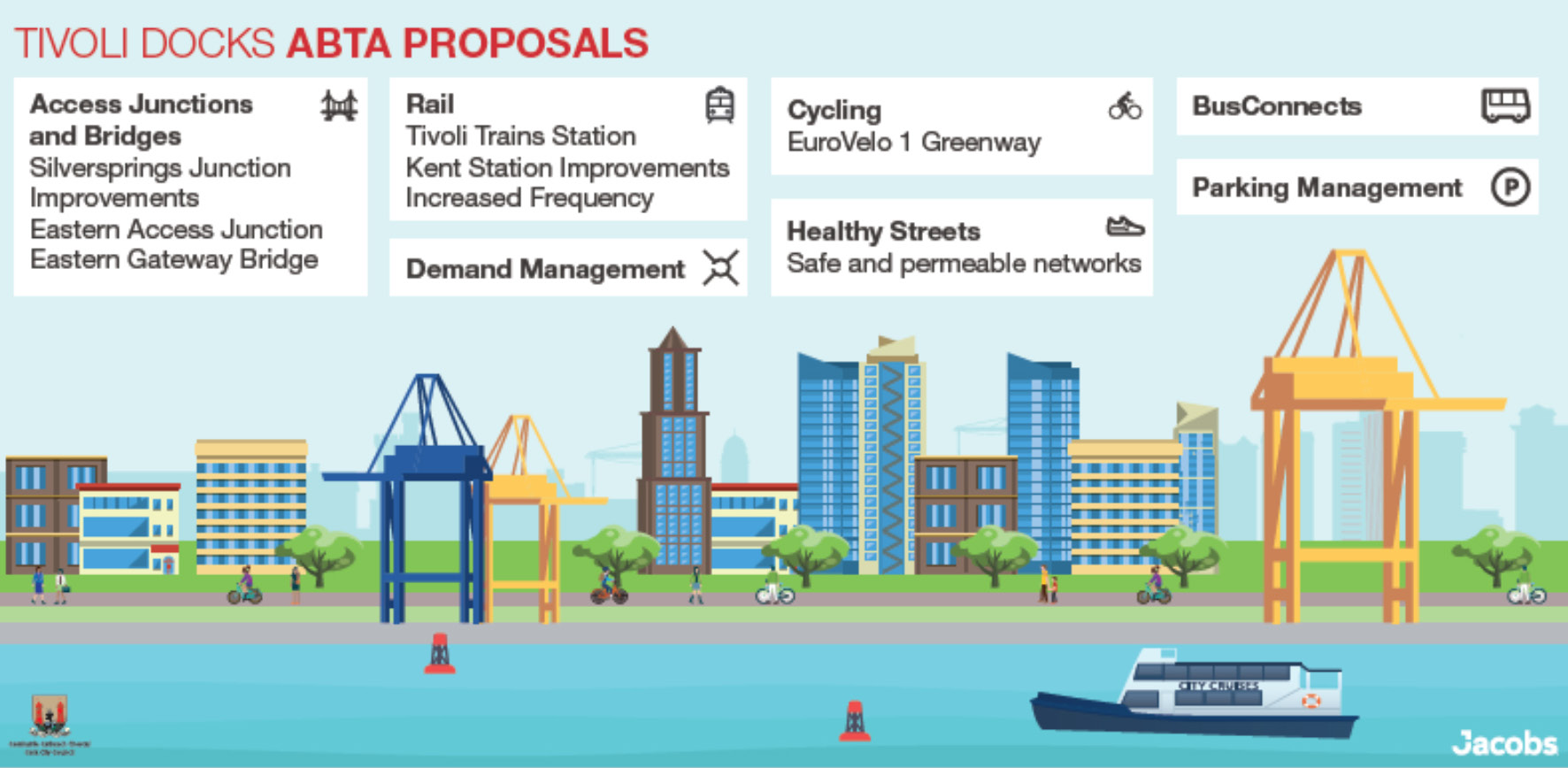
Figure 10.17: Tivoli Docks ABTA - Transport Infrastructure Requirements (Click on Map for High Resolution Image)
10.150
The Draft ABTA provides further details on the range of transport infrastructure necessary to deliver this movement strategy, including some initial design concepts. Significant infrastructural investment will be required as part of every phase, including notable upfront investment in the train station, the new eastern access, the central bus corridor and mobility hubs.
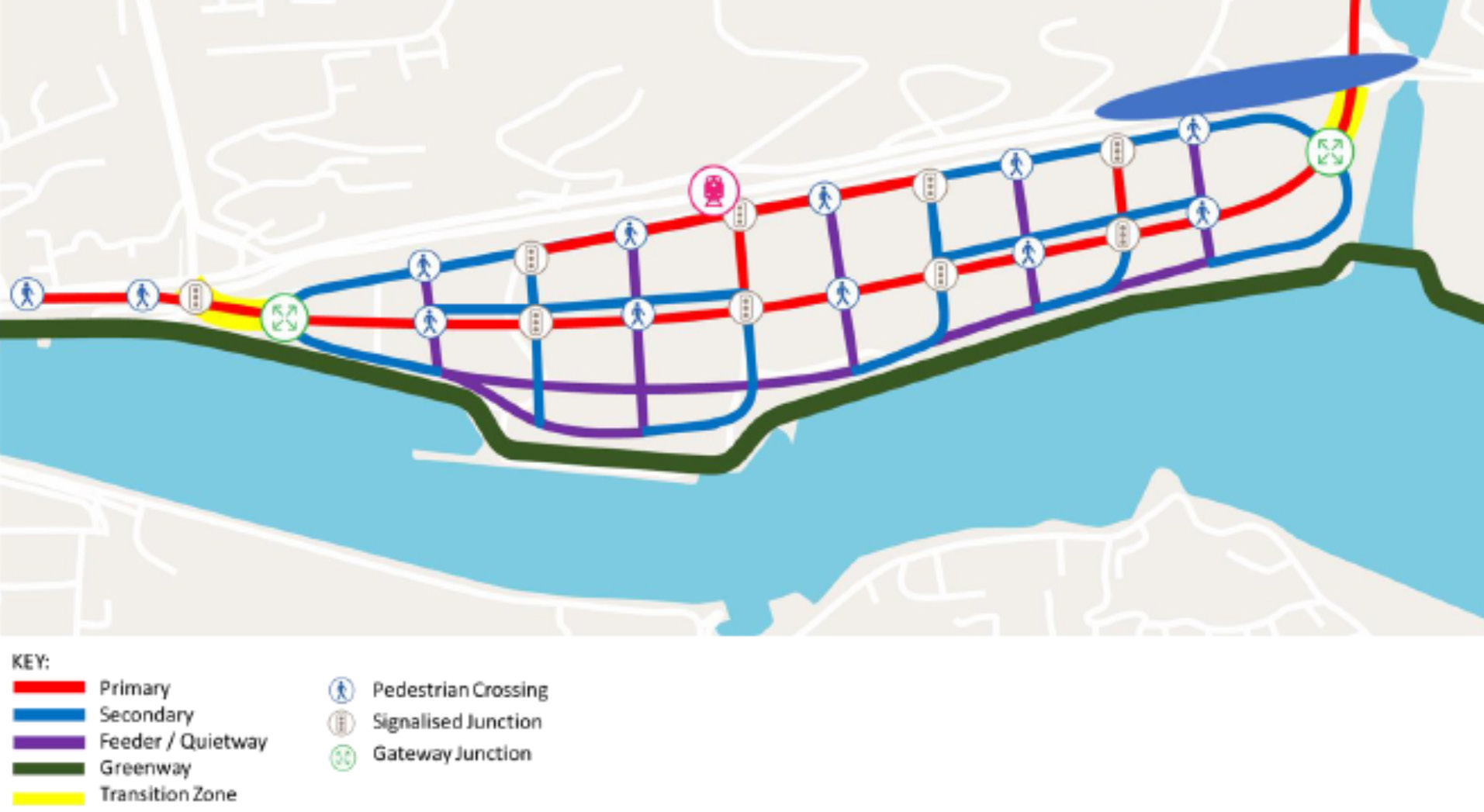
Figure 10.18: Indicative Tivoli Docks Pedestrian and Cycle Network (Click on Map for High Resolution Image)

10.151
In accordance with the Design Manual for Urban Roads and Streets (DMURS), the Tivoli Docks Movement Strategy sets out a highly legible and functional street hierarchy that prioritises pedestrians, cyclists and public transport while facilitating external connectivity by all modes. Arterial routes and link streets connect key destinations and facilitate a range of users. These routes and streets are supported by strategically designed gateways junctions, located at both entrances, creating essential filters for traffic calming and place-making.
10.152
Every street is designed to create a safe environment conducive to walking and cycling. Local streets and filtered permeability measures prevent vehicular through-traffic, with design speeds set at 30 kph (or lower). High quality public realm and soft landscaping features including seating, lighting, rain gardens and trees is required to deliver quality place making and enhance climate mitigation.
10.153
An integral element of the movement strategy is the waterfront greenway. Forming part of the EuroVelo 1 Route, its south-facing orientation will create an attractive, east-west pedestrian and cycle journey between the City Centre and Little Island. The greenway also connects to a network of pedestrian and cycle streets designed to the south of the Central Bus Corridor, enabling safe and people friendly permeability between Tivoli’s neighbourhoods and the waterfront.
![]()
10.154
A new train station is positioned centrally along the rail corridor to the north of the site. This location maximises its 5-minute walking catchment area by covering the majority of the site. CMATS proposals for the Cork Suburban Rail Corridor mean the station will be served by a high-frequency rail service. High-quality cycling connections to the station will further bolster interchange possibilities.
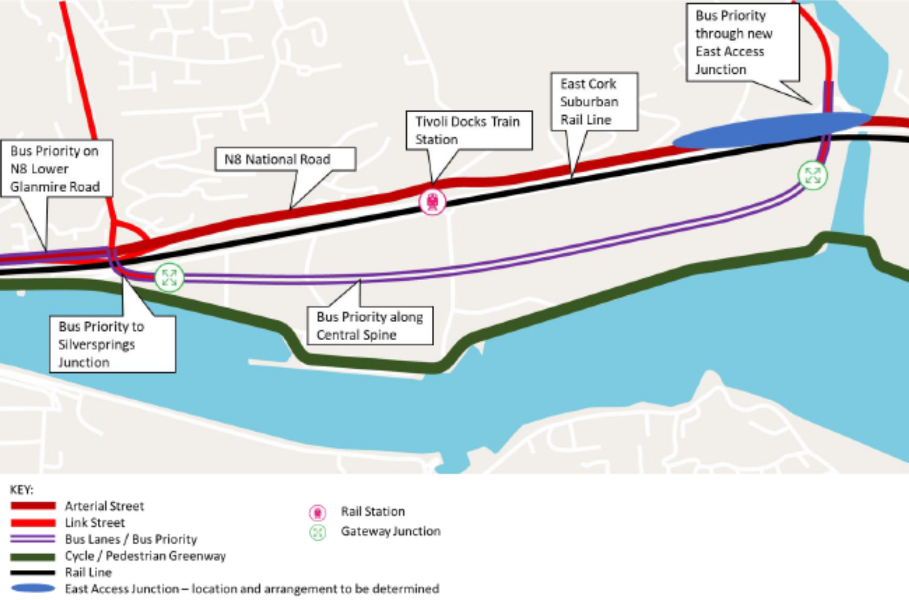
Figure 10.19: Indicative Tivoli Docks Public Transport Network (Click on Map for High Resolution Image)
10.155
The Eastern Gateway Bridge (EGB) to the west of will provide an important multi-modal connection between Tivoli Docks, City Docks and the City Centre. Bus priority measures will be implemented through gateway designs at the Silversprings interchange and the new East Access Junction. This will facilitate reliable journey times and onward connections to key employment destinations across the Metropolitan Area. The delivery of a viable water-based transport system can provide further advantages for Tivoli Docks including increased connectivity to the City Centre, City Docks, Blackrock, Cobh and Crosshaven.

10.156
Mobility hubs deliver a range of sustainable transport infrastructure including car-share and bike-sharing systems, cargo bikes, high quality cycle parking, Mobility as a Service (MaaS) systems and Electric Vehicle Charging Points (EVCP). They are characterised by a high level of accessibility to high quality public transport that provide better alternatives to private car usage, allowing lowerthan- norm parking standards. The development of mobility hubs within Tivoli Docks will help manage overall numbers of parking and enable the delivery of shared mobility services.
10.157
Mobility hubs can be wrapped around apartment blocks, workplaces or retail outlets and include consolidated waste collection and provision of parcel collection points. Prices for car parking spaces within these hubs are typically decoupled from the cost of housing units. This helps reduce housing cost, for those who choose not to buy a space, while providing multiple alternatives transport options. Mobility hubs should only be constructed as demand requires to minimise the risk of over-provision of car parking and to ensure that sustainable travel patterns are embedded from the outset.
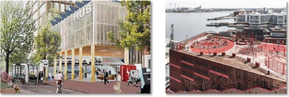
Figure 10.20: Proposed Mobility Hub (Utrecht), Rooftop Playground (Copenhagen).
10.158
The parking provision within mobility hubs should be in line with the parking standards and maximum capacities set out in this Plan. In the context of Tivoli Docks, mobility hubs would; reduce the landtake from car parking areas; reduce housing cost by de-coupling car parking spaces from residential units; enable the better use of public services and significantly contribution to mode share targets. A Mobility Hub Feasibility Study is required to determine their feasibility, including the number of hubs, their format, car parking capacity, operations and management.

10.159
To achieve the sustainable mode share targets set out for Tivoli Docks, smart demand management measures are required in tandem with infrastructure delivery. Car-free and low-car developments need the support of Mobility-as-a-Service (MaaS) systems such as low emissions car clubs, bicycle share schemes and cargo bikes to facilitate alternatives to private car ownership and usage. Investment is also needed in supporting infrastructure such as Electric Vehicle Charge Points (EVCP).
10.160
To ensure high usage of public services, car parking policies and standards need to be managed appropriately including maximum car parking standards and the designation of Controlled Parking Zones (CPZs). The following residential and employment parking standards outline the maximum car parking levels applicable for both residential (origin based) and education and workplace (destination based) within Tivoli Docks.
10.161
The regeneration of Tivoli Docks will also require a tailored Mobility Management Plan. The plan shall be prepared and implemented to help reduce the amount of car travel to the site over time and agreed in partnership with Cork City Council and relevant transport infrastructure and service providers.

10.162
Construction and Logistics Centres (CLCs) reduce the amount of delivery and construction vehicles on the local road network by coordinating logistics flows. They help mitigate negative noise, air and amenity impacts associated with large-scale construction activity. The regeneration of Tivoli Docks offers opportunities for rail and water based CLCs similar to those used in the longterm regeneration sites at Uppsala and Hammerby in Sweden and the Olympic Park, London. The need for and appropriate design of CLCs shall be established during the planning process.
| Study Sub-Area | European Case Study Norm | ABTA Maximum Proposed |
| Tivoli Docks (Zone 1) | Limited – typically limited to multi storey at edge of city centre e.g. Aarhus, Utrecht, Uppsala | 0 – 0.1 spaces per person |
Table 10.17: Employment (Zone 1) Car Parking Standards for Tivoli Docks.
| Study Sub-Area | European Case Study Norm | ABTA Proposed (Per 2 Bed Unit) |
| Tivoli Docks (Zone 3) | 0 – 0.25 | 0.4 – 0.5 spaces |
Table 10.18: Residential (Zone 3) Car Parking Standards for Tivoli Docks.
![]()
10.163
Phased delivery of transport infrastructure and services is key to successful implementation of the Tivoli Docks movement strategy. The figure below sets out timelines for infrastructure delivery. This phasing aligns with CMATS and the overall phased approach for regenerating Tivoli Docks, as set out elsewhere in this Plan.
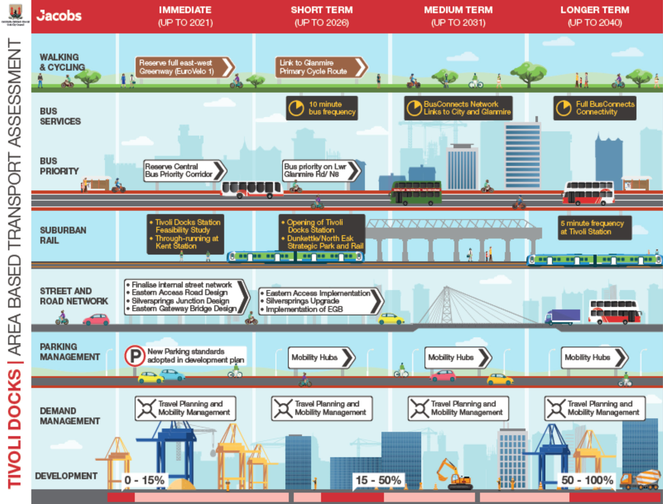
Figure 10.21: Phased Delivery of Transport Infrastructure in Tivoli Docks. (Click on Map for High Resolution Image)
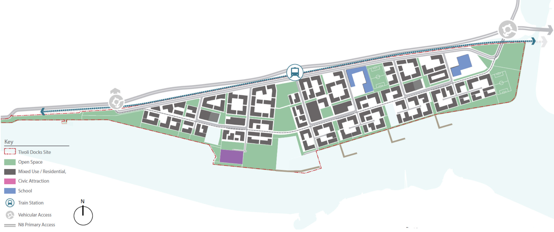
Figure 10.22: Tivoli Docks Urban Framework Plan. (Click on Map for High Resolution Image)
Tivoli Docks Urban
Framework Plan
10.164
If Cork City is to reach its potential as a major growth centre for Ireland, the development of large-scale mixed-use regeneration schemes at sustainable densities is essential. To attract people to live, work and enjoy these new neighbourhoods, these schemes need to apply best practice, delivering high quality design and exceptional public realm. With this in mind, Cork City Council has prepared an Urban Density and Building Height Strategy (UDBHS) for Tivoli Docks. This includes an updated urban framework plan integrating a hierarchy of streets and public spaces, a range of densities and building heights, waterfront design and a mix of uses.
10.165
The strategy is prepared in line with the Draft Tivoli Area Based Transportation Assessment (ABTA) and balances the need for clarity in the overall regeneration of the site while allowing flexibility for further guidance and creative design at a more detailed level. The Tivoli UDBHS provides more detailing on a range of elements including the following:
• A site-specific framework for public realm, density and building height,
• A multi-modal transport network integrating the Draft Tivoli ABTA and CMATS,
• A hierarchy of streets, public spaces and green and blue infrastructure designed for people,
• Specific density targets in line with population, homes and employment targets for Tivoli,
• Locations for tall buildings that integrate into the surrounding environment, and
• A sense of place that respects natural heritage and landscape character.
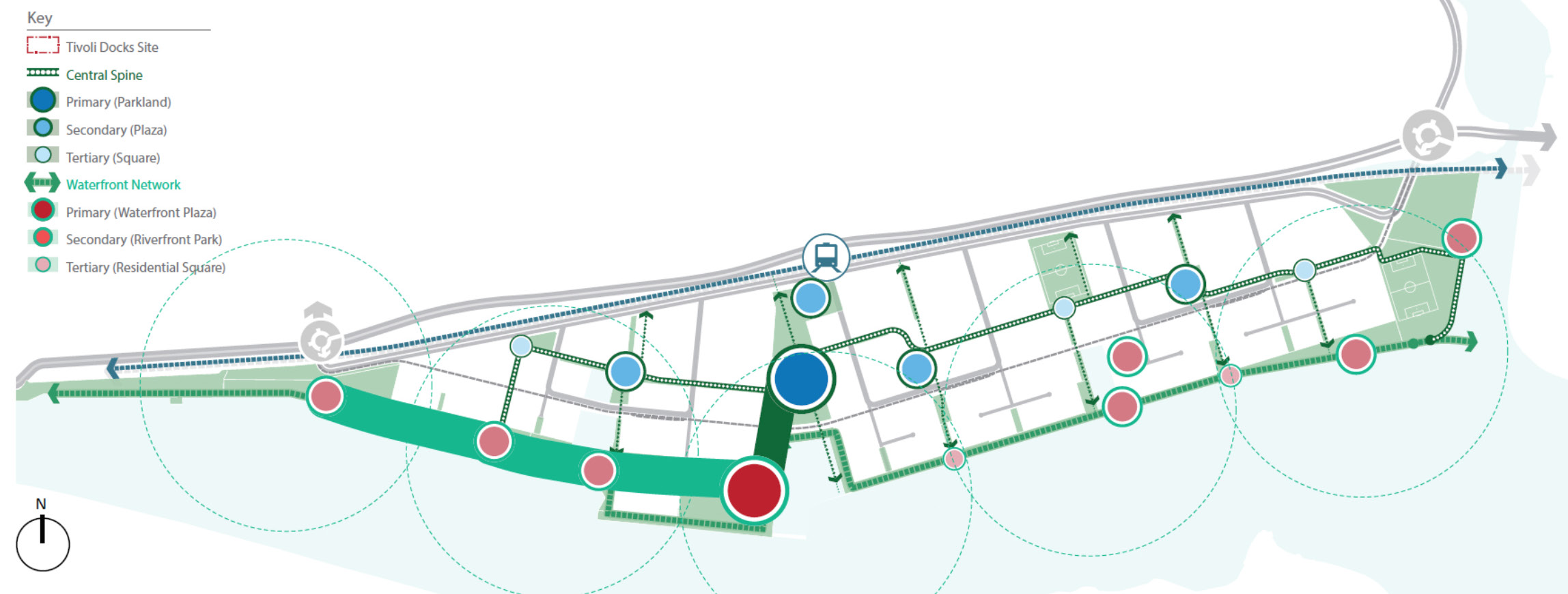
Figure 10.23: Tivoli Docks Network of Streets and Spaces. (Click on Map for High Resolution Image)

|
Waterfront Network |

|
Central Spine |

|
Connections |

|
Amenity & Buffer |
|
|
Waterfront Plaza Leveraging Tivoli's unique waterfront and the proposed central park open space, the waterfront plaza is the centre-piece of public realm development across the scheme |
|
Tivoli Central Park Forming the largest and most central node of Tivoli's varied central open space spine, Central Park caters for a broad variety of events, sports and family occasions, all year round. |
|
The Cranes Promenade Bringing the public realm to the forefront of the river and to City's iconic Port of Cork cranes, the central promenade forms the central focal point of the 3km network along the River Lee |
|
Sports Ground Priority sports pitches are located near or directly adjacent to Tivoli's school plots, ensuring the provision of athletics and amenity grounds fo these educational institutions. |
|
|
Riverfront Park A series of public parklands are located along the river corridor, benefiting from the south-facing aspect and the passive surveillance of surround residential neighbourhoods and local retails. |
|
Neighbourhood Plaza Three neignbourhoods are structured around central plazas, the key node to each settlement. These spaces are enveloped with mixed-use edges, hosting performances and public life. |
|
Waterfront Links Key pedestrian and cycling routes are determined as priority links along the River Lee, allowing Tivoli's promenade links to accomodate non-motorised transport along its entire 3km length. |
|
Peripheral Amenity Space Further amenities are located at the far east and west ends of Tivoli, offering informally designed spaces with outdoor gymnasium elements that connect to the primary routes |
|
|
Residential Square Intimate spaces are proposed at key residential junctures along the waterfront, presenting recreation spaces, small lawns for relaxing and nodes of seating for local residents to meet. |
|
Home Recreation Along the central open space corridor of Tivoli, small nodes of open space are designed specifically for the recreation and enjoyment of local residents and their families. |
|
Local Connector A system of intimate local spaces are linked through the development of human-scale pedestrian corridors, offering opportunity for local retail, safe movement and quiet living. |
|
Carriage way Buffer Landscape Due to the heavy impact of infrastructural connections into the development site, an amount of open space is prioritised towards offering a planted buffer. |
Table 10.19: Tivoli Docks Hierarchy of Streets and Spaces.
10.166
The Tivoli UDBHS provides a guide for substantial infrastructural investment required to deliver regeneration over the longer term. It considers social, human and environmental impacts of higher density and tall buildings. Visual impacts on the surrounding environment are assessed including internal and external views of the waterfront, Tivoli ridge and landmark buildings. Consideration is given to how urban density and tall buildings best address the waterfront while limiting overshadowing and maximising access to daylight/sunlight/solar energy.

10.167
The Tivoli UDBHS set outs density and building height targets to deliver the population, housing and employment targets detailed in the Core Strategy (Chapter 2). Densities are area based and are based on a net deliverable site area of 82%. This net site area excludes the existing Millennium Park and a new eastern park to act as a biodiversity and rewilding corridor at the mouth of the Glashaboy River.
| Tivoli Docks Development Data | |
| Population Growth Target | 12,900 persons |
| Residential Unit Target | 4,500 – 5,000 units |
| Overall Density - Units per Hectare (UPH) | 90-100 UPH (net) |
| Employment Target | 5,100 jobs |
Table 10.20: Tivoli Docks Development Data.
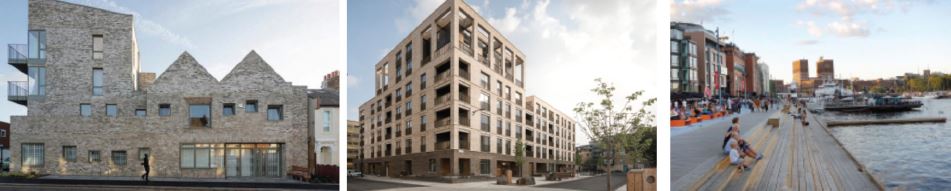
Figure 10.24: Best Practice Housing in Walthamstow and Kings Crescent, London and in Oslo, Norway.
10.168
The density range offers a variety of housing mix options and is broadly in line with similar European waterfront regeneration projects. Neighbourhood A (Tivoli West) and B (Tivoli Central), located closer to the train station, are both characterised by medium to high density. Neighbourhood C (Tivoli East) is characterised by medium density. The Tivoli UDBHS (2021) also set outs floor area targets for development zones, including a breakdown for residential, mixed use, civic, open space, parking (including mobility hubs) and other utilities.
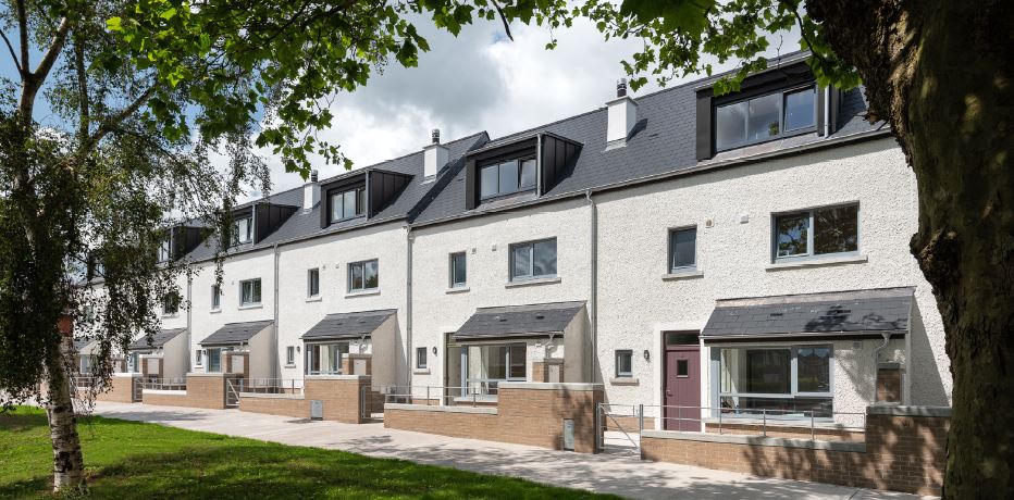
| Site Wide Development Zones | |
| Categorisation | % of Total Site Area |
| Neighbourhood A | 28% |
| Neighbourhood B | 30% |
| Neighbourhood C | 24% |
| Total Developable Area | 82% |
| Exclusion Zones | 18% |
| Total Site Area | 100% |
| Land Use Categorisations | ||
| Land Use | Character / Density | % Developable Area |
| Civic Uses | Culture, Entertainment, Education, etc | 10% |
| Residential | Upper Density | 6% |
| Residential | Medium to Upper Density | 16% |
| Residential | Lower to Medium Density | 10% |
| Mixed Use | Commercial, Local Retail, Residential | 10% |
| Mixed Use | Neighbourhood Centre Uses | 6% |
| Open Space | Active, Passive, GBI | 22% |
| Parking | Upper Density | 4% |
| Utilities | Lower Density | 1% |
| Rest of Works | Rest of Works | 15% |
| Total | 100% | |
Table 10.21: Tivoli Docks Floor Area Targets for Development Zone.

Figure 10.25: The one-third Tivoli Ridge rule (Note: ridge is c.+90m above sea level at this point) (Click on Map for High Resolution Image)

10.169
Tivoli UDBHS (2021) sets out guidance for the delivery of building heights and tall buildings. This guidance is based on a detailed assessment of the site and its surrounding environment. The methodology applied seeks to protect and enhance specific local character assets identified in the area. This includes the character of the waterfront, the areas rolling topography, key views and existing landmarks. In tandem with the overall urban framework plan, these characteristics have shaped the policy approach for building heights in Tivoli Docks, as set out in this plan.
10.170
The range of building heights proposed enhance key views and reinforce unique landscape features, most notably that of Tivoli Ridge. Importantly, the strategy seeks to integrate with Tivoli Ridge by protecting views of the top-third and framing key views of the Tivoli Merchant Houses.
10.171
Based on this approach, three locations for tall buildings are identified. Each tall building will need to apply designs that integrate with and respect their local environment, while reflecting their wider setting:
1. West: a visual marker at the entrance to Tivoli Docks closest to the city.
2. Centre: defining Tivoli Central Park and the adjoining waterfront.
3. Train Station: a viable and vibrant building beside the public transport hub.
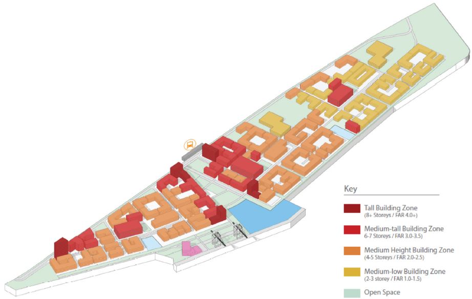
Figure 10.26: 3D of Proposed Building Height Ranges for Tivoli Docks.
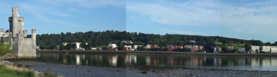
Figure 10.27: View of Tivoli Ridge from Castle Road
Design Quality
10.172
The Tivoli UDBHS (2021) also sets out guidance for design quality based on best practice examples delivering multifunctional spaces, people orientated design, waterfront regeneration, integrated green and blue infrastrucuture and nature based solutions.
10.173
The examples below are drawn from the strategy and illustrate the quality of overall design required in the regeneration of Tivoli Docks.
10.174
Figure 10.31 provides a 3D image illustrating a concept plan for the regeneration of Tivoli Docks. The image is based on the urban framework plan, Tivoli UDBHS and Tivoli ABTA and is designed to visually present some of the overall objectives set out in this plan.
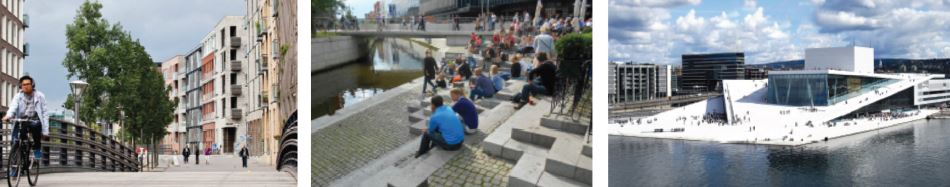
Figure 10.28: People Orientated Design (Copenhagen, HafenCity and Oslo)

Figure 10.29: Waterfront in Tivoli Docks, (Norrkoping, Sweden)
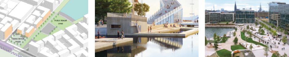
Figure 10.30: GBI in Cork (Marina Park, Douglas Street Parklet, Cork).
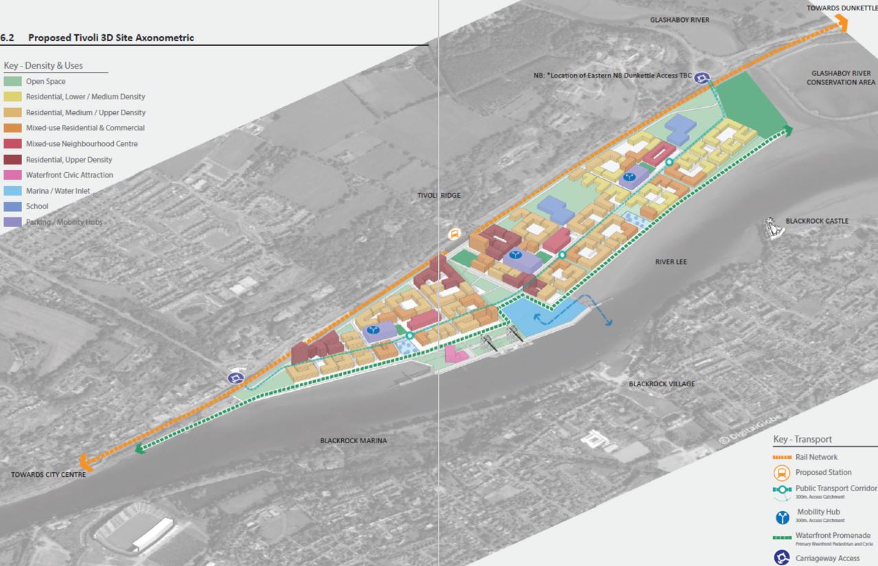
Figure 10.31: 3D Concept Plan for Tivoli Docks.
|
|
Objective 10.38 |
|
Objective 10.39 |
|
Planning the
|
Planned Regeneration
|
|||
|
|
Objective 10.40 |
|
Objective 10.41 |
|
Tivoli: Temporary and
|
Tivoli Public Realm
|
|||
|
|
Objective 10.42 |
|
Objective 10.43 |
|
Tivoli Housing,
|
Tivoli Economy
|
|||
|
|
Objective 10.44 |
|
Objective 10.45 |
|
Tivoli Green and
|
Tivoli Seveso Sites,
|
|||
|
|
Objective 10.46 |
|
Objective 10.47 |
|
Tivoli Phasing,
|
Tivoli Delivery
|
|||
4. Cork Airport
Introduction
10.175
Cork International Airport is the principal gateway to the Southern region and one the most significant strategic employment areas in the City.
10.176
A report undertaken by InterVISTAS in 2019 demonstrates the regional economic benefit of Cork Airport. This InterVISTAS (2019) report indicates that prior to the COVID 19 pandemic traffic at Cork Airport increased in recent years resulting in a growth rate of 5.7% per year. The economic impact of Cork International Airport has been estimated at €904 million by directly or indirectly creating and supporting the employment of 12,180 people. This equates to 10,740 full time jobs.
10.177
To help reinvigorate the Airport and support its efforts to re-establish and grow its business model this plan is cognisant, that the financial models that underpin the airport have changed significantly.
10.178
Direct airline and passenger related charges can no longer be relied upon to sustain the enterprise and the need for non-direct income sources is now fundamental to the Airports future survival and instilling a renewed competitiveness.
10.179
Allowing land uses which will provide potential alternative income streams from those direct charges that have historically supported Cork Airport will be provided for in this plan.
10.180
Whilst in recent years Cork Airport which is owned and operated by Dublin Airport Authority has expanded its strategic vision to take account of this dynamic funding environment, the importance of this particular asset to the regions socio-economic wellbeing requires all stakeholders to consider policy options that will place Cork Airport on a sustainable financial trajectory – facilitating route and frequency expansion and ensuring ongoing and enhanced international connectivity for the region.
10.181
In this context it is appropriate that land use planning supports further diversification of activities at the Airport including,
• zoning of additional lands for Airport related enterprise activities
• identifying public transport and active travel improvements
• Facilitate the upgrade of environmental and technological infrastructure including water and waste water, sustainable energy generation and broadband upgrades.
10.182
A new Framework Plan for the Airport and surrounding area will be prepared during the lifetime of this plan.
10.183
This will provide for a new land use strategy together with the identification of new infrastructural development necessary to support and sustain the future development of the area whilst supporting the international competitiveness of Cork City and Cork Metropolitan Area.
Primary Infrastructure

10.184
A terminal building opened in 2006 replacing the original structure which had been operational since the 1960’s. A number of additions and modifications may be required to the terminal and wider Airport campus to facilitate anticipated growth.
10.185
It is considered appropriate that further expansion of the terminal to facilitate a number of new additional gates and enhancement of security facilities be facilitated in order to regain previous levels of business and sustain its growth into the future.
10.186
The original terminal building has been vacant since 2005 and is no longer suitable for modern aviation needs. Demolition of the old terminal building will be required to facilitate the construction of new aircraft stands and a pier extension to facilitate additional gates at the southern end of the terminal.

10.187
It is envisaged that the existing 16/34 runway may be extended north and south to facilitate increased capacity and to accommodate aircraft serving long haul destinations. Land use planning in proximity to the runway should acknowledge the importance of safeguarding the future of Cork Airport subject to appropriate impact assessments.

10.188
Cork City Council are cognisant of the need to protect and enhance accessibility to and from the Airport. Cork Metropolitan Area Transport Strategy has earmarked delivery of the Core Bus Network (BusConnects) with the potential to dramatically improve transportation links between the Airport, the City Centre and suburbs as well as the bus and train stations. In addition, a secondary road access to the Airport via the proposed Southern Distributor Road is being examined. Currently the primary access to the airport is via N27 Road and the R600 road, both of which converge at the Airport Roundabout which is located on the eastern periphery of the Airport campus.
10.189
It is desirable that upgrades to both of these roads, including the provision of bus priority lanes on the N27 and an improvement in the alignment of the R600 be undertaken, along with improvements to the roundabout entrance to the Airport.
10.190
The Airport is served by several car parks within walking distance of the terminal and there is currently adequate capacity for both passenger and staff parking to cater for current demand and for the medium term future.
10.191
In conjunction with public transport improvements, it considered that enhanced modal shift targets aimed at reducing the number of private car journeys to the airport be provided for in the new framework plan for the Airport. Cork City Council will work Dublin Airport Authority and the National Transport Authority to successfully achieve these targets.
10.192
Notwithstanding modal shift targets it is recognised that additional lands will be necessary to accommodate the parking requirements generated by increased passenger numbers in the longer term. Additional lands may be identified to allow for car park expansion, and these will be safeguarded in the new framework plan.
Noise
10.193
Cork Airport has at present three noise contours associated with aircraft operations, namely 57db (outer zone).66dB (inner zone) and 72dB (inner, inner zone) These existing noise contours for the airport are indicated on the following map. The noise environment and contours around the airport are likely to change because of future growth and development. Increased operations, changes in aircraft type and mix, changes in the associated operations such as maintenance and construction activity during implementation of developments will all contribute to increased noise.
Neighbouring Land
Uses, Rural Housing
and Airport Safeguard
Zone
10.194
To safeguard the future operations of the Airport new housing will not be permitted within the area delineated as Airport Safeguard Area, save in exceptional circumstances where consideration may be given to the development of new housing for those actively involved in farming.
10.195
Site selection must ensure that the rural character of the area is maintained, multiple sites on single landholdings will not be permitted. Planning applications within this area shall be accompanied by a noise assessment report produced by a specialist in noise measurement which shall detail all proposed noise mitigation measures together with a declaration of acceptance of the applicant of the result of a noise acceptance report. Further indemnification Cork City Council and Cork Airport from any loss of amenity which may arise as a result of Airport Operations shall be agreed at Development Management Stage.
Air Quality
10.196
Most recent environmental assessments carried out at Cork Airport indicate that the air quality at residential locations in the vicinity of the airport are comfortably within current air quality standards and that future intensification of operations is unlikely to have a significant impact. The evolution of future air quality on increased aircraft movements will be offset by reductions in jet engine pollutant emissions. This should result in air quality remaining essentially unchanged in the locality. In allowing for growths in Air traffic, it is considered appropriate that an air quality monitoring programme be established for Cork Airport.
Public Safety Zones
10.197
Cork Airport has two Public Safety Zones (inner and outer) which are recognised in this plan and are identified on the following map.
10.198
Planning applications in the vicinity of these zones will be referred to the Irish Aviation Authority (IAA) by Cork City Council’s Development Management Section to seek their observations as part of the statutory planning process under Section 28 of the Planning and Development Regulations, 2001. Cork City Council will adhere to the advice of the Irish Aviation Authority regarding the effects of proposed development on the safety of aircraft and the safe and efficient navigation thereof.
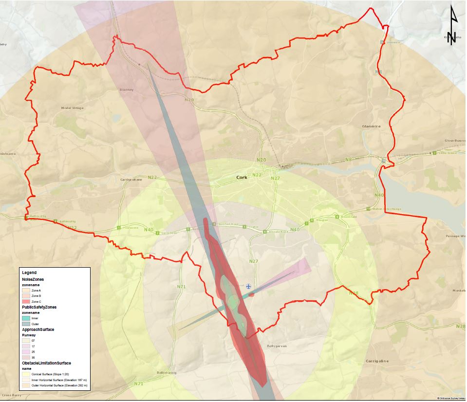
Figure 10.32: Cork International Airport Safety Zones. (Click on Map for High Resolution Image)
|
|
Objective 10.48 |
|
Objective 10.49 |
|
Role of Cork International
|
Development of additional
|
|||
|
|
Objective 10.50 |
|
Objective 10.51 |
|
Airport Infrastructure
To promote and support the operations of Cork International Airport subject to normal planning considerations in relation to: |
Strategic Development
|
|||
|
|
Objective 10.52 |
|
Objective 10.53 |
|
Airport Safeguard Area
This objective is intended to safeguard the sustainable development of the Airport. All proposed developments within this area will be referred to the Irish Aviation Authority by Cork City Council’s Development Management Section to seek their observations as part of the statutory planning process under Section 28 of the Planning and Development Regulations, 2001. In addition, the construction of one-off housing will generally not be permitted save for exceptional circumstances such as those actively engaged in farming. Additional requirements for the construction of dwellings in this area are set out in the Cork Airport Chapter. |
Airport Safety ZonesImplement the policies to be determined by Government in relation to Public Safety Zones for Cork Airport. Additionally, the Obstacle Limitation Surfaces will be safeguarded. Planning applications in the vicinity of these zones will be referred to the Irish Aviation Authority for observations as part of the statutory planning process. Issues such a proposed development’s height and proximity to these zones will form part of considerations. |
|||
5. Ballincollig
Introduction
10.199
Ballincollig is the largest urban town in Cork City and one of the largest in the Southern Region. It is positioned between the quarries and cave systems to the west, the N22 to the South East and the River Lee to the North. These local geographic factors have helped shape the town and retained much of its village character.
Population
and Housing
10.200
Ballincollig experienced significant growth in recent economic times. Future housing and population growth in Ballincollig will be concentrated in the Maglin Area to the south of the town and other zoned lands to the west and on infill and brownfield lands within the existing built-up area of the town.
10.201
There remains some vacancy within the town centre and there may be opportunities in this area with existing vacant retail units potentially suitable for conversion to residential use. The area to the South of the main street also presents significant opportunities for regeneration including Time Square and the Village Shopping Centre on Station Road where mixed use developments will be encouraged.
10.202
The Maglin Area has drainage constraints, and these are being assessed as part of the South Ballincollig Drainage Study, in addition there are deficiencies with the town water and wastewater network which require upgrades to accommodate additional growth.
Flooding
10.203
No parts of the urban area of Ballincollig have experienced flooding, however some northern parts of the town along the banks of the River Lee, located within the Ballincollig Regional Park, have been subject to recurring flood events due to the low-lying nature of the lands.
10.204
Parts of the Maglin Urban Expansion site are also at risk of flooding and this issue will need to be addressed as part of the preparation of the development proposals for those lands. There have been no unexpected flooding events within Ballincollig Town or on the Urban Expansion lands. 10.189 Cork City Council has commissioned a Drainage Study for the Maglin Urban Expansion which will inform part of the overall infrastructure masterplan for the Ballincollig (Maglin) Urban Expansion Area. The initial findings of the Drainage Study indicate that the potential for flood risk in this area may be more pronounced than previously indicated when the lands were last surveyed as part of the Lee Catchment Flood Risk Assessment and Management Study in 2010.
10.205
Cork City Council has commissioned a Drainage Study for the Maglin Urban Expansion which will inform part of the overall infrastructure masterplan for the Ballincollig (Maglin) Urban Expansion Area. The initial findings of the Drainage Study indicate that the potential for flood risk in this area may be more pronounced than previously indicated when the lands were last surveyed as part of the Lee Catchment Flood Risk Assessment and Management Study in 2010.
10.206
As part of the preparation of this Development Plan, Cork City Council has updated the indicative flood zone mapping for this area to take account of the information that has become available from the South Ballincollig Drainage Study.
10.207
The flood zones illustrated in this plan are based on an undefended scenario and do not take the presence of flood protection structures such as walls or embankments into account. This is to allow for the fact that there is still a residual risk of flooding behind the defences due to overtopping or breach, and that there may be no guarantee that the defences will be maintained in perpetuity. The indicative mapping is being made available as a resource. It has been prepared for use in applying the Guidelines for The Planning System and Flood Risk Management.
Retail
10.208
Ballincollig has a modern town centre with a large supply of retail space. The town has a strong convenience retail base with all the main multiples represented but the comparison offer is somewhat lacking when compared to similarly sized centres in the CMA and nationally.
10.209
There is significant vacancy on the north side of the town centre, principally along the streets which form part of the Ballincollig Town Centre Development, which was completed in 2007. There is also some vacancy within the Castlewest Ballincollig Shopping Centre itself. As a whole vacancy in the town is somewhat higher than the averages for both the Cork Metropolitan Area and nationally. The challenge for Ballincollig through this plan is to reduce the vacancy levels on the North side of the main street particularly in the Town Centre Development whilst consolidating the current offering.
10.210
The Cork Metropolitan Area Strategic Plan (MASP) has identified a hierarchy of retail settlements within which Ballincollig is considered a Level 2 Large Metropolitan Town Retail Centre.
10.211
Consolidating the retail core to protect the vitality and viability of Ballincollig as a retail centre is a key aim of this Plan, only in exceptional circumstances where no alternative site is available within the CRA will consideration be given to additional large scale standalone retail in other areas of Ballincollig
10.212
Findings from the Draft Retail study indicate that Ballincollig requires more leisure activities in the form of cafés, restaurants and accessible green space and it is considered that the Times Square Area immediately south of Main Street / Carrigrohane Road is the optimal location for an initiative aimed at diversifying the retail and leisure offering of the town. (See Future Initiatives)
Employment
10.213
Recent data available to Cork City Council indicates that there are currently 5,002 people employed locally within the town primarily in information and communications technology, professional services, retail, logistics and education with the overwhelming majority of these workers commuting into Ballincollig from elsewhere. Of the resident population 8,401 people are in employment with over 80% of these workers commuting to jobs elsewhere in the City and Metropolitan Area. This represents a net outflow of approximately 3,400 workers from Ballincollig which is an issue Cork City Council will attempt to address during the lifetime of this Plan via the identification of more employment areas and opportunities within the town. Ballincollig is also very close to the proposed Cork Science and Innovation Park at Curraheen which may be an important employment location in future.
Connectivity and
Transportation
10.214
Connectivity and mobility both within and from Ballincollig has improved considerably in recent years. Significant public realm improvements on Main street have prioritised pedestrians and cyclists over private cars. However, the town is still very heavily car dependent with only 18% using Green or public transport modes to commute to work and school.
10.215
In common with other urban towns and the established City, future transport and Connectivity in Ballincollig will be guided by the Cork Metropolitan Area Transport Study (CMATS). The National Transport Authority (NTA) published CMATS in 2020. Amongst the proposals for Ballincollig include a new light rail service, high frequency and local feeder bus services and enhanced walking and cycling infrastructure.
10.216
This plan will transform commuting from and within Ballincollig, enhancing its role as a residential and employment destination. Ballincollig has a welldeveloped cycling network and has the potential to be well linked to the City owing to existing infrastructure and geographical proximity. Good quality cycling facilities have been introduced in Ballincollig Regional Park, Old Fort Road, and the Main Street in recent years and these will be incorporated into the Cork Cycle Network Plan which has now been subsumed in CMATS where they will be further developed as part of 16 proposed cycle routes and 4 Greenways.
10.217
Ballincollig has benefited from public transport improvements in recent years most notably the introduction of Ireland’s first 24-hour bus service which connects Ballincollig to Carrigaline via the City Centre. This will be further built on initially with the introduction of BusConnects, a high frequency bus service linking the town with the City Centre and other suburbs, and a local bus service within the settlement, followed by Light Rail which will connect Ballincollig with Mahon via the City Centre and Kent Station providing significantly improved connectivity for the area.
10.218
Ballincollig has good roads infrastructure, parking facilities and enjoys good access to the National Road network. The town also has a relatively good internal road network however as the town grows it is important that other roads are improved to keep pace with the additional traffic volumes particularly from new development areas to the south. Further improvements to pedestrian and cycling facilities are also required. Ballincollig will form the western terminus of the proposed N40 Cork Northern Relief Road and the preferred route corridor from inappropriate development once the route has been finalised.
10.219
The future development of the Maglin/South Ballincollig Area is dependent on the construction of a distributor road. Some of this road has been built from the north through the Heathfield Development. The route alignment, capacity and overall function of this road (Public Transport Corridor etc) is currently being appraised. It is envisaged that the first phase of the road from Heathfield to Maglin Road will be selected and constructed during the lifetime of this plan. The second phase involves areas of land which present difficulties in terms of topography, archaeology and flooding and requires a more detailed appraisal. It is not envisaged that Phase 2 will be constructed during the lifetime of this plan.
Education
10.220
Ballincollig has 4 primary schools and 2 secondary schools. There is also a special needs school, Our Lady of Good Counsel, in Innishmore. Ballincollig as a growing town requires additional educational facilities. The Maglin Urban Expansion Area in the south of the town is considered the optimum location for these schools. The former Supernova Site on the link road has also been identified as a suitable location for a new Primary and Secondary School Multicampus with shared facilities.
Community
10.221
Ballincollig will benefit from additional community facilities such as a community centre and playgrounds in the centre of the town and at the eastern end of the town. This Plan identifies lands suitable for the construction of a new Civic Centre to facilitate community uses but may also house Council services such as a new library for Ballincollig. A Primary Healthcare Centre is currently under construction in the centre of the town.
Future Initiatives

10.222
This area extends from Carrigdene / Main Street Junction at the eastern end of the Town Centre to the filling station in the western end and southwards to the Westside Retail Park, encompassing the Village Shopping Centre and Time Square. The redevelopment of lands behind the Main Street and reduction of dead frontage onto Time Square and adjoining streets will be supported. Enhanced pedestrian and connectivity should be created by the removal of steps and embankments and installation of traffic calming through shared surfaces across car parking areas, improvements to street lighting, paving surfaces, and increased street furniture. There is scope within this area for the provision of a mixed use residential and infill residential developments in this area.
Figure 10.33: Caption to be supplied.
Development
Framework Areas
at Leo Murphy Road
(Link Road)
10.223
The Link Road is a significant entrance point and arterial route in Ballincollig. Currently the area is largely characterised by an irregular development pattern with comparison shopping co-existing with light industrial and other uses.
10.224
As a potential route for the proposed Light Rail this area provides an opportunity for the creation of an urban focal point. A framework plan presents an opportunity to reinvigorate this area of the town and provide aesthetic cues that signal a sense of arrival to an exciting and important place.
10.225
The renewal or enhancement of this area has the potential to frame a view of Ballincollig – high quality landmark buildings, an appropriate mix of developments including employment, education and residential coupled with infrastructural and environmental improvements, landscaping and enhanced pedestrian/cycling and public transport connectivity will inform residents and visitors alike to the commercial and cultural opportunities Ballincollig has to offer.
10.226
The Framework will propose an integrated land use and development plan to be conducted in collaboration with the relevant stakeholders including, relevant landowners, the National Transport Authority and Transport Infrastructure Ireland.
Development of lands
between Ballincollig
and the western City
suburbs
10.227
The lands between Ballincollig and the western suburbs of Cork City, some 220 ha in extent, represent a strategic future growth location for Cork City due to:
• location between the City and Ballincollig
• the Location along the proposed Light Rail Transit route
• proximity to services such as employment, higher education and health care.
• the location adjacent to the proposed Cork Science and Innovation Park.
10.228
However, the scale of the site requires a multi-disciplinary master planning approach in order to provide for the comprehensive and co-ordinated development of these lands.
|
|
Objective 10.54 |
|
Objective 10.55 |
|
Ballincollig Retail
|
South Ballincollig (Maglin)
|
|||
|
|
Objective 10.56 |
|
Objective 10.57 |
|
Ballincollig Regeneration
|
Ballincollig West Side
|
|||
|
|
Objective 10.58 |
|
Objective 10.59 |
|
Ballincollig Framework
|
Ballincollig Flood RiskDevelopment in Ballincollig will only be permitted in areas not at identified risk of flooding. Additionally, all new proposed development proposals within the Maglin / South Ballincollig Expansion Area shall be accompanied by individual site-specific flood risk assessments. |
|||
|
|
Objective 10.60 |
|||
Ballincollig EducationCork City Council will work with the Department of Education and landowners to identify new school sites for the town and its wider catchment. |
||||
6. Blarney
Local Context
10.229
Blarney located 8km north-west of Cork city centre, is internationally regarded for its castle, its attractive surroundings and the historic character of the village. The old village centre is centred around the town square, an area of open space at the heart of the village.
10.230
Blarney Castle is one of Irelands most important tourist centres with a range of associated tourist related facilities such as the Blarney Woollen Mills Hotel complex, which has a significant comparisonshopping element mainly, directed at niche tourism markets.
Population and
Housing
10.231
Residential development has been concentrated mainly on the northern side of the village along Waterloo and Station Roads and Monacanappa. Although the pace of residential development has gathered momentum in recent years, with some pockets of residential development coming on stream, Blarney remains behind other urban towns in Cork City in terms of construction activity and population growth largely due to infrastructural constraints.
10.232
Stoneview, a large area earmarked for residential and employment development, requires investment in transport and utilities infrastructure to enable growth. Cork City Council recognises the potential Stoneview presents for public transport orientated development given its strategic position on the Dublin-Cork Railway line and will be preparing a framework plan in collaboration with relevant stakeholders including the NTA, TII, IDA and landowners which aims to address infrastructural constraints and allow for the development of this area.
10.233
Similarly, constraints have been identified at Ringwood, another large-scale development area located just outside the town centre on Station Road, and significant works will be required to allow for development of these lands.
10.234
It is therefore expected that residential developmentin Blarney will largely be confined to areas adjoining the built-up area along Waterloo Road/Monancappa for the initial period of growth for Blarney.
10.235
There are a number of brownfield sites close to the centre of Blarney which may be suitable for residential development.
Built Heritage
10.236
There are currently 4 structures on the Record of Protected Structures (RPS) within the development boundary of Blarney including the following: Blarney Catholic Church, Blarney Bridge, Blarney Woollen Mills, and Blarney Church of Ireland Church. There are four additions RPS located to the south of Blarney and outside the development boundary including the following Blarney Ornamental Tower, Blarney Castle Country House, Icehouse, and Blarney Tower House & Bawn.
10.237
The area of Blarney town centre and Blarney Castle Estate is a designated Architectural Conservation Area (ACA). The Blarney ACA includes the key buildings and groups of buildings of architectural, historical and cultural merit and public spaces around them in Blarney Town Centre.
10.238
This Plan proposes to extend the ACA boundary to the north to include Mornington and Millstream Terraces respectively.
Archaeological
Heritage
10.239
The town contains a significant number of archaeological monuments which reflect the historic significance of the area. There are approximately 25 archaeological sites within the development boundary. All Recorded Monuments are subject to statutory protection under section 12 of the National Monuments (Amendments) Act 1994. Any potential subsurface archaeology within the site and all archaeological sites and their setting shall be protected in line with the objectives for the protection of archaeological heritage as set out in this Plan.
Water
10.240
Blarney is supplied from the Cork Harbour and City Water Supply Scheme at Inniscarra. Water supply is available for residential development on Tier 1 zoned lands. Significant investment and upgrades are however required to service Tier 2 and Tier 3 zoned lands most notably the Stoneview area. Wastewater from Blarney is currently received and treated at Tower WWTP, upgrades to this plan may be required in the short term but a long-term solution lies in a Strategic network serving the northern Urban towns and the northside of the City. Cork City Council will continue to work with Irish Water to achieve a long-term solution for both drinking and waste water in Blarney.
Flooding
10.241
Parts of Blarney have been identified as being at risk of flooding. The areas at risk follow the path of the River Shournagh, that runs to the south of the town and are illustrated on the settlement map. There have been a number of recorded flood events with the development boundary of Blarney in recent years.
Economy and
Employment
10.242
In 2020 1,380 Blarney residents were in full time employment, the majority of which commute to destinations outside the settlement. There are 892 jobs within the settlement which represents 0.89% of the City jobs market,25.3% of these posts are filled from the local population. These figures represent a net outflow of 488 jobs.
10.243
Employment and economic activity in Blarney is currently focused on the retail and service sectors with an emphasis on tourism. Blarney Castle and the Woollen Mills complex are together a significant tourist attraction not only during the summer but also during the winter months. There is also an area of industrial and business development adjoining the Woollen Mills complex.
10.244
In addition to the established employment uses within the town, the Blarney Business Park located 1 km to the north east of Blarney, provides for employment in the form of manufacturing, logistics and the National Car Test Service. This park has seen large growth in recent years and is at capacity. An expansion to the Business Park is provided for it this Plan. Given its location on the rail corridor and its proximity a proposed train station, the site has the capacity to accommodate significant employment generating developments.
Tourism
10.245
Tourism is a significant industry in Blarney as it contains one of the principle tourist attractions in Ireland, Blarney Castle. This industry relies on the quality and attractiveness of the built and natural heritage of the local area. It is important therefore that future development initiatives within the vicinity of the Castle do not compromise the tourism potential of the town and actively seek to enhance this important sector of the local economy.
10.246
The tourism offer has expanded in recent times and now includes Blarney House and the wider estate and gardens. As a result of this growth, there is a need to have regard to the impacts of proposed developments on both Blarney Castle and the wider Blarney Estate. Future development within the vicinity of the Estate should not compromise the landscape and heritage character of the area on which the local tourism economy relies.
10.247
When assessing development proposals in the vicinity of the Estate, regard should be given to the Department of the Environment, Heritage and Local Government “Guidelines on Architectural Heritage Protection” which acknowledge that new development can have a negative impact on a protected structure, even when the proposal is detached from the protected structure and outside the curtilage of the attendant grounds.
10.248
A heritage-led framework plan for Blarney will be developed by Cork City Council during the lifetime of this Plan and will contain measures and guidance to allow the village meets its full development potential without comprising the heritage and tourism asset the town presents.
Retail
10.249
Blarney is defined as a Small Metropolitan Town. There are 43 retail units within Blarney town centre, with a small proportion of comparison units in general indicating that the centre provides a local function, more focused on convenience provision and services. There is no major anchor convenience store within the centre. Given Blarney’s proximity to the northern suburbs of Cork City with their offering of large convenience stores it is considered that there is not currently capacity in the town to support a large-scale standalone retailer.
10.250
The centre has a higher proportion of leisure and tourism related retail. The importance of tourism to the town indicates that there may be an opportunity for a strong role for independent retail in sustaining the commercial heart and providing a distinct sense of identity for Blarney.
Regeneration Areas
10.251
The site of the former Blarney Park Hotel site is of strategic importance to the town. The site has been vacant for many years and its redevelopment is paramount to sustaining Blarney as one of the countries prime tourist attractions.
10.252
Cork City Council is conscious of the need to diversify economic activity within Blarney, however the proximity of this site to Blarney Castle and Town Square makes it particularly sensitive. Any future development will need to protect and enhance the existing character of the area and views of the Castle.
10.253
Consideration is required regarding the following,
• The location, siting, and design of any future development on the site
• Development must have regard to the existing streetscape around the adjoining square.
• Mixed use redevelopment may be considered on the site, retail which boosts the local convenience and tourist is encouraged.
• Design must be of a high architectural standard and should reflect and complement the Architectural Conservation Area particularly with regard to building materials proposed.
• Any development must ensure that adequate linkages are provided between the site and the current active town centre.
10.254
The framework plan which will be prepared for Blarney Town Centre will include guidance on the redevelopment of this site, adjoining lands, and other identified sites in this Development Plan.
Community Facilities
10.255
Blarney currently has a wide offering of Community facilities including a library, garda station and health centre. As Blarney grows in the coming years, there will be new demands on social and community infrastructure (schools, recreational facilities, healthcare etc.). It is important that new community infrastructure keeps pace with development so that it continues to perform as an attractive convenient town offering a good quality of life. In this context significant investment will be required in community infrastructure to meet the needs of the growing population. Cork City Council will work with various stakeholders to identify sites for additional community facilities including a Primary Health Care centre as part of the Town Centre Framework Plan.
Education
10.256
Education facilities are largely focused to the east, south and west of the town centre close to established residential areas. There are currently three primary schools serving Blarney. There is also a secondary school Scoil Mhuire Gan Smál. As new development comes on stream the provision of additional educational facilities in this area will need to be prioritised. Cork City Council will work with the Department of Education to identify and deliver new school sites for Blarney.
Active and Passive
Recreation
10.257
Blarney is widely regarded as one of Ireland’s most picturesque towns. One of the principal features of the town centre is the wellpreserved village square maintained by Blarney Castle Estate. The castle, built nearly 600 years ago, is situated in over a thousand acres of woodland and is one of the principal tourist attractions in the country.
10.258
The future development of Blarney offers opportunities to develop an integrated open space strategy which can perform a number of functions including passive and active amenity areas, wildlife corridors and carbon filters to offset impacts of iincreased development and traffic.
10.259
The limited supply of active and passive open spaces in the town indicates that there is a clear need to develop an integrated open space strategy for Blarney. This can perform a number of functions including passive and active amenity areas, wildlife corridors and carbon filters to offset impacts of recent development and traffic within the town.
10.260
Clogheenmilcon Fen, also known as Blarney Bog, is an area of local biodiversity importance within the Plan area and its enhancement will be a critical component in the development of an integrated open space network and the creation of attractive walking routes for both residents and visitors to Blarney alike.
10.261
There is a lack of an appropriate range of cultural facilities in Blarney and Tower. The provision of such facilities should be considered as part of development proposals in the town centre. In addition, Blarney GAA club is the only active recreational facility of significance in the town, and it is considered important that this complex remains within the town.
Public Transport
10.262
Blarney is served by the Cork City Bus network, significant improvements to both frequency and reliability are required on this route. CMATS proposes both a Core and Orbital bus network as part of BusConnects (see Chapter 4 Transport and Mobility). Future provision for Blarney is as yet undecided but Cork City Council will endeavour to deliver significant improvements for public transport in Blarney during the lifetime of this Plan.
10.263
In addition to bus improvements, CMATS has also identified lands at Stoneview for the construction of a new railway station as part of the expansion of Cork Commuter Rail services. Enabling infrastructure such as new pedestrian and cycling linkages and upgrades to the local road network will be examined in both the Blarney Town Centre and Stoneview Framework Plans.
National Road
(M/N20)
10.264
The M/N20 scheme is currently at Phase 2, Option Selection. Four emerging routes have now been identified with a preferred route due to be selected later in 2021. Some areas of Blarney may form part of the final route and therefore appropriate safeguards within the study corridor are being applied in this plan to ensure the long-term feasibility of the proposed route. Once the emerging preferred route is identified further safeguards of the preferred route will be included in this Development Plan.
Local Road Network
10.265
Deficiencies in the local road network is one of the key reasons for the low level of development in Blarney, relative to other urban towns, with the existing road infrastructure unable to serve proposed developments. This issue is of particular concern in Stoneview and solutions to this problem will be identified as part of the Blarney Town Centre and Stoneview Framework plans which will prepared simultaneously during the lifetime of this Plan.
Walking and Cycling
10.266
Facilitating a modal shift to walking and cycling for local journeys within the town would help ease congestion. There is significant potential for cycle routes in the town given the compact nature of the town and the proximity of most residential areas to the centre.
10.267
The Cork Cycle Network Plan which has been absorbed into CMATS contained proposals for both on and off road cycling infrastructure in the Blarney / Tower / Kerry Pike area and Cork City Council will work with relevant stakeholders to further these proposals during the lifetime of this Plan.
Future Initiatives

10.268
The former Blarney Park Hotel site occupies a strategic location on the western edge of Blarney. The site is currently vacant and detracts from the visual amenity of the Town Square. It is proposed to include this site along with an area along with St Ann’s Road from its junction with the Sunberry Road.
10.269
Its proximity to Blarney Castle and the Town Square makes it a sensitive area where any future development will need to protect and enhance the existing character of the Square and views of the Castle. The location, siting, and design of any future development on the site will require careful consideration be carried out via high-quality architectural design.
10.270
Such development must respect the existing streetscape around the adjoining square and could include a architecturally iconic building which reflect or complement the character of the area. It is an objective of the Plan to facilitate the mixed-use redevelopment on this site residential development on the western portion. Any development should ensure that adequate linkages are provided between the site and the existing town centre.

10.271
The Blarney Town Centre Framework Plan will be a Heritage Led plan which outlines the opportunities, advantages and challenges for the regeneration of Blarney Town Centre to a prime commercial, tourism, service and community hub. The key objective of the Framework Plan will be the creation of a vibrant and attractive town centre for residents, businesses, and visitors alike.
10.272
The Framework Plan will contain short, mediumand long-term actions for the redevelopment and enhancement of Blarney town centre. Through collaboration with key stakeholders including the Heritage Council, the local community and business owners, the Framework Plan will allow for a wide practical involvement in the process of regenerating and shaping the town.
10.273
Amongst the benefits accruing will be,
• Opportunities to create a wide range of jobs and services, commercial, tourist and community facilities.
• Ease of movement for pedestrians and cyclists through targeted improvements.
• Evidence to support grant applications in relation to matters such as Building conservation etc.

10.274
Stoneview which is situated 1.9km north west of Blarney town centre site has been identified in successive plans as major residential expansion for the town. It occupies a strategic position on the Dublin-Cork railway line and the development of a large site in close proximity to the suburban rail network offers a major opportunity to achieve high modal shift by providing new homes at a location where residents can gain easy access to high quality rail. However, there are a number of infrastructural constraints which will prohibit development of this site in the short term, primarily water services and the need for major local road upgrades.
10.275
During the lifetime of this plan Cork City Council will collaborate with key stakeholders including Irish Water, NTA and TII to develop solutions to these constraints and provide Framework Masterplan for the co-ordinated development of this site which is considered paramount in delivering on the ambitions for both Blarney and Cork City in the National Planning Framework.
Clogheenmilcon Fen
(Blarney Bog)
10.276
Clogheenmilcon Fen Bog also known as the ‘Blarney Bog’ is a rare Fen Bog habitat occupying a 100 acre site immediately adjacent to the village of Blarney and is a proposed Natural Heritage Area (pNHA). The site is currently used as an outdoor amenity by the people of Blarney but its offering with regard to parking, access, surfaces, and signage requires improvement.
10.277
Cork City Council has recently been successful in securing funding under the Town and Village Renewal Scheme to carry out works to further enhance Clogheenmilicon as an amenity area. The enhancement and protection of the Clogheenmilcon Fen Bog in Blarney will now progress in phased steps overseen by Cork City Council in collaborative partnership with the Irish Peatland Conservation Council IPCC, IPWS and our community partners in Brand Blarney, Blarney Tidy Towns and the Blarney and District Chamber of Commerce. The purpose of this project will be to enhance the overall amenity including its visible appearance, and access to which will assist its harnessing its significant potential as an amenity area for residents and visitors to Blarney alike whilst acknowledging the site’s sensitive ecological designation as a proposed Natural Heritage Area.
10.278
The future development of the town offers opportunities to develop an integrated open space linked by an upgraded network of attractive pedestrian routes. This is a site of local biodiversity importance within the plan area and will form part of an integrated open space network.
|
|
Objective 10.61 |
|
Objective 10.62 |
|
Blarney East / Ringwood
|
Blarney Town Centre
|
|||
|
|
Objective 10.63 |
|
Objective 10.64 |
|
Stoneview Framework
|
Blarney Public
|
|||
|
|
Objective 10.65 |
|||
Blarney HinterlandConsolidate future development within the development boundary of the Town and maintain the City Hinterland between Blarney and Tower and Kerry Pike respectively. |
||||
7. Glanmire
Introduction
10.279
Glanmire is a linear town situated to the east of Cork City and encompasses the communities of Riverstown, Sallybrook and Brooklodge. Glanmire is home to significant built heritage with the stone bridge at Riverstown and former mill buildings. The town expaneded during the 19th Century with wollen factories and mills and further during the 20th Century, primarily as a commuter town to the City and Little Island. The land mainly slopes north to south with the Glashaboy River (forms part of the Cork Harbour Special Protected Area) running through the heart of the town and the M8 motorway forming the eastern boundary.
Population
and Housing
10.280
Glanmire has an approximate population of 9,903 people, with approximately 38% under 25 years of age. There are 13.4% of the population at pre-school level and 14.9% of the population at early school level. 10% of residents have a disability and 2.5% live in a deprived area.
Transport and
Connectivity
10.281
Glanmire has local road network challenges and this is exacerbated by high car dependency with 81% people choosing the private car to travel to work and education. This could improve with improved sustainable and active travel infrastructure and services. These include improved pedestrian and cycle routes, bus network upgrade and development of the proposed greenway adjacent to the Glashaboy River.
Employment
10.282
To the north of Glanmire, there are a range of businesses in Sallybrook and on the southern end of Glanmire. Future employment growth is proposed to the north of Glanmire at Killydonoghue (adjoining the M8 at Junction 18 east of Sarsfield Court). Due to its location, this is considered a Strategic Employment Land Site for the City. Further details can be read in Chapter 7 on Economy and Employment.
Retail and Ancillary
Services
10.283
Glanmire has a Small Urban Town Centre and a good mix of services and facilities for its scale. The convenience offer includes the Glanmire Shopping Centre and the nearby convenience good suppliers. The comparison offer is limited given its proximity to the city centre. With the proposed growth of Glanmire, proportionate additional retail and local services will be required to meet the needs of the town. There is a desire to accommodate a more distinctive Town Centre for Glanmire and with the growth proposed, a Framework Plan shall be progressed to achieve such a centre. This will include review of convenience and comparison retail, tourism, sustainable and active travel, public realm upgrades, health services and other local services appropriate for the scale of Glanmire.
Education
10.284
The town has two secondary schools, six primary schools and a range of pre-school facilities. With the town projected to grow, additional educational facilities will be required. Cork City Council will work with the Department of Education to ensure future educational demands are met in line with development growth.
Recreation,
Sports Grounds and
Open Space
10.285
Glanmire is home to a variety of sports grounds and open space recreational areas. These include John O’Callaghan Park, Glanmire Communities Sports Grounds, Glanmire GAA grounds, Sarsfield GAA grounds, Riverstown FC grounds, St Stephens Pitch and Putt, Concierge Golf and informal community green spaces. Over the long term, a North East Regional Park is proposed to accommodate the active recreational needs of Glanmire, Ballyvolane and Mayfield residents. This is discussed in more detail under North East Regional Park. In terms of the proposed growth to the south, additional open space (including local and pocket parks) and community sports ground will be required.
Future Growth
10.286
Glanmire will require significant infrastructure including a new road bridge over the Glashaboy River (forms part of the Cork Harbour Special Protected Area), additional school services, passive and active open space, local shops, community services and facilities, water and wastewater services, energy, telecommunications etc. The Proposed Natural Heritage Areas of Glanmire Wood and Dunkettle Shore form the western part of this large land release (including Neighbourhood Development Site – details below). This site should incorporate native mixed woodland to complement the adjoining riparian woodland.
Water and
Waste Water
10.287
There are no significant issues with network capability in Glanmire apart from local upgrades which will be needed for connections. Irish Water will work with relevant stakeholders to accommodate development growth.
|
|
Objective 10.66 |
|
Objective 10.67 |
|
Glanmire EducationCork City Council will work with the Department of Education and landowners to identify new school sites for the town and its wider catchment. |
South Glanmire
|
|||
|
||||
Glanmire Town Centre Framework PlanDuring the lifetime of the Plan, Cork City Council, in consultation with relevant stakeholders, will prepare and implement a Framework Plan to identify short, medium and long term regeneration objectives to provide a distinctive town centre for Glanmire. These objectives will prioritise a vibrant, distinctive, welcoming and accessible town centre with a focus on sustainable and active travel, place making and nature based solutions. The framework will coordinate provision of services, infrastructure, land use, travel, urban design and development. |
||||
8.Tower
Introduction
10.288
Tower is situated in the northwest of the City, 11 km from Cork City centre. The town developed rapidly in the earlier part of the 20th century around a smaller village. Tower is set within visually prominent, steep slopes that form catchments for rivers and streams feeding into the River Lee to the south, and which help distinguish Tower from Blarney which lies 5 km to the east.
Population and
Housing
10.289
Tower has a young population, with 38% of the estimated 3,274 population aged under 25 years old. Most households living in the town consist of young families, with over half being pre-school, early school or adolescent families. Development is somewhat constrained by the topography of the area and associated flood plain to the east. Large areas to the south and west have also experienced significant flood risk. The potential for additional development in Tower needs to be examined in the context of these constraints and the need to balance development with the ability to service providers to cater for large population increases, notably the education and transport providers. There may be limited potential for additional housing on infill sites within the development boundary.
Transport and
Connectivity
10.290
Tower is extremely car dependent with 85% of the population travelling by private means (car, van, motorbike, etc.) to their place of work or education. In common with Cork City and the other Urban towns, future transport and connectivity in Ballincollig will be guided by the Cork Metropolitan Area Transport Study (CMATS) which was published by the National Transport Authority (NTA) in 2020. It provides for significant investment in transport in the Cork region including commuter rail, bus corridors, light rail, park and rides, walking and cycling infrastructure and road networks.
10.291
Tower, along with the neighbouring settlements of Blarney and Kerry Pike, is being considered for high frequency bus services. Tower currently has no dedicated cycling facilities. The Cork Cycle Network Plan estimates that the future demand flows for commuter cyclists is relatively low for Tower. Potentially 50-60 cyclists might utilise the main corridors to and from the City however It is considered that there will be significant leisure and amenity benefits to be derived from providing improved cycling links to Blarney. It is proposed to link Tower and Blarney via a shared greenway route, as well as provide a network of cycling routes within the town centre to improve access to schools and other key destinations. Interurban routes are also proposed, which will provide a connection from Tower and Blarney to Cork City Centre. Much of future cycling traffic to and from Blarney and Tower is expected to be tourism and leisure cyclists.
Economy and
Employment
10.292
The employment function of Tower is limited. In 2020 1,762 Tower residents were in full time employment with the overwhelming majority commuting to destinations outside the town. There are 426 jobs within the town which represents 0.42% of the City jobs market, 35% of these posts are filled from the local population. These figures represent a net outflow of 1,336 jobs.
Retail and Ancillary
Services
10.293
The Draft Cork City Council and Cork County Council Joint Retail Strategy suggests that Tower does not require additional retail floorspace during the Plan period and that the existing shopping centre and the nearby Cloghroe village centre will continue to be the principal location for future retail development and that it will continue to be limited to small scale convenience uses.
Education
10.294
There is one primary school, located in Cloghroe that serves Tower. The nearest secondary schools are in Blarney and Ballincollig. Cloghroe National School has a current enrolment of 530 pupils with 45 teaching and ancillary staff. The current and future capacity of this school will be a determining factor in the number and phasing of all future housing developments.
Recreation
and Open Space
10.295
Blarney and Tower complement each other as regards sporting facilities. Blarney United AFC has their main playing facilities in Tower. There is also a Golf Club and a former hotel complex located in the City Hinterland north east of the town. There is a small local park in the centre of Tower.
10.296
The scale of growth in population envisaged may not require significant investment in large scale social infrastructure however there is a need to enhance the quality of life for existing residents through the provision of improved community facilities in the form of a cultural facility, possibly provided jointly with Blarney, improved off-road pedestrian and cycling facilities, improved footpaths and improved children’s play facilities. Enhanced connections to Kerry Pike and Ballincollig will also be examined during the lifetime of this Plan.
Flooding
10.297
Tower has been subjected to a number of recorded flood events. Flooding has occurred in Riverview Estate, Tower Bridge and at the junction of the R579 and R617 at Cloghroe which has recurred on a regular basis. Other areas of the settlement have been identified as being at risk of flooding. These are identified in the mapped objectives. Development proposals in the south west of the town and in all areas identified as being at risk of flooding must be accompanied by both area-based and site-specific floor risk assessments.
Water and
Wastewater
10.298
Tower is supplied from the Cork Harbour and City Water Supply Scheme at Inniscarra. Capacity is available to cater for the current planned level of development in Tower. The Tower Wastewater Treatment Plant serves Tower, Blarney, Cloghroe and Kerry Pike. There is capacity currently to serve Tier 1 zoned lands in Tower and Blarney.
|
|
Objective 10.69 |
|
Objective 10.70 |
|
Tower Public Realm
|
Tower EducationAll future planning applications for multiple housing units in Tower including the phasing and numbers permitted will be examined in the context of the current and future capacity of Cloghroe National School. |
|||
|
|
Objective 10.71 |
|||
Tower HinterlandConsolidate future development within the development boundary of Tower and maintain the City Hinterland between Tower and Blarney and Kerry Pike respectively. |
||||
8. Ballyvolane East and West
Introduction
10.299
Ballyvolane is situated to the northeast of the city. Ballyvolane residential neighbourhood includes Kempton Park and playground. Existing retail offer is the Ballyvolane Shopping Centre, convenience retail and local shops.
10.300
Significant areas of land on either side of Ballyhooly Road to the northeast of Ballyvolane are identified for future growth including residential, employment, local services and open space. The majority of this land rises in a north-easterly direction. This land release will require associated infrastructure, social and community services and facilities including education, community centre, sustainable and active travel, retail, community sports grounds and public open space.
10.301
Due to the growth proposed for Ballyvolane, existing retail either side of Ballyhooly Road is identified as a District Centre which provides a range of convenience shopping, a range of comparison outlets, food outlets, public house, off licence and local services. The Centre provides for the weekly shopping needs of the catchment area. Ballyvolane Shopping centre forms the core of the District Centre with the lands due northeast allowing additional retail of convenience and comparison goods in line with retail objectives.
|
|
Objective 10.72 |
|
Objective 10.73 |
|
Ballyvolane East and
|
Ballyvolane
|
|||
|
|
Objective 10.74 |
|||
Ballyvolane EducationCork City Council will work with the Department of Education and landowners to identify and deliver new school sites for the town and its wider catchment. |
||||
10. Blackpool / Kilbarry
10.302
Blackpool is a unique area of Cork City in that it retains the character and appearance of the original village with important buildings and groupsof buildings framing historic streets and lanes. For many Blackpool is synonymous with Cork: its buildings, people and folklore evoking a strong image and identity of the City. Blackpool valley is the traditional economic and industrial heart of the northside of Cork City, but the traditional manufacturing and industrial sector is in decline. Blackpool has potential to be rejuvenated as the social and economic heart of the northside, especially through re-use of brownfield lands. The Blackpool / Kilbarry area forms the northern gateway to Cork City from Limerick. The River Bride, N20 national road and national railway run through this area.
10.303
Blackpool District Centre provides a range of convenience shopping, a range of comparison outlets and local services such as banks, post office, restaurants, public houses, and community facilities. The Centre provides for the weekly shopping needs of the catchment area. Blackpool Shopping centre forms the core of the District Centre. With the proposed growth of the Blackpool / Kilbarry area, additional convenience and comparison retail will be supported in line with retail objectives.
10.304
The Cork Metropolitan Area Transport Strategy (CMATS) proposes a train station at Blackpool / Kilbarry with easy access to Blackpool shopping centre. This will support the regeneration of Blackpool and the proposed residential development along Old Whitechurch Road and new mixed-use development to the north of Kilbarry Business Park. CMATS further proposes a local mobility hub to accommodate a mix of travel modes and this could see the existing multi-store car park adapted for multiple travel modes besides private car e.g. communal car hire, communal bikehire, bike storage, bike repair station, electric bike and electric charging points).
|
|
Objective 10.75 |
|
Objective 10.76 |
|
Blackpool / Kilbarry
|
Blackpool / Kilbarry
|
|||
|
|
Objective 10.77 |
|
Objective 10.78 |
|
Blackpool
|
Blackpool / Kilbarry
|
|||
11. Douglas
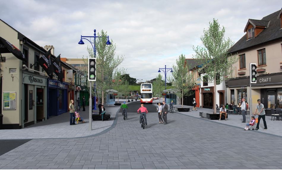
Source: CMATS Illustration of walking, public transport and public realm improvements in Douglas.
Introduction
10.305
Douglas and surrounding neighbourhoods including Rochestown, Frankfield, Donnybrook and Grange form an integral and vibrant part of Cork City. The area has experienced significant growth and investment in recent years with the dual-core Douglas village district centre acting as the commercial and community core. Douglas still retains its village character and compact urban fabric derived from times where it was a milling village. There are also a number of long-standing challenges including traffic congestion, restricted public open space accessibility and public realm that need to be tackled over the plan period and beyond.
10.306
There are opportunities to support consolidation of housing and economic growth. The availability of good infrastructure and services means the area remains an attractive location for development with a number of sites offering regeneration potential alongside the delivery of a sustainable new neighbourhood at Castletreasure. This growth combined with wider transport proposals, infrastructure investment such as the Flood Relief Scheme, due for completion in 2021, community infrastructure provision and public realm improvements will assist in delivering a better and healthier place to live, work and visit.
Socio-Economic
Profile
10.307
In the 2016 census Douglas together with Rochestown, Frankfield, Donnybrook and Grange had a combined population of just over 18,000, equating to 8.5% of the population of Cork City. The Cork City Neighbourhood Profiles (2021) study provides a more detailed socio-economic overview for each neighbourhood in Cork City. The following represents some headline points relating to Douglas and its immediate neighbourhoods:
• With the exception of Douglas (20.3%), the other neighbourhoods all had a higher percentage of persons aged under-18 than the city-wide average of 21.1%. All other age groups were broadly similar to the wider city with the exception of Frankfield where 4.5% of the population was aged 65 or over – this was less than half of the city-wide 13.3% figure.
• Douglas and its surrounding neighbourhoods generally had higher education attainment rates across all education levels than the city-wide average.
• The percentage of unemployed labour force was lower than the city-wide figure of 12% across all areas. With the exception of Douglas (9.3%) all of the other areas were 8.5% or less.
• Douglas and surrounding neighbourhoods are net exporter of workers.
• In common with all other neighbourhoods in the south east suburbs, the urban towns and the Hinterland, the use of private vehicles to travel to work or education exceeded the city-wide rate of 62.6%.
Transport and
Land Use
10.308
Traffic congestion during peak hours is one of the greatest constraints affecting Douglas and the wider south east suburbs. During the ifetime of the Development Plan, Cork City Council will work with stakeholders in supporting the delivery of sustainable transport proposals contained within the Cork Metropolitan Area Transport Study (CMATS, 2020) and using the Douglas Land Use and Transportation Study as a reference point and guide for evaluating further transportation and public realm improvements in the area.
10.309
At time of preparation of this plan the following transport projects are advancing in Douglas / Grange:
• Grange Road Transport Corridor and Tramore Valley N40 Bridge
• South Douglas Road Junction Improvement Scheme
• Southern Orbital Route Selection
• Clarke’s Hill Improvements
• Donnybrook Hill Pedestrian Upgrades
• Douglas to Grange Bridge
Cork Metropolitan
Area Transport Study
(CMATS, 2020)
10.310
Strategic transport investment in Douglas will be informed by the National Transport Authority’s (NTA) CMATS and covers the period up to 2040. The proposals for Douglas include enhanced walking and cycling infrastructure connecting with the City Centre and improvements to public spaces and greater pedestrian and cycle access to Tramore Valley Park.
10.311
CMATS also details BusConnects – the delivery of crucial bus corridors and enhanced services. This includes proposals for higher frequency on the existing Ringaskiddy-Monkstown-Douglas-City route, the prioritisation of the Douglas Road and South Douglas Road bus corridor and an orbital bus corridor which would run from Cork University Hospital (CUH) via the Western Road to Hollyhill, Blackpool, Mayfield, through the Jack Lynch Tunnel, and on to Mahon Point, Douglas village and the Black Ash park and ride site, before returning to CUH.
10.312
To address the significant shortfall in local connectivity in the southern city area, CMATS also identifies the requirement for a more comprehensive, multimodal Southern Distributor Road.
Douglas Land Use
and Transportation
Study, 2013
10.313
The Douglas Land Use and Transportation Study (DLUTS) was prepared in 2013 with a horizon year of 2032. The DLUTS vision is “to secure a successful vibrant urban centre with a more efficient transport network for Douglas, that provides an improved public realm, reduces congestion, encourages greater levels of walking & cycling, and improves the quality of life for the community, thereby enabling sustainable future growth.” This remains valid and will act as a reference point for future growth and investment in Douglas. DLUTS remains relevant and represents a robust baseline document for informing planning decisions in Douglas.
10.314
DLUTS analyses traffic congestion in Douglas and provides an integrated land use, transport and urban design strategy for reducing congestion through targeted investment and policies to improve the vibrancy and competitiveness of the District Centre. Some of its key recommendations include:
• Only traffic with a destination in the village should travel through the village.
• A 30km per hour speed limit to encourage and protect other road users.
• Cycle paths through the Mangala and connecting with the City Centre via cycle paths along the Douglas and South Douglas Roads. It proposes almost 40km of new/improved cycle infrastructure across the Douglas area.
• Improved public amenity areas through direct access to Tramore Valley Park, Grange open spaces, enhance town park and walking and cycling facilities in the Mangala area.
• School travel planning.
• Improved public realm in Douglas Village District Centre.
• Bus priority in the village centre and at all key junctions.
Future Growth
10.315
The Douglas Village District Centre hosts a range of retail, employment, leisure and community uses. Further sustainable growth may be facilitated in the area through redevelopment or infill opportunities in the existing built-up area to continue making Douglas and surrounding neighbourhoods a sustainable location to live, work, visit and shop. This will be supported by community infrastructure and the sustainable transport initiatives summarised above.
10.316
In accommodating additional growth, all development proposals will be expected to comprise a high quality design and seek to maximise opportunities to provide public realm improvements and contribute to wider placemaking principles as set out in Chapter 11 Placemaking and Managing Development.
Retail
10.317
Measures to reduce the severance of St Patrick’s Woollen Mills from the wider District Centre and provides for a more pedestrian orientated public realm will be supported. The facility currently accommodates a range of retail facilities and proposals that enhance the retail, employment, leisure and community facilities offering at a scale appropriate to the wider District Centre and in accordance with the guidance in the Douglas LUTS which will be supported in principle.
Residential
Development
10.318
Douglas and its surrounding south eastern environs have experienced significant and prolongedresidential growth which has supported the provision and maintenance of services whilst boosting patronage for the Douglas Village District Centre. The continued growth of the area will be accommodated by on a combination of infill and brownfield sites along with specified greenfield sites.
10.319
Additional lands located on Carrigaline Road in Castletreasure, Douglas, contiguous to the builtup footprint of the City, have also been zoned for residential use and have significant potential for compact residential development. Any development proposal at the site will need to be supported by a comprehensive transport assessment and travel plan, provide on-site active recreation and public open space, facilitate connectivity to adjoining public open space including the Mangala and include supporting infrastructure.
Employment
10.320
The future focus for employment and economic activity in Douglas and the wider south-east suburbs is to continue to direct it to Douglas Village District Centre where despite recent redevelopment proposals, there are further opportunities to provide enhanced employment, increase patronage spend and provide urban design and public realm enhancements that would benefit the centre overall.
10.321
The identification of Land at Barry’s Field as a local transformation site represents an opportunity to incorporate, a comprehensive high-quality mixed-use development that positively responds to Carrigaline Road, Church Street and Church Yard Lane. This has the potential to incorporate a mix of employment generating uses, homes and community infrastructure into an underutilised infill site and introduce public realm improvements and pedestrian permeability that will improve the overall urban experience in this part of Douglas. During the lifetime of the Plan, the telephone exchange facility directly to the south could come forward as part of a comprehensive scheme with the Barry’s Field Site or independently but having regard to the need to integrate and contribute towards the design ethos and mix of uses proposed at Barry’s Field.
Community & Infrastructure
10.322
The provision of new and enhanced community infrastructure will be supported and facilitated. This includes:
• Improve connectivity to blue and green infrastructure. This includes the provision of a pedestrian/cycle bridge across the N40 at Vernon Mount providing a connection with Tramore Valley Park.
• Support the identification of a longer-term library facility.
Chapter 10: Key Growth Areas and Neighbourhood Development Sites
427
Amendments to CE’s Draft Cork City Development Plan 2022 – 2028 for Elected Members
• Support the retention of existing sports and recreational facilities and explore the delivery of additional facilities where opportunities arise during the lifetime of the plan.
• To work with the Health Service Executive to support the delivery of a primary care centre in Douglas and with the Department of Education to support the expansion of existing schools or the provision of new schools where there is a defined need.
• Support the retention of a swimming pool in the catchment area.

|
|
Objective 10.79 |
|
Objective 10.80 |
|
Douglas Sustainable
|
Douglas Community
|
|||
|
|
Objective 10.81 |
|
Objective 10.82 |
|
Douglas St Patrick’s
|
Castletreasure
|
|||
12. Farranferris
10.323
The site of Farranferris Seminary Building and North Monastery Buildings and their curtilage grounds is of significant historical and architectural importance. This site was occupied by the late 19th century Farranferris Seminary building (1887) and landscaped grounds. This is a Protected Structure which is in sound condition and retains many of its original internal features. It is currently occupied by a Gaelscoil and by a community-based education and training centre. The curtilage of the building contains the associated landscaped grounds which are of particular note containing fine specimens of mature deciduous trees. Vehicular and pedestrian access to the site is via the historic avenue located off Lover’s Walk.
10.324
Any proposed development, future use or treatment of the Seminary Building and the North Monastery Buildings, their curtilage and attendant grounds must be respectful of the long-established use on site. Given that the buildings and grounds have been historically operated and continue to read as a single entity it is important that efforts be made to preserve the buildings’ intrinsic character and ensure that future uses integrate sensitively and appropriately.
10.325
Given the legacy of these institutional buildings as an important educational resource in this area of the City and the previous protection status afforded to the site as set out in the Farrenferris Local Area Plan 2009, it is an objective to prioritize and support the continuing use of the building as an educational and training centre for the surrounding community. Such a proposal extends a long standing tradition and is best suited to preserving the layout and key external and internal features of the buildings into the future. The current use of the original buildings as an educational / training facility without loss of the buildings’ character and integrity is a key planning requirement and its continued use would be encouraged provided the scale of activity extends beyond the ground floor to all floors above.
10.326
Much of the area is designated as an Area of High Landscape Value in this Development Plan as it forms one of visually dominant series of ridges on the northside of the City. The aim is to conserve and enhance the special landscape character and visual amenity of these areas though ensuring that all development is landscape dominated and in keeping with the character of the area.
|
|
Objective 10.83 |
c. Any development proposal involving the main building shall be accompanied by a detailed conservation strategy for the building, attendant grounds and other on site features of historical value. The landscaped gardens and pathways shall be retained in situ and a detailed landscaping plan and tree survey shall be undertaken to determine the location and range of species on site. A landscaping management plan shall also be undertaken. d. Mobility management plans shall accompany all non-residential development proposals and shall incorporate proposals to encourage non car modes of transport, including public transport. e. Any development proposal must be accompanied by a detailed Traffic Impact Assessment (TIA). This assessment will involve traffic modelling which should be undertaken in consultation with Cork City Council. This TIA is central to determining the scale, density and layout of development on site and the appropriate quantum of on-site car parking. |
||
Redevelopment
|
||||
13. Hollyhill
10.327
Cork City Council will seek to maintain the focus of the Hollyhill neighbourhood centre at the junction of Courtown Drive and Harbour View Road and to explore the potential of developing a strong retail frontage on Harbour View Road. The current neighbourhood centre is host to a number of retail units, secondary school, church, youth centre and other community facilities. The location of the internationally important Apple facility is a key economic driver for the area and the City. Efforts to support and enhance this area will help to promote Hollyhill as an area to both live and work.
14. Mahon
10.328
Mahon is a well-connected, mixed-use suburb located within a 15-minute cycle from the City Docks and a 20-minute cycle from the city centre. It is a vibrant neighbourhood with a range of residential communities, businesses and community facilities. It accommodates a zoned District Centre that includes the Mahon Point Shopping Centre and adjoining retail park. The Core Strategy identifies Mahon as an area for growth consolidation and enhancement by providing a mix of new neighbourhood uses in suitable and underutilised locations.
10.329
Mahon is earmarked for significant transport upgrades, with the Cork Metropolitan Area Transport Strategy outlining plans for highfrequency bus routes, an upgraded greenway, and a future light rail linking Mahon with Ballincollig via the City Centre. This major investment in Mahon will enable the area to continue growing as a sustainable neighbourhood and support planned future growth as a District Centre. In 2016, almost one-quarter of people living in Mahon worked within their neighbourhood.
10.330
Mahon / Blackrock currently does not have a library and would benefit from one given the size of population in these areas and the associated Cork City RAPID area. The area also needs a new youth facility to meet the growing needs of young people. The objective below supports the principle of a new city library and youth facility within Mahon / Blackrock area.
15. North East and North West
Regional Parks
North East
Regional Park
10.331
It is the ambition of Cork City Council to create a Regional Park in the North East area, primarily to accommodate the needs of Mayfield, Ballyvolane and Glanmire residents and visitors. This area is currently agricultural land with rolling hills and would primarily be accessed via Old Youghall Road. Depending on the final location, any panoramic views of the city and Lough Mahon should be maximised in the overall design. This shall be achieved in collaboration with stakeholders. Access connections to Mayfield, Ballyvolane, Lotabeg, Tivoli and Glanmire will be integral to the effectiveness of this potential Park, with priority given to sustainable and active travel links. Measures to complement existing natural heritage assets on site and maximise benefits to biodiversity will form part of the overall proposal. This is a medium to long term goal and will require a Framework plan. Such a plan will consider a mix of uses to ensure effective natural surveillance of the regional park to ensure the park will be safe, friendly and welcoming to visitors.
North West
Regional Park
10.332
Cork MASP Policy Objective 17 requires the creation of a North West Regional Park. The location for this Park is on the edge of the existing built-up part of the City near the existing Apple facility. To the north the site can be accessed from Nash’s Boreen which is a popular walking route. The location of a park in this location would also allow for future pedestrian and greenway or walkway linkages to the Hinterland. This proposed park would help create sustainable green infrastructure and an interconnected series of green spaces including parks, natural green spaces and ecosystems, greenways and blueways.
10.333
The central part of the site affords panoramic views in most directions. The northern end of the site area slopes downwards dramatically towards Nash’s Boreen and further towards a small stream that is a tributary of the River Bride further to the east. Cork MASP requires that local authorities facilitate the implementation of open space initiatives that provide important economic, leisure and tourism, health, active and sustainable travel and environmental benefits to the metropolitan area. This proposal would align with this requirement and would provide a valuable public open space and natural amenity for the north west quadrant of the City it is considered.
16. North-West Regeneration Area
10.334
The North-West area has been part of a major regeneration initiative in recent years. It is a key aim of Cork City Council to continue this work and to support neighbourhood improvements for this area. The regeneration catalyst will see 400 homes being replaced by 600 new homes resulting in a 16Ha site being transformed into a new residential neighbourhood. This neighbourhood will have community services and facilities including public open space, improved transport services and public realm.
17. Sundays Well
10.335
Sundays Well is a mainly residential area with a character of long established vernacular dwellings located along the northern side of the River Lee. Historic and established institutional buildings such as the UCC School of Music, St Vincent’s Church and the Cork City Gaol are located in this area, with St Kevin’s and Atkins Hall located to the west.
18. Tramore Road / Kinsale Road
10.336
The mixed industrial / commercial area centred on the Tramore Road and Kinsale Road has regeneration potential with higher density development, linked to the development of high quality public transport. The range of existing land-uses in the area includes light industry, trade showrooms, retail and retail warehouses. Nearby uses include sports facilities and residential neighbourhoods. This is a longer-term strategic growth area with capacity to contribute to compact growth in Cork City out to 2040. A future strategy for the area may be in the form of a Framework Plan.
19. Wilton
10.337
Wilton is an established neighbourhood to the west of the city centre. It is well-connected with a range of mixed-use areas including the Wilton Shopping Centre (District Centre) and the Cork University Hospital campus. The Core Strategy identifies Wilton as an area for growth consolidation and enhancement by providing a mix of new neighbourhood uses in suitable and underutilised locations.
10.338
Wilton shopping centre forms the core of the District Centre which provides a range of convenience shopping, comparison outlets and local services such as bank, post office, library, and community facilities. The Centre provides for the weekly shopping needs of the catchment area and is located due south of Cork University Hospital. The shopping centre would benefit from redevelopment to transform it into a high quality mixed-use urban-format centre.
10.339
The BusConnects and future Light Rail Transit route will likely be located adjacent to this District Centre. The feasibility of this route is underway and will be supported through the delivery of Cork Metropolitan Area Transport Strategy projects. The proposed upgrades in public transport along with cycle lanes will improve access to the city centre, Ballincollig and Mahon.
|
|
Objective 10.84 |
|
Objective 10.85 |
|
Hollyhill District CentreTo support the development and regeneration of Hollyhill District Centre in Hollyhill to serve the north-west sector of the City, as a vibrant mixeduse urban centre. This may be supported by a Framework Plan. |
Mahon
a. To support the development of Mahon as an area for growth consolidation and enhancement by providing a mix of new neighbourhood uses. |
|||
|
|
Objective 10.86 |
|
Objective 10.87 |
|
Jacobs IslandTo provide for mixed use development on Jacob’s Island to accommodate the mix of uses set out under the ZO 5 Mixed Use Development Zoning Objective to include an hotel and up to 15,000 square metres of business and technology office use. |
North East and North
|
|||
|
|
Objective 10.88 |
|
Objective 10.89 |
|
North-West
|
Sundays WellTo protect and improve existing residential neighbourhoods, character and landscape value of the Sundays Well Ridge. To support the sensitive redevelopment of St Kevin’s and Atkins Hall. |
|||
|
|
Objective 10.90 |
|||
Wilton
a. To support the development of Wilton as an area for growth consolidation and enhancement by providing a mix of new neighbourhood uses. |
||||
20. Kerry Pike
10.340
Kerry Pike is an extensive linear village located approximately 3 kilometers to the north west of the built-up part of Cork City and lying immediately north of the Shournagh River Valley. The village is host to numerous single dwellings that line the main road through the town with a number of larger residential estates. Existing services include a primary school, garden centre, pub, ancillary retail services and a town hall which is housed in the primary school building.
10.341
The existing population of the village is 496 people with 177 households. Existing land located on the northeast of the settlement allow for adequate residential expansion. New development over the Plan period should not exceed 10% of the existing village population. This requirement is to fulfil projected population targets but also to allow new development to respect the scale, character, pattern and grain of existing development.
10.342
To allow the village to develop sustainably, it is important that proper infrastructural improvements are made. In particular, the road network has to be upgraded with improved facilities for pedestrians and cyclists and the risk to water quality must be overcome. Securing the development of a mix of uses is required to create a sustainable village community.
21. Killeens
10.343
Killeens is located approximately 2 kms north of the built up part of the City and lies directly adjacent to the main N20 Cork to Limerick road. The village is bound to the south by the N20 and is set against a backdrop of elevated hills to the north. Significant residential development has taken place on the settlement’s fringes mostly within an estate to the north east of the village. Services are limited with only a public house and a bus service from the City.
The existing population of the village from the most recent census data is 765 people with 258 households. New development in Killeens over the Plan period should not exceed 10% of the existing village population. This requirement is to fulfil projected population targets but also to allow new development to respect the scale, character, pattern and grain of existing development.
10.344
The vision for Killeens up to 2028 is to secure a small increase in the population of the settlement to retain and improve local services and facilities, to create a sense of place and character, and to strengthen infrastructure provision and public transport connections.
22. Upper Glanmire
10.345
Upper Glanmire is located within the Hinterland northeast of Blackpool / Kilbarry and White Cross. The village is elevated with land falling southwards. Significant residential development has taken place at Ros Ard. Services include primary school, hall, fitness centre, church and public house. The vision for Upper Glanmire up to 2028 is to secure a small increase in the population of the settlement, to retain and improve local services and facilities, to create a sense of place and character, and to strengthen infrastructure provision and public transport connections.
The village population is 530 people and 156 households. New development in Upper Glanmire over the Plan period should not exceed 10% of the existing village population. This requirement is to fulfil projected population targets but also to allow new development to respect the scale, character, pattern and grain of existing development.
23. Cork’s Hinterland
10.346
The City Hinterland is a large area of mainly agricultural land that circles the built up part of Cork City and the urban towns and forms a number of very important planning functions. The hinterland acts as a greenbelt area that prevents the sprawl of the built up part of the city into the surrounding countryside whilst also protecting the character and integrity of the rural area and the towns, villages and
settlements that surround the built up parts of the City.
10.347
The primary objective of this area is to preserve the character of the City Hinterland generally for use as agriculture, rural amenity, open space, recreational uses, green and blue infrastructure and to protect and enhance biodiversity. Rural-related business activities which have a demonstrated need for a rural location are also permissible. Any development associated with such uses should not compromise the specific function and character of the City Hinterland.
10.348
Other uses open for consideration in this zone include renewable energy development (wind turbines, solar farms), tourism uses and facilities, garden centres and nurseries, cemeteries and community and cultural uses, subject to the other provisions of this Plan.
10.349
The City Hinterland area is under the strongest urban influence. It is estimated that there are approximately 3,100 dwellings currently in the City Hinterland outside of the City Centre, suburbs, and any urban town or village, representing a population of approximately 8,700 people.
10.350
Single housing in the City Hinterland will be facilitated only where the objectives and requirements on rural housing set out in Chapter 3 Delivering Homes and Communities are met. Housing must be based on exceptional rural housing need and on the core considerations of demonstrable economic or social need to live in a rural area. Other considerations including siting and design criteria are also relevant.
Protection of
Natural Landscape
10.351
An important function of the City Hinterland area is to protect the natural amenity and biodiversity of the area. The Hinterland incorporates and includes many rivers and streams that are host to a number of and species. The area is also characterised by mature, longstanding trees and hedgerows which are key habitats for various birds and other wildlife. These natural features are the physical characteristics that define the Hinterland’s rural personality and makeup and therefore there is a real need to protect and enhance these natural features. The removal of extensive amounts of trees, hedgerows and historic walls or other distinctive boundary treatments will be discouraged.
Protection of
Settlements
10.352
Existing settlements such as the four urban towns of Ballincollig, Blarney, Tower and Glanmire and the smaller settlements of Kerry Pike, Killeens and Upper Glanmire are surrounded by the Hinterland area. The integrity and the character of these towns settlements and villages should be respected.
Protection of
Prominent and
Strategic Hilltops
and Ridges
10.353
The Hinterland is dominated by existing agricultural land that consists of both prominent, elevated hillsides and ridges, and valleys and rivers. It is important to protect these natural features from inappropriate development.
|
|
Objective 10.91 |
(iv) Where possible, all development should be connected to the public water supply, the public waste water treatment system and make adequate provisions for storm water storage and disposal. (v) Development within the core of the villages shall be designed to a high standard and reinforce the character of the existing streetscape. Where appropriate development should be in the form of small terraced development courtyard schemes. (vi) Residential development in other areas shall provide for small groups of houses, detached housing, serviced sites or self-build options. (vii) Retail and local services development should be accommodated within the core of the village and should make adequate provision for off street parking. (viii) The development of lands closest to the village centre is proposed in the first instance, and the development of good pedestrian and amenity links with the village core/main street are considered to be an important part of any proposed scheme. (ix) Extend footpaths and public lighting to serve the wider village and where practical, to provide for the undergrounding of utilities. (x) Roadside development within the villages should be sited and designed to ensure that the development potential of backland sites is not compromised and that suitable vehicular and pedestrian access to these lands is retained. (xi) Encourage additional retail and community services within the village to coincide with the needs of any future growth. (xii) Any proposals for development within areas identified as being at risk of flooding will need to comply with the provisions of the Ministerial Guidelines – ‘The Planning System and Flood Risk Management’. |
||
Hinterland Settlements
a. To limit the development of residential developments in the hinterland settlements of Kerry Pike, Killeens and Upper Glanmire to no more than 10% population growth over the lifetime of the Plan. Any further residential proposals must set out how developments will tie into the village and provide adequate pedestrian and cycling linkages to the village. |
||||
|
|
Objective 10.92 |
|
Objective 10.93 |
|
Protection of HinterlandMaintain the Hinterland for the purposes of retaining the open and rural character of lands between and adjacent to urban areas, maintaining the clear distinction between urban areas and the countryside, to prevent urban sprawl and the coalescence of built up areas, to focus development on lands within settlements which are zoned for development and provide for appropriate land uses that protect the physical and visual amenity of the area. |
Protection of Natural
|
|||
|
|
Objective 10.94 |
|||
Protection of
|
||||
NEIGHBOURHOOD DEVELOPMENT SITES IMAGE
Neighbourhood Development Sites
10.354
Neighbourhood Development Sites are sites which are considered to have the potential to provide local benefit to the local neighbourhood and act as catalyst developments, if developed appropriately and to their potential. Many of these sites could benefit from active land management during the Plan period. These Neighbourhood Development Sites are illustrated through accessible maps which include site details and a series of icons which are explained in the icon description key. Each icon reflects site specific considerations which should be considered in drafting development proposals for these sites. The icons are solely a guide (and are not exhaustive) of planning factors to be addressed in submitting a planning application.
10.355
Potential densities provided are the minimum range informed by the Urban Densities, Building Heights and Tall Buildings Strategy. In most cases, higher densities will be encouraged due to the specific location or context of the site, e.g. proximity to public transport routes.
10.356
Pre-application consultations with Development Management will clarify site requirements in more detail. Where adjoining sites become available, these can be considered as part of the overall development. Each of these sites will require careful design consideration to incorporate: 1. place making, 2. easy, safe and welcoming environments to move around, 3. sustainable and active travel, and 4. local services and amenities.
|
|
Objective 10.95 |
|||
Neighbourhood
|
||||
|
Neighbourhood Development Site 1 Address: Avenue de Rennes Site area: 1.47 Ha Zoning: Neighbourhood and Local Centres Potential Land Use: Mixed Use including residential, community facilities and shops |
Neighbourhood Development Site 2 Address: Land at and adjoining Barry’s Field, Church Street and Carrigaline Road Site area: 1.5 Ha Zoning: Mixed Use Recommended Land Use: Mixed Use including residential, community facilities, local services and shops, and public realm improvements. |
|
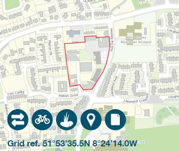
|
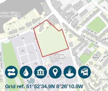
|
|
|
Neighbourhood Development Site 3 Address: Blackpool Retail Park, Mallow Road Site area: 2.21 Ha Zoning: Mixed Use Potential Land Use: Mixed use including Residential, Employment, Youth Facility and Open Space |
Neighbourhood Development Site 4 Address: Castle Road, Ballincollig Site area: 14.37 Ha Zoning: Mixed Use Recommended Land Use: mixed use including residential, employment, community facilities and open space |
|
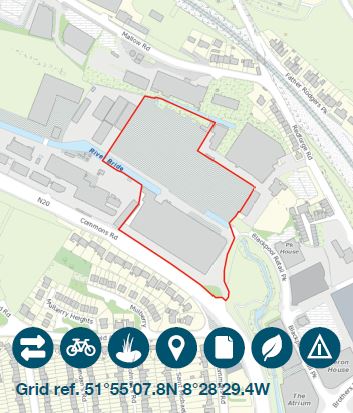
|
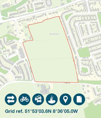
|
|
|
Neighbourhood Development Site 5 Address: Dunkettle, Glanmire Site area: 38.84 Ha Zoning: New Residential Neighbourhoods Potential Land Use: Mixed Use including residential, school, local shops, community centre, open space and residential (potentially 1,360 homes) road bridge access. |
Neighbourhood Development Site 6 Address: Former Vita Cortex plant, Kinsale Road (ID 248) Site area: 1.2 Ha Zoning: Mixed Use Potential Land Use: Mixed Use including Residential and Convenience Retail |
|
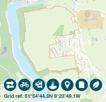
|
|
|
|
Neighbourhood Development Site 7 Address: Land north of Ballinlough Road Site area: 1.02 Ha Zoning: New Residential Neighbourhoods Potential Land Use: Residential with minimum of 35 homes |
Neighbourhood Development Site 8 Address: Land North of South Douglas Road Site area: 1.98 Ha Zoning: New Residential Neighbourhoods Potential Land Use: Residential with minimum of 70 Homes |
|
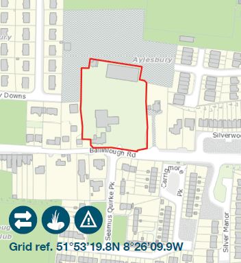
|
|
|
|
Neighbourhood Development Site 9 Address: Lee Garage, Model Farm Road Site area: 1.68 Ha Zoning: New Residential Neighbourhoods Potential Land Use: Residential with minimum of 75 Homes |
Neighbourhood Development Site 10 Address: Meadow Rise Site area: 2.23 Ha Zoning: New Residential Neighbourhoods Potential Land Use: Residential with minimum of 80 Homes and potential community facilities |
|
|
|
Key for Site Map Icon

|
Access and Permeability Consideration should be given to permeability and how users will access the site from any adjoining roads or paths. This includes access by all modes of transport, with priority given to sustainable and active travel. Connections to all nearby local roads should be maximised. |

|
Natural Environment Development proposals should assess and compliment through suitable mitigation measures proximity to protected natural areas and habitats including Special Protection Area and Proposed Natural Heritage Areas either on site or adjacent. |
|

|
Active Travel Plan An Active Travel Plan should be submitted as part of planning application on this site. Development should demonstrate how connections are to be maximised for ease of access to community facilities, neighbourhood centres, schools, local services, public open space, existing paths and public transport. |

|
Land Contamination A land contamination assessment may be required to be submitted as part of the planning application. Pre application consultations will clarify the level of detail required. |
|

|
Archaeological Assessment Archaeology is either on or adjacent to site and an assessment including necessary mitigation measures should be submitted with the planning application. |

|
Placemaking Priority Public realm improvements are required and should be considered as part of any development proposal. |
|

|
Design Document A design brief or masterplan should be submitted as part of the planning application. Pre-application consultations will clarify which type of document is required. |

|
Road Safety Consideration should be given to how proposed development will support the safety of local road users, with priority given to pedestrians and cyclists. Road safety is relevant to every site; however, this icon is specifically used where road safety concerns are a specific factor to address. |
|

|
Flood Risk Assessment A flood risk assessment should be submitted with the planning application. Pre-application consultations will clarify the level of flood assessment required. |

|
Sustainable Drainage Systen (SuDS) SuDS details are required at the planning application stage. Proposed SuDS systems should maximise use of permeable and natural materials, support biodiversity and avoid culverts. |
|

|
Historic Environment An Architectural Conservation Area and / or Protected Structure and / or other historic asset falls within or adjacent to the site. Planning applications should show how the development compliments the historic environment and its setting. |
|
Transport Assessment A traffic and transport assessment is required as part of the planning application. Pre-application consultations will clarify the level of assessment required (e.g., a transport statement or a more detailed Traffic Impact Assessment). |
-
1- The Joint Housing Strategy has assumed a citywide average household size of 2.4935 for the Development Plan period,
however an average household size of 2.3 is considered more appropriate for the City Docks. - 2- Indicative targets for Dwellings per Hectare relate to net developable area
Clár ábhair
Tuairimí
Tuairimí
Objection
I have heard today that there is the possibility of rezoning of lands adjoining Crestfield Downs in Hazelwood Glanmire. The infrastructure in the area can’t handle the existing housing in the...
Ballincollig Issues for City Development Plan
Firstly I welcome the opportunity to contribute to the City Council's new development plan. The new development plan sets out priorities and opportunities for Cork city for 2022-2028 and for the...
Freefoam Plastics Limited Support the Plan-led Regeneration of Cork City Docks
The purpose of this submission is to:
Confirm Freefoam Plastics Limited’s support for the plan led regeneration of Cork City Docks to as an exemplar development for regeneration and...